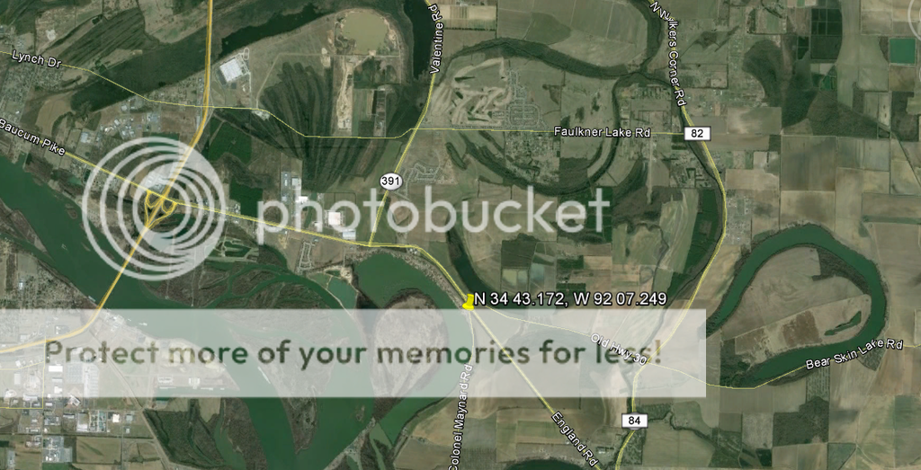
Although today a lake, in 1863 this was the main channel of the Arkansas River.
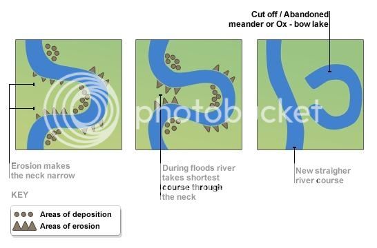
An oxbow lake forms when a river creates a meander, due to the river's eroding the bank through hydraulic action, abrasion and erosion. After a long period of time, the meander becomes very curved, and eventually the neck of the meander becomes narrower and the river cuts through the neck during a flood, cutting off the meander and forming an oxbow lake.
When a river reaches a low-lying plain, often in its final course to the sea or a lake, it meanders widely. In the vicinity of a river bend, deposition occurs on the convex bank (the bank with the smaller radius). In contrast, both lateral erosion and undercutting occur on the cut bank or concave bank (the bank with the greater radius.) Continuous deposition on the convex bank and erosion of the concave bank of a meandering river cause the formation of a very pronounced meander with two concave banks getting closer. The narrow neck of land between the two neighboring concave banks is finally cut through, either by lateral erosion of the two concave banks or by the strong currents of a flood. When this happens, a new straighter river channel is created and an abandoned meander loop, called a cutoff, is formed. When deposition finally seals off the cutoff from the river channel, an oxbow lake is formed. This process can occur over a time scale from a few years to several decades and may sometimes become essentially static.

Scott is a small community on the line between Pulaski County and Lonoke County, north of the Arkansas River. Surrounded by farmland and by oxbow lakes, Scott is also near two state parks and several historic properties.
Over the centuries, events such as floods, droughts, and—most recently—human construction have altered the path of the Arkansas River. Remnants of former sections of the river remain near Scott as oxbow lakes, particularly Bearskin Lake, Horseshoe Lake, and Willow Beach Lake.

LOGGING REQUIREMENTS
Do NOT post your answers in your log or your log will be deleted!
1. What is the elevation at the posted coordinates?
2. What is the elevation at the boat launch area?
3. Estimate how wide the Oxbow Lake is at the boat launch area.