The cache is not at these coordinates.
But, this is where you should start your journey.
**WARNING: this is a long journey **
This ride will be a 10ish-mile mountain bike ride, ONE WAY. Yes, it will be 20 miles round trip if you do not stage cars at both ends. And yes, a mountain bike is recommended as there are varying types of trails … everything from dirt road to single track. That being said, hiking and cross country skiing is always an option, and I believe snowmobiles are allowed as well.
Heads up: The final coordinates for the cache are placed in a winter friendly place not too far from the Thompson Ferry parking lot, so plan accordingly.
The multi-use Minnesota Valley State Trail is ideal for hiking, biking, cross-country skiing, horseback riding, mountain biking, and snowmobiling. The trail is a natural surface trail running from Chaska to Belle Plaine, paralleling the Minnesota River. The trail travels within the Minnesota Valley State Recreation Area in part of the Minnesota River Valley as it converges into the Mississippi River. If you ever get confused about which trail to take, choose the one following close to the Minnesota River.
As for the waypoints, here we go…
Middle Road Sign: On this sign, there are how many things not allowed on Middle Road? Consider this A.
Three Signs: There is a sign pointing out a destination 3 miles away. The destination has two numbers in it. What is the second number (ie, not the 4). Consider this B.
Mileage Marker: Keep a keen eye for a mileage marker here. What mile is it? Consider this C and D
Turnaround Signs: Here there are two signs on one stick. How many of these signs are red in color. Consider this E.
With this info, grab a pen and consider:
N 44 41.DE(B+8) W 093 38.(C+A)E(C+4)
Hope you had a great ride!
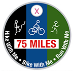
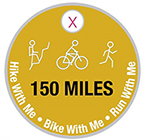
Earn the 75 and 150 mile Pathtag!
So far there have been 37 of these Hike/Bike/Run With Me Multi-caches - if you were to complete them all, you would have travelled more than 210 miles. Currently (August 2023), there are 32 active geocaches totaling 185 miles (This includes three Hike With Me Adventure Labs). I wanted to give something to the geocachers who have "put a big dent" in trying to find these. So I created two pathtags for all cachers who completed at least 75 and 150 miles while trying to get smileys on these caches. On each of the cache pages, I mention how long the travel should be for that cache. They vary from just a couple miles to a 20-mile mountain bike ride.
Here is a bookmark list of all of the caches.
So, take a look at your finds, add up the miles, and if you are more than 75 or 150 miles, let me know. You can either PM me, email me, or just grab me at an event. You do not have to show/prove anything to me about you qualifying. I will give you one if you say you have qualified.