The last two million years of Earth history, known as the Quaternary Period have been a wee bit chilly. The land masses of the northern Hemisphere have been periodically covered by large ice sheets. All of the Maritime Provinces were covered by kilometres-thick glaciers as recently as 15-20,000 years ago during the Pleistocene Ice Age. In the Maritimes, this system of ice sheets is called the Appalachian Glacier Complex.
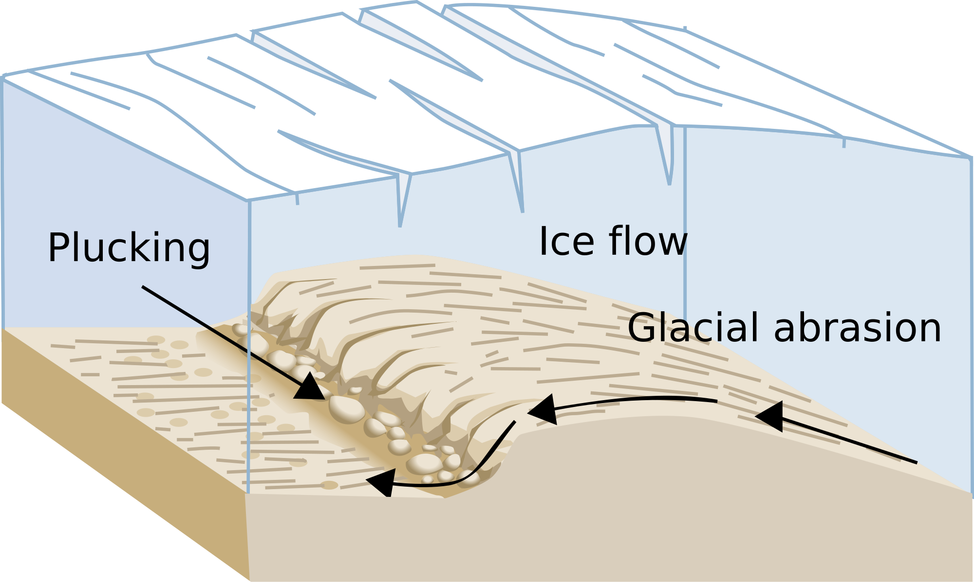
The ice sheets were kilometers thick, their mass was powerful enough to grind and scratch the surface of the bedrock along the surface of the Earth. They leave marks in the bedrock called Glacial Striations.
Glacial striations go by other names besides Striations. They are sometimes called glacial grooves, glacial abrasions, or scratches or gouges. They are long, straight, parallel lines or grooves in a bedrock surface, formed by boulders, gravel, and pebbles embedded in a glacier that has passed over the surface. But they are much more than that - they are a representation of the force & beauty of nature and a record of our earth's history. The striations here were formed here during the Pleistocene Ice Age 20- 30,000 years ago.
Now, Abrasion is defined as the erosion that occurs when particles scrape against each other. The enormous weight of the glacier, along with rocks and sediment plucked up and clinging to its belly scratch and carve the rock surface below. It's almost as if the moving glacier is sanding the rocks with abrasive sandpaper. As the glacier sands the rock, it leaves behind long scratches that form in the direction of the glacial movement called glacial striations. Seeing these scratch marks is a sure sign that a glacier once covered the land. The gracier retreated at some point due to the warming of the Earth. This process is called Catastrophic subglacial drainage. Once it has retreated, it is the grooves that are left behind.
The orientation of the striations reveals the direction the glacier was taking as it passed. The depth of the striations reveal the hardness of the bedrock itself, as well as the hardness of the material which cut the grooves.
How do you determine the direction of the movement of the glacier? By lightly running a finger along the striation, it is possible to discover that when moving one way along it, the rock feels smooth, but when moving the other way it feels more coarse. The moving ice leaves the rock grains aligned with the direction of movement, so when the striation feels smooth, your finger is moving in the direction of ice flow. When the striation feels rough, you are moving against the ice flow.

Your best vantage point to observe the striations is on top of the rock formation. Be careful in making your way there, the rock can be quite slick. Adult supervision of children is recommended.
To claim this Earthcache, you must email me, through my profile, the answers to the following questions:
-
Using a compass or compass app, determine the direction of the grooves.
-
How long ago, and during which ice age were the glacier and ice sheets formed?
-
There is an angular metal sign on top of the rock formation. What is written on the sign and what color is it?
-
Optionally, take a photo of yourself at the striations, and add it to your log.