Geology/History
The Paleozoic Era spans from 541 to 252 millions years ago. It is the longest of the Phanerozoic Eras, and is subdivided into several geologic periods. The Cambrian being the oldest; 541 million years to 485 million years ago, to the Permian being the youngest; 299 million to 252 million years ago. When most of the sediments that make up the rocks in Arkansas were being deposited, (during the Carboniferous Period, between 359 million to 299 million years ago), north Arkansas was a shallow sea floor (continental shelf), the Arkansas River Valley was near the edge of the shelf, and the Ouachita area was the deep sea floor. Late in the Paleozoic Era, the northern part of Arkansas, (north of the Arkansas River), referred to as the Boston Mountain Plateau, a/k/a Ozarks, was forced up in an "intact mass" in the collision with the South American Continent that also formed the Ouachitas Mountains, (south of the Arkansas River). This created an area known geologically as the "Ozark Dome."
The Mississippian Period is one of two sub-periods of the Carboniferous Period the other is Pennsylvanian. The Mississippian Period is named after the rocks that can be seen in the Mississippi River Valley. Within the Mississippian Period is the Imo, Pitkin, Fayetteville, Batesville, Ruddell, Moorefield, Boone and St. Joe Formations.

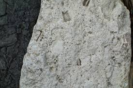
What you can see at this location is the Boone Formation with the St. Joe Limestone Member. The Boone Formation consists of gray fossil-filled limestone, (a biochemical sedimentary rock type), intermixed with chert (a crystalline sedimentary rock) and irregular-shaped chert nodules. The Boone Formation contains lots of crinoid fragments, as well as bryozoa, mollucks, corals, trilobites, shark’s teeth, and conodonts. Many small fragments of white to gray chert/limestone contain numerous fossil crinoid column fragments. The Boone Formation is generally 300 to 350 feet thick. The Boone Formation supports numerous quarries for aggregate purposes such as gravel, road bed and building stones.
This limestone is also the host-rock for karst topographic features such as sinkholes, caves and caverns, formed by water erosion called Speleogenesis. It can be seen above ground as extremely rough limestone surfaces, that has been exposed to wind, air, and weather. Speleogenesis is the main process of water reacting with the limestone, over millions of years, to dissolve it and produce sinkholes, caves and caverns. It often deals with the development of caves through limestone, caused by the presence of water with carbon dioxide dissolved within it, producing carbonic acid which cause the calcium carbonate to leave the limestone. Newton County, Arkansas has numerous sinkholes, caves and caverns.
The St. Joe Limestone Member is exposed throughout the central Ozark Plateau in Arkansas, Missouri and Oklahoma. This formation ranges from a feather edge to over 110 feet in thickness of brick red, red, green and gray crinoidal limestone. The St. Joe Limestone Member also contains fossil fragments. It looks a lot like slate or shale but it is really limestone. It is a frequent bluff former. The Buffalo River is famous for it's bluff lines all the way from Ponca to Buffalo City, about 150 miles. Crinoids, brachiopods, bryozoa, conodonts, blastoids, ostracods, and rugose coral can been seen in the stone/layers.
This is a small, abandoned rock quarry. This easy pull-off area is a great location where you can see and collect limestone and chert fragments from the Boone Formation, and limestone from the St. Joe Limestone Member.
In the late 1970's, G. R. Scott, from the University of Texas in Dallas, TX, took small core samples from the St. Joe Limestone Member of this abandoned quarry and a corresponding quarry located in St. Joe, Arkansas, to study the Paleo-magnetic field of these rocks for comparison with Carboniferous rocks in a rock formation in Pennsylvania. He was looking for additional knowledge of the North American polar wander path that would aid in plate tectonic reconstructions for the late Paleozoic Era. As hard as he tried, he was not able to come up with any conclusive results with this comparison. About 60 feet north of the posted coordinates, you can see the core sample drilling holes that were left behind. The coordinates for some of the core sample drill holes are located at N 036 01.527 W 093 10.295
To log this EarthCache, please email us your answers. You can go ahead and log your find, (i.e. you don't need to wait for permission) but if we don’t think you have honestly completed the required tasks we will delete your log (after emailing you first of course). We ask that you not post answers or a photo of this formation in your log. There is no informational sign. You will not need any special equipment other than your GPS to arrive at the coordinates. You can arrive at the coordinates 24/7 but it does not have street lights. If you climb on the rocks, you do so at your own risk.
Questions:
1. In the debris field, how many basic colors of rock do you see? List the colors.
2. How many core sample drills holes do you see? How big are they? Are all the core sample holes in one layer?
3. In your own words, explain what you see that would make you believe this was once a quarry?
4. What is the color of the rock that comes out into the parking area? Do you think this is part of the St. Joe Limestone Member? Explain.
5. If you wish, share/post a photo of any fossils you find. We kindly ask that you practice the principles of Leave No Trace. Feel free to take as many photos of the fossils that you wish, but leave them at the site for future visitors to photo and enjoy, just as you have. If you enjoyed this cache and your new smiley, please feel free to add to your favorites!!
CONGRATS TO 'topgun5403 & Co-Pilot Marty' for FTF!