1. tepe: sarayburnu'ndan içeri doğru yükselen ayasofya'nın, sultanahmet camisi'nin ve topkapı sarayı'nın bulunduğu yükselti.
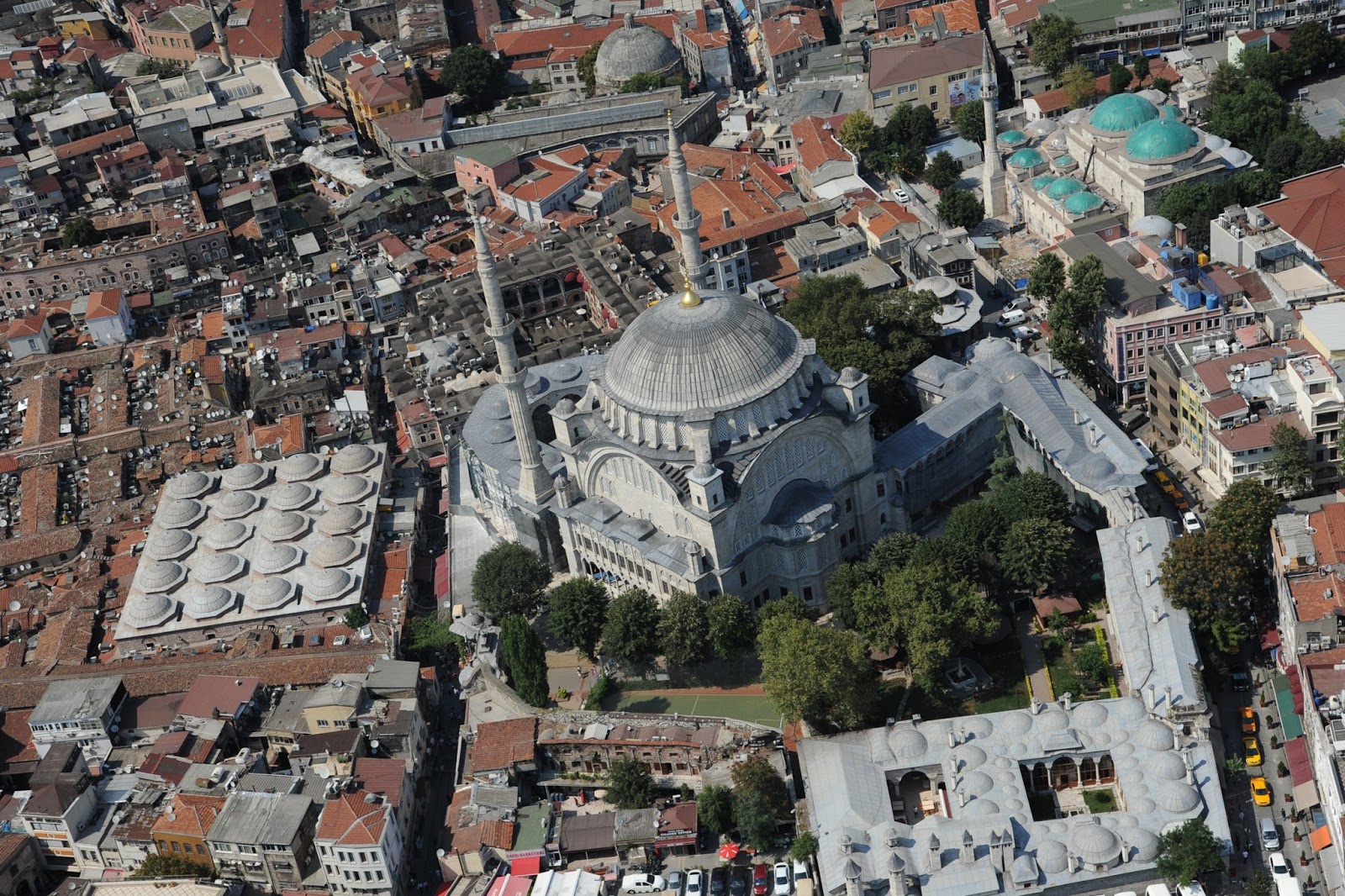
2. tepe: nuruosmaniye külliyesi'nin bulunduğu, çemberlitaş'ın yer aldığı yükselti.
3. tepe: istanbul üniversitesi merkez binası olan eski harbiye nezareti'nin bulunduğu yer.
4. tepe: üstünde fatih külliyesi bulunan, güneyde lykos deresi vadisine ve aksaray'a doğru inen, kuzeyde dik yamaçlarla haliç sahiline kavuşan tepe.
5. tepe: sultan selim külliyesi'nin yer aldığı tepe.
6. tepe: edirnekapı ve ayvansaray'ın kurulduğu, şehrin batı surlarını taşıyan tepe.
7. tepe: aksaray semtinden surlara ve marmara sahiline kadar giden bölge.
2 Nuruosmaniye Camii
-----------------------------------------------------------------------------------------------------------------------
1 Ayasofya
2 Nuruosmaniye Camii Camii
3 Süleymaniye Camii
4 Fatih Cami
5 Yavuz Sultan Selim Camii
6 Mihrimah Sultan Camii
7 Hekimoğlu Ali Paşa Cami
-----------------------------------------------------------------------------------------------------------------------
The seven hills, all located in the area within the walls, first appeared when the valleys of the Golden Horn and the Bosphorus were opened up during the Secondary and Tertiary periods. In the Ottoman Age, as in the earlier Byzantine period, each hill was surmounted by monumental religious buildings (churches under the Byzantines, imperial mosques under the Ottomans).
The first hill on which the ancient city of Byzantium was founded, begins from Seraglio Point and extends over the whole area containing Hagia Sophia, the Sultan Ahmed Mosque and Topkapı Palace.
On the second hill are to be found the Nuruosmaniye Mosque, Grand Bazaar and Column of Constantine. The second hill is divided from the first by a fairly deep valley running from Babiali on the east Eminönü.
The third hill is now occupied by the main buildings of Istanbul University, the Bayezid II Mosque to the south and the Süleymaniye Mosque to the north. The southern slopes of the hill descend to Kumkapi and Langa.
The fourth hill on which stood the Church of the Holy Apostles and, subsequently, the Fatih Mosque, slopes down rather steeply to the Golden Horn on the north and, rather more gently, to Aksaray on the south.
On the fifth hill we find the Mosque of Sultan Selim. The fifth and the sixth hills are separated by the valley running down on the west to Balat on the shore of the Golden Horn.
On the sixth hill are to be found the districts of Edirnekapı and Ayvansaray. Its gentle slopes run out beyond the line of the defense walls.
The seventh hill, known in Byzantine times as the Xērolophos (Greek: ξηρόλοφος), or "dry hill," it extends from Aksaray to the Theodosian Walls and the Marmara. It is a broad hill with three summits producing a triangle with apices at Topkapı, Aksaray, and Yedikule.