The River Mersey begins in Stockport with the confluence of the River Tame and River Goyt and flows 70 miles to the Irish Sea. The River Mersey has the second highest tidal range in the UK, varying from 4m at neaps to 10m at spring tides. The river flow is about 1% of the tidal flow.
New Brighton, on the Birkenhead side of the river, began to develop in 1830, as the potential of a seaside resort on the doorstep of Liverpool began to be realised.
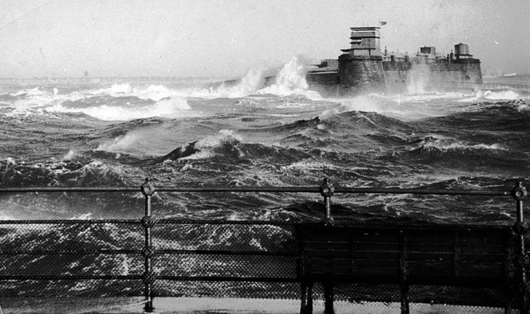
The original name of the fort was taken from a wooden perch which was built at the spot in the 1690s to warn passing ships of the dangers of the rocks nearby.
In 1803 Liverpool merchants concerned about a possible invasion by the French during the Napoleonic wars put forward the idea of a fort at New Brighton. Naturally there were disputes about how it was to be financed and consequently construction didn’t get under way until 1826.
Fort Perch was completed three years later. It was built out of stone blocks on a base of natural rock, confusingly known as the Black Rocks.
To claim this geocache you will need to use local observation, conduct some research and possibly get your feet damp...
1. Visit the posted coordinates and you will get a good view of Fort Perch. What material is the fort made from and what are the 'black rocks' close to it's base ?
2. Why would this material prove to be suitable for construction of the fort ? Describe the texture of the fort walls and its colouration
3. Take a walk around Fort Perch. Describe how the effects of the natural environment have affected the walls of the fort. Now look at the seaward elevation, what evidence of erosion is visible. Describe what you see - is this different on the landward elevation ?
4. At the posted coordinates you will find numerous rock pools and more evidence of the same rock type - the 'black rocks'. Please could you comment on the texture of the rock and describe it's colouration. How does this differ from the stonework of the fort.
5.Between Fort Perch and Black Rock lighthouse is a band of more rocky ground. Estimate the width of this band of rock.
Please try to post a photo of your visit to Fort Perch in your log.
This earthcache was placed with permission from Natural England.
Interesting information on coastal erosion and weathering that can help answering these questions can be founded on the related webpage link.