Welcome to Smuggler’s Notch. This area is part of the Green Mountain Range and within Smuggler’s Notch State Park. This earthcache will require visiting 2 locations. The first is an information board in a parking lot and the other is in the actual Notch. The Notch road is closed in the winter months but can be accessed by hiking, skiing, and snowmobile. In the Summer this will much easier to access, but due to the more challenging winter conditions, the D/T is listed as such.
In order to claim this earthcache, please send the answers to the following questions through geocaching messaging or email.
Posted Coordinates:
- How tall are the cliffs on either side of Smuggler’s Notch?
- How long is the highway through the notch?
- The folding and twisting of schist has created these mountains, what is the rock type group according to the board?
- According to the board, what is the name of one of the most significant rock formations found in this area? (Hint: named after an animal)
Waypoint 2

5.You are looking for a large rock next to a tree. See the picture posted. On the opposite side of this rock you will see a white layer in the rock, estimate the thickness of this layer (it is at an angle, so estimate the thickness of this layer
6. (optional) post a picture of yourself somewhere near Waypoint 2.
Origin of Schist
Millions of years ago, before the Green Mountains were formed, this area of Vermont was covered by a shallow sea. Ancient rivers deposited fine grained sediment into this sea. Over time these layers continued to build upon each other with older layers of sediment, shells buried deep below. These materials were subjected to high pressure and temperatures during the mountain-making period. Recrystallization of these sediments during this time of physical-chemical changes formed mica-albite-quartz schist. The influence of pressure caused the platy minerals to develop at right angles to the pressure, causing the rock to have a layered appearance. Where the layering is coarse, the metamorphic rock is gneiss. Schist is the name for the layers where the rock appears fine but pronounced. During the process, and following the formation of schist, continued pressure caused the rocks to crumple and fold.
Over the past 350 million years, this area has been subjected to erosion as it has pushed up above sea level. These rocks have then been exposed to erosion, which has removed the younger layers, and have gradually exposed the older rocks, the mica-albite-quartz schist.
Schist Description
As the name states, these rocks are made up of the minerals mica, albite, and quartz. When examined with the naked eye, mica appears to be the most abundant. It appears in the form of colorless, to white flakes that shine in the sunlight. Mica flakes are responsible for the pronounced layering in many schists. Quartz and albite are also important parts of schist, and together make up more than the mica found within the schist. Quartz appears glassy in schist and as rounded or irregular grains. Albite appears as white and chalky and in small grains. Schist gets much of its greenish color from Chlorite, and important mineral found in some of the schist. Like mica, this occurs in thin sheets. In this area, some other important minerals include garnet (pink to red grains) and magnetite (bluish-black and metallic).
The Green Mountains
The current Green Mountains is believed to have been formed by the folding and crumpling of schist by a westward movement of large masses or rock. The large complex fold that is the basic structure of the Green Mountains is called an anticlinorium. An anticline is defined as an upward fold where the individual rock layers can be traced through the structure and is similar to that of the arch. The opposite of this is called a syncline, where the layers dip into a trough or basin. The anticlinorium is a large anticline with smaller anticlines and synclines superimposed within it.
Glaciers!
Since the “ice-age”, this area of North America has had numerous large continental glaciers advance over it. Some evidence points to the fact that some of these ice sheets were so thick that they covered Mount Mansfield. This has been evidenced by glacial striae and erratics. Striae are scratches in the bedrock produced from large rocks embedded in the glacier as it moved. Erratics are these rocks that were moved and then deposited by glaciers. The most recent ice sheet, which covered much of New England, melted about 12,000 years ago.
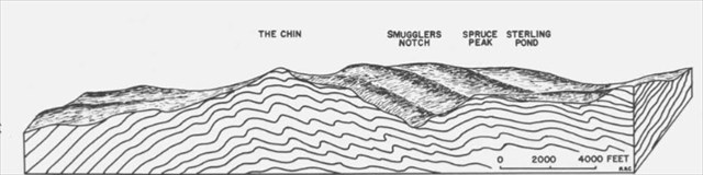
The Notch
The formation of Smuggler’s Notch began millions of years ago by eroding streams that created a small passage. About 20,000 years ago, glaciers moving towards Mt. Mansfield and Spruce Peak encountered this small passage which was a barrier and the ice gradually broke through this barrier transforming an old stream valley into a much more enlarged area with steep rock walls. Over the next 10,000 years the ice receded and the Notch experienced a large flow of water through the notch and a number of of post-glacial lakes.
History of the Notch
The Notch was originally a footpath for the Abenaki, a native people of the area. In the late 1700’s the path was cleared as a bridle path. According to legend, the Embargo Act of 1807 saw the beginning of the notch becoming known as Smuggler’s Notch. The Embargo Act forbade trade with Britain and then in 1809, trade with Canada was also prohibited. Due to it’s location far from main cities further south, the people of north Vermont depended on trade with Canada for survival. These smugglers would use the notch to move and hide smuggled items, such as cattle coming back and forth from Canada. “Smuggler’s Cave” is where smugglers would hide their loot while making the trip through the pass. The smuggling did not stop there, and during the Civil War this routed aided in smuggling slaves across to Canada. During Prohibition in the 1920’s the smuggling of liquor from Canada made their way into the US through Smuggler’s Notch.
