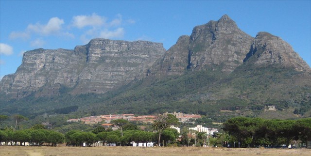
The cliffs of the Table Mountain Formation
as viewed from Rondebosch Common
General Information
Scientists studying the minerals and materials that make up the earth are sometimes loosely termed either “hard rock” or “soft rock” geologists. In general hard rock geologists are concerned with igneous and metamorphic rocks such as granite, basalt, gneiss, or schist while soft rock geologists focus on sedimentary rock, such as shale or limestone, and on unconsolidated sediments: sand, silt and clay. This earth cache introduces the “soft rocks” of the Rondebosch Common, focusing on the Ferricrete.
TO CLAIM AND LOG A FIND FOR THIS EARTH CACHE YOU NEED TO ANSWER THE FOLLOWING QUESTIONS AND EMAIL YOUR ANSWERS VIA MY GEOCACHING PROFILE.
[Each member of a caching group must submit individual answers.]
A. What do you observe beneath your feet at location 1?
B. At location 2 explain briefly in your own words how this type of ferricrete forms.
C. What do you observe beneath your feet at location 3?
D. What type of ferricrete occurs at location 4?
E. What colour sand do you observe beneath your feet at location 5?
F. (a) What colour sand do you observe beneath your feet at location 6?
(b) why is the colour different to the sand at location 5?
G. The two photographs labelled Rondebosch 1, and 2, both have relevance to this earth cache. From what you have learned from this earth cache, EITHER explain their relevance, OR Outline the process that causes the discolouration shown in picture 2.
The Sands of the Common
The common is covered by the remnants of a slightly undulating wind formed Quaternary dune field. The north-easterly portion has well drained neutral to alkaline white sands; along Campground road the soils contain more clay and have a brown tinge; while most of the common is covered with sand that is lightly acid and grey, this is due to the occurrence of organic matter. These changes in soil conditions cause the vegetation on the common to change from Renosterveld in the south-west through Cape Flats sand fynbos in the centre to Strandveld in the north-east corner. These vegetation changes are easily observed.
Ferricrete
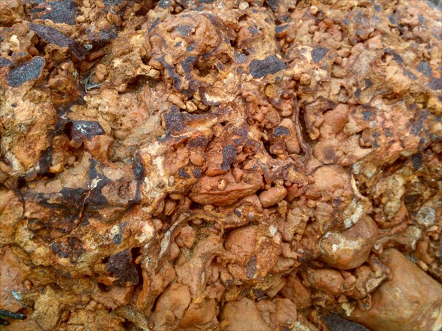
Ferricrete Conglomerate
Ferricrete is a hard, erosion-resistant layer of material consisting of near surface sediments that have been cemented by iron oxide into a duricrust. Duricrust is a general term for a zone of chemical precipitation that has caused hardening of soil. The hardened soil crust can range in thickness from a few millimeters to several meters. They are formed when mineral-bearing waters deposit the minerals they contain onto the sediments through which they are passing.
Ferricretes consist of sediments cemented together by iron minerals. (The word is derived from the combination of the latin word for iron, ferrum, and concrete.)
Two conditions are required for the formation of ferricrete. The first is a large, long-term source of dissolved iron, the second is that reduced iron-rich ground water mixes with oxygen to drive the precipitation of iron minerals.
Iron rich Malmesbury Group rocks underlie the Rondebosch Common. When reduced iron-rich acidic ground water from the Malmesbury rocks is exposed to the atmosphere, or to oxygenated surface water, small amounts of iron minerals precipitate. Goethite and schwertmannite are the two most common iron-oxide minerals saturated in iron-rich ground water and are commonly present in ferricrete. When there is a fluctuating water table (most usually due to variations in seasonal rainfall) the seasonal precipitation of iron minerals over long periods of time cements the soil particles to form ferricrete. Ferricrete is generally red, brown or black.
Ferricrete has five development stages: initial precipitation within a soil; powder form; nodules; honeycomb; and hardpan. The process commences with the precipitation of fine particles of the relevant mineral and in time these increase in concentration. Accretion of these particles leads first to discrete nodules which consist mostly of the precipitated material that cement soil particles. These nodules seem to float in or on the host soil. Gradually, these nodules coalesce into a sponge-like, hard mass full of small cavities, the whole mass having a honeycomb structure. The cavities are usually filled with remnants of the host soil although the cementing material may already have become quite hard. The filling of these cavities with the precipitate eventually results in rock-like hardpan. Hardpan can also develop without passing through a nodular or honeycomb stage. The development of these materials can come to an end at any stage and not all stages need to be passed through during the process of formation.
|
TYPES OF FERRICRETE
|
DESCRIPTION
|
|
Powder
Ferricrete
|
Generally loose silt and fine sand consisting of cemented or aggregated particles of nearly pure soil minerals.
|
|
Nodular
Ferricrete
|
Mixture of gravel-sized nodules of cemented particles.
|
|
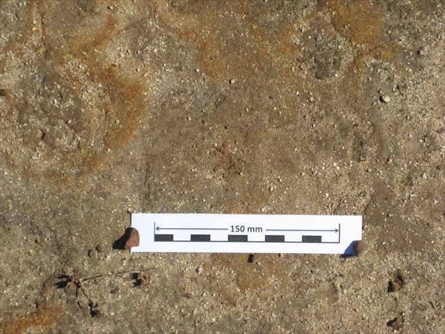
Honeycomb
Ferricrete
|
Partly fused nodular Ferricrete intermediate between the nodular and hardpan varieties. It may still contain loose/soft pockets, but is usually hard and not easily broken.
|
|
Hardpan
Ferricrete
|
Indurated and strongly cemented, massive, rock-like material. Consistencies vary, but usually at least medium hard rock.
|
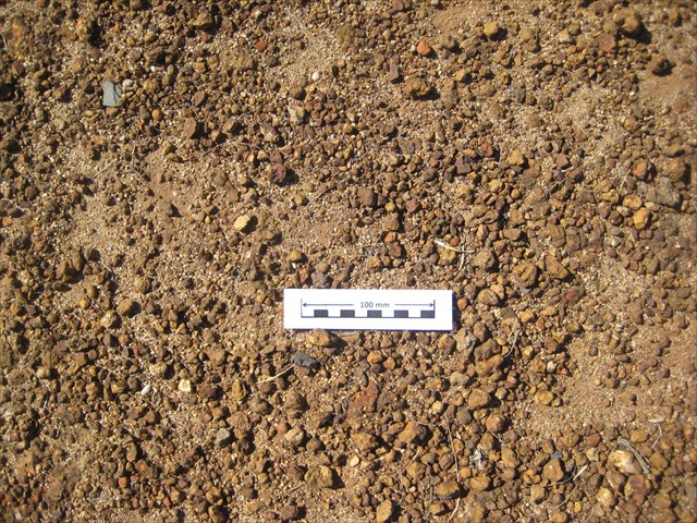
Nodular Ferricrete

Honeycomb Ferricrete
Hardpan Ferricrete
Ferricrete is used widely in South Africa for road building. It is utilised as subgrade for asphalt and concrete pavements or roads and as the gravel wearing course on unsealed roads. It is often known in by its Afrikaans name "Koffieklip" (coffee stone).
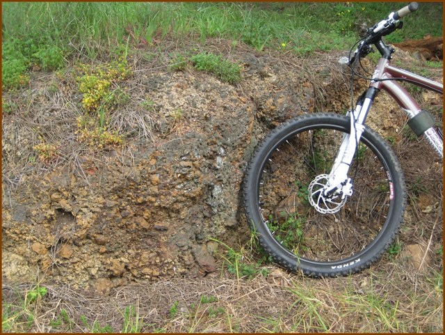 A ferricrete outcrop at S 33 57.483 E 18 28.797
a consequence of quarrying for gravel to surface Campground Road
in bygone years
Your Visit to the Rondebosch Common
This Earth cache requires that you walk across the common making simple observations at each of six locations (the locations can be visited in any order). It is suggested you park at either of the parking waypoints.
Note: All the locations are on the Common well away from the surrounding roads. Some Apps will lead to points on neighbouring roads instead of to the precise coordinates. It may help to first use Google Earth to find the locations and paths leading to them.
The locations you must visit are:
PARKING:
S 33 57.570 E 18 28.800
S 33 57.235 E 18 28.900
1. S 33 57.492 E 18 28.893 Answer: A
2. S 33 57.397 E 18 28.872 Answer: B
3. S 33 57.356 E 18 28.860 Answer: C
4. S 33 57.187 E 18 29.035 Answer: D
5. S 33 57.201 E 18 29.089 Answer: E
6. S 33 57.341 E 18 29.021 Answer: F
Rondebosch Photographs
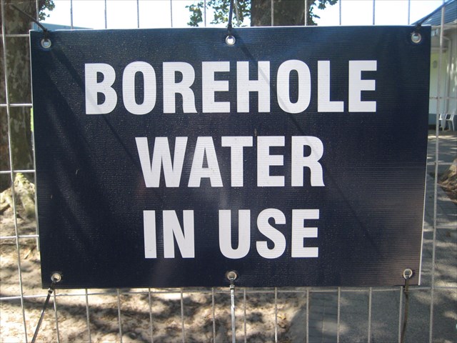
1. Water Source
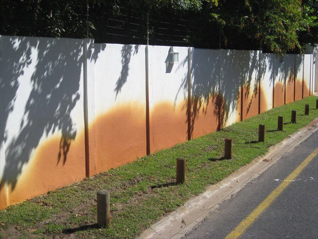
2. Stained Wall
Sources:
J.N. Theron et al: The Geology of the Cape Town Area, Explanation of sheet 3318. Geological Survey, department of Mineral and Energy Affairs, Republic of South Africa.
L. Wirt et al: Geochemical and Hydrologic Processes Controlling Formation of Ferricrete. Professional Paper 1651 U.S.Geological Survey.
D.I. Cole: Report on economically-viable mineral resources in the City of Cape Town’s administrative area. Council for Geoscience, Western Cape regional office
Friends of Rondebosch Common: Rondebosch Common.
| This EarthCache developed by an |
 |
 |
