About Village Sign Caches
|
 ⠀ ⠀ |
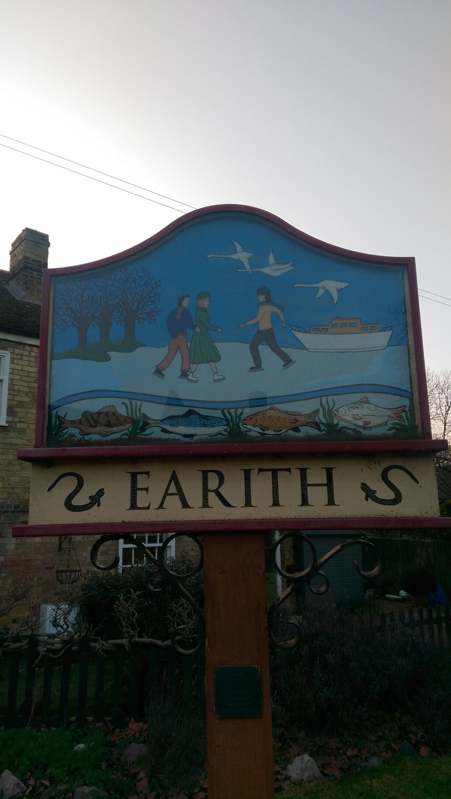
This cache belongs to the Village Sign Series, a series of caches based on ornate signs that depict the heritage, history and culture of the villages that put them up (generally on the village green!).
The signs can be made of different materials from fibreglass to wood, from forged steel to stone. They can depict anything from local industry to historical events. The tradition probably started in Norfolk or Suffolk and has now spread across most of the country so we thought we would base a series on them!
|
More information, bookmarks and statistics can be found at the Village Signs Website
If anybody would like to expand the Village Sign Series, please do.
I would ask that you request a number for your cache first at www.villagesignseries.co.uk
so we can keep track of the Village Sign numbers and names to avoid duplication.
Earith is a village and civil parish in Cambridgeshire, England. Earith lies approximately 10 miles (16 km) east of Huntingdon. Earith is situated within Huntingdonshire which is a non-metropolitan district of Cambridgeshire as well as being a historic county of England. At Earith, two artificial diversion channels of the River Great Ouse, the Old Bedford River and the New Bedford River, leave the river on a course to Denver Sluice near Downham Market, where they rejoin the Great Ouse in its tidal part. At the 2001 census, the parish had a population of 1,677.
To the north east of the village, between the Old Bedford River and the New Bedford River lies the remains of an English Civil War fort known as Earith Bulwark. It is believed to have been constructed as early as 1643, to fortify the crossing point of the River Great Ouse. Many fenland inhabitants resented the Royalists because they believed that the King's drainage projects undertaken by Dutch engineer Cornelius Vermuyden, had damaged their livelihoods (his Forty Foot Drain had been completed in 1637). Today, the fort is visible as a series of earthworks only, showing a square fort design with ditches and corner bastions. It is similar in design to Fort Nassau in the Netherlands. During the Second World War, a machine gun turret was built on the south bastion.
In 1947, there was the "Battle of Earith Gap". Melting snow had built up in the Fenland waterways, unable to be released into the sea because of high tides. On 17 March a 50 yards (46 m) gap was torn in the river bank, and water poured out to flood the Fen farms for five days. Eventually the breach was blocked with amphibious vehicles while more orthodox repair work was carried out.
The cache is just over the road from the village sign so please do not go climbing all over the it!
white 35mm pot.