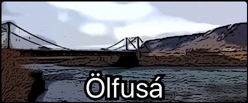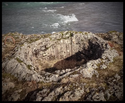
There are interesting geological formations on the river bank (between the listed coordinates and the river). They are, in fact, listed in the Icelandic Nature Conservation Register. About 8700 years ago a great lava flow hit this area. It was the Earth's largest lava flow since the end of the last Ice Age and was very hot and fluid. It flowed at least 140km and it's volume is 25 cubic km.
Some basic information on lava. Lava is the molten rock expelled by a volcano during an eruption. The resulting rock after solidification and cooling is also called lava. The composition of almost all lava of the Earth's crust is dominated by silicate minerals. These are rock-forming minerals which contain different ratios of silicon and oxygen. Rock examples include basalt and rhyolite. In general, the composition of a lava determines its behaviour more than the temperature of its eruption. The physical behaviour of lava creates the physical forms of a lava flow or volcano. More fluid lava flows tend to form flat sheet-like bodies, whereas viscous lava flows form knobbly, blocky masses of rock. Lava cools quickly at first while forming a thin crust. This thin crust insulates the flow. Because of its insulating properties, the remaining lava can take a long time to cool. (Lava tunnels can even be formed this way, but that is a different topic.)
On the riverbank of Ölfusá you will see unusual geological formations in the form of small circular pots up to 2m in diameter. How did these form? One theory:
-They are traces of large bubbles of gas, which came up in the molten lava.
-The walls of the bubbles cooled down before the bubbles burst at the surface.
-A once thin crust of lava is now displayed as the current circular pots.

To log this Earthcache, please message me the following answers:
1. The circular pots are possibly the first stages of a hornito or pseudo crater in formation. Have a think about the circular pots in comparison to a hornito and a pseudo crater. What do you think the differences are, regarding lava, during formation?
2. Between the listed coordinates and the riverbank, how many circular pots can you count not including under the bridge? Looking down from the bridge is easier to count but I recommend having a close look at the formations. Please Note: THIS AREA IS NOT SAFE IF COVERED IN SNOW. If covered in snow, please tell me what colours are used in the drawing of the circular pot on the information board.
3. According to the information board at the listed coordinates, what is the diameter of the circular pots?
4. The western edge of what great lava is the bank of Ölfusá?
'Found it!' logs will be deleted without contact if not accompanied by answers within a week. Photos of the pots are welcome but please no photos from the bridge looking at them all. Please add in your log if you have seen anything like these pots before. I haven't. I hope you got something from this Earthcache and these unusual formations.
http://earthcache.org