There is nothing hidden at the posted coordinates. This is the final of a four-cache series where you will use the topographical map (& legend) provided to navigate to certain features in the woods, and then use your GPS to project a waypoint from a particular feature to the cache. There will be streams to cross, steep inclines, possibly tough bushwhacking (depending on your navigation skills), and you may even get lost. Come prepared! (see below)
To find this cache, you must first retrieve the clue from the Toponaut: Hemlock 3, Summit cache.
Please see the first cache in the series for preamble and important information on what you'll need.
Primer
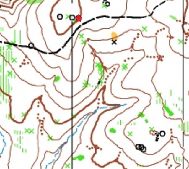
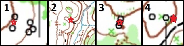
- Three stages. Each stage consists of navigating to a "red star" location and performing a projection from that point.
- The first and third navigation points ("red stars") are directly next to trees.
Some other notes:
- I have set the "not winter friendly" attribute solely due to difficulties with finding the piles of rocks in the snow.
- As you navigate, it might be prudent to come up with a point that is "too far". For example in the first cache, going over the ridge in search of the piles of rocks.
- Have fun wandering! However this is wild territory so be mindful of heffalumps, woozles, and other bumbling bumbles.
Links to caches:

No night caching
ZippyFinn consolation memes:


Best Mystery/Puzzle Cache and Best Series 2016
F1: .lyybu lono n bg gkrA .jabq yyrs rybc f'eroenO
F2: .grrs gvoobU rug arrjgro upnrE