Mount Fable:
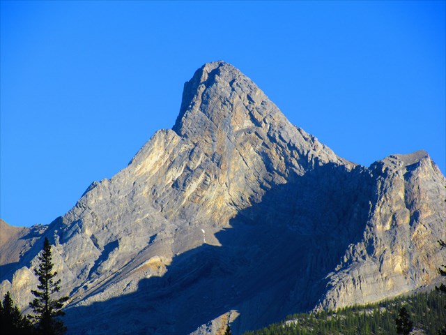
Naming Note: In 1947 a group claimed they were unsuccessful in climbing the mountain due to heavy bush. A subsequent attempt by Hind, Parker and Tarrant was successful and they decided the story of heavy bush was a "fable" - the name stuck.
Begin your day by parking at the suggested parking lot. Note: If you park along the streets of Exshaw, you risk having your car towed - use the suggested lot instead. Hike up alongside Exshaw Creek for about an hour, scrambling up and above an old dam along the way. There is no definitive trail thanks to the flood of 2013, but it is still quite passable. Expect to hop over the creek 10 - 20 times; not an issue in times of low water flow.
Reach the Fable drainage and turn left. Continue up more rubble for several kilometers. Eventually, you can scramble up a trail to a bench on the climber's right - this offers easier terrain than the gully. Follow up, navigating through scree and slabs. Once above the slabs, a scree slog leads up to a col.
Scramble up slabs and scree. I used climbing shoes on ascent and descent for the slabs - definitely not required but the added traction made things much easier. Several scree ramps present an easier yet more tedious alternative to the slabs in places, although some slab scrambling is still required. Higher up, things get exposed and the routefinding gets a little tricky. Watch for cairns and well trodden routes. The exposure continues all the way to the summit, where you're finally rewarded with 360 degree views!
If this route isn't adrenaline pumping enough, there are several popular climbing routes as described in Chris Perry's Bow Valley Rock. The toughest of which is a 5.10a trad climb called "The Boulevard" which tackles the imposing south face! The SW and SE ridges both offer slightly more sane 5.5 trad climbs.
Enjoy this incredible backcountry peak and scramble safely!
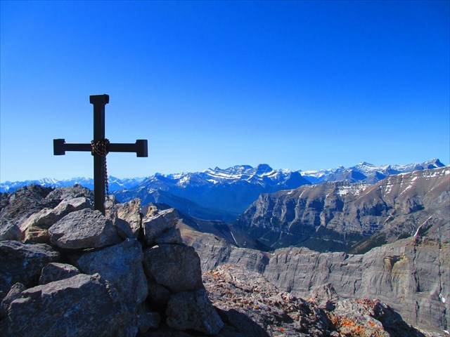
The Summit Cairn & The Lougheed Peaks:
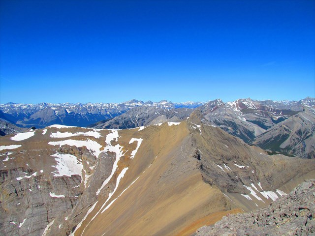
Summit Views West:
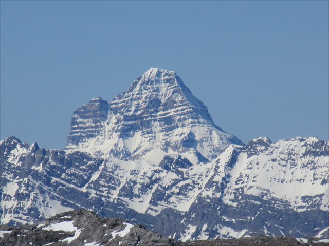
Mount Assiniboine on a Clear Day, 40 km Away: