Traditional owners and custodians, the Bindal and Wulgurukaba People are the first people to have lived in the Townsville region.
When Europeans first arrived in Townsville, they presumed that no one occupied or owned the land because there were no boundaries, marked by farms or fences. However the Bindal and Wulgurukaba Peoples had been living here for many, many generations. Archaeological sites near Townsville have been dated over 10,000 years old.
The Bindal People
The Bindal people call the country “Thul Garrie Waja”. An important symbol for the Bindal people is the shooting star. They believe that wherever the star fell, or the the direction the star fell meant there was either danger coming or someone from that direction was in need of help or in danger.
The Wulgurukaba People
The Wulgurukaba people call their country “Gurrumbilbarra” Wulgurukaba means “canoe people”. An important symbol of the Wulgurukaba people is the carpet Snake. Wulgurukabas creation story tells the story of the creation snake that comes down from the Herbert River, went out to sea creating the Hichinbrook Channel and down to Palm and Magnetic Islands. His body broke up leaving parts along the coast. The tail of the snake is at Halifax Bay, his body is at Palm Island, While his head rests at Arcadia, Magnetic Island.
Local Geology
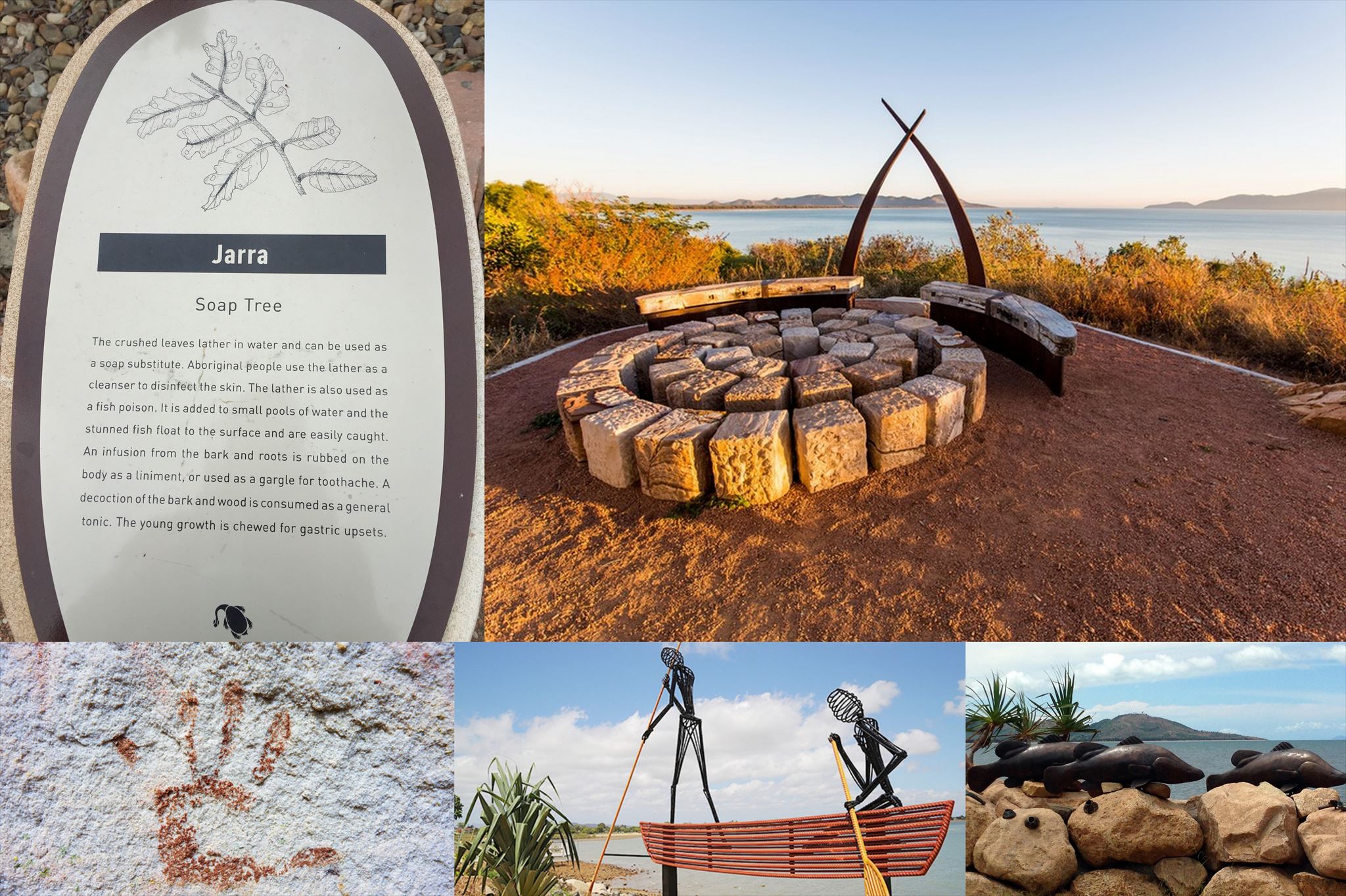
Local Aboriginal people used the natural features of the landscape and crafted tools from their surroundings to forage and hunt. At low tide they set curved stone wall traps to catch fish along the sandy spit that extended from Pallarenda to West Point, Magnetic Island.
Today, local Aboriginal people still fish and gather oysters in the area, but the lush coastal woodlands and vine thicket is gone. The trees around the lagoons were cut for timber as soon as Europeans settled here in 1864, and the water soon dried up. The mangroves are also gone, and development of the coast has changed the movement of the sands and there is no longer a spit leading to Magnetic Island.
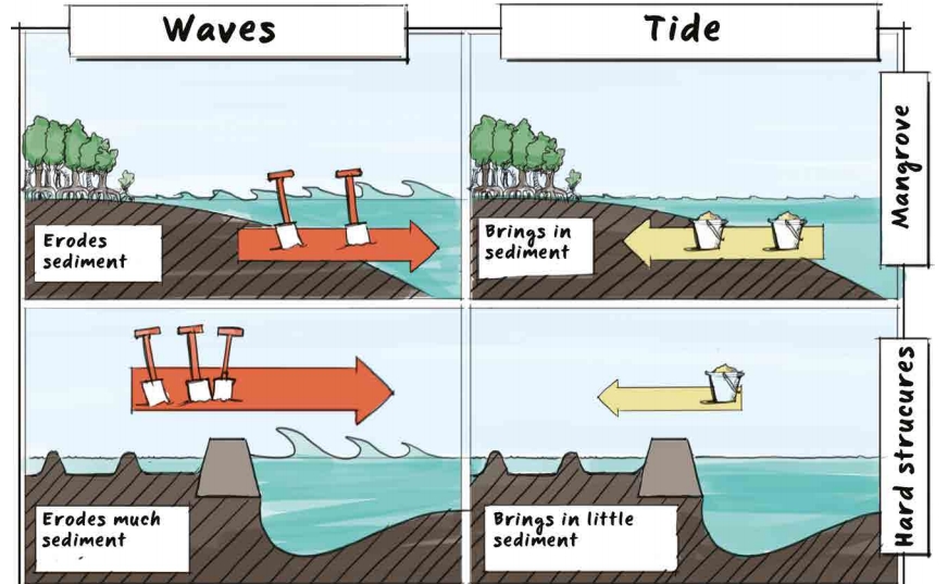
Mangroves play a role in protecting the coastline against erosion caused by wind, waves, and currents, reducing the impact of storms and cyclones. The dense tree root system keeps the sediment carried from the soil above from pouring into the ocean all at once, which stabilises the banks, protects the corals from choking, reduces turbidity, and filters and traps pollutants. At the interface between the ocean and earth, mangroves play a fundamental role in reducing monsoon flooding.
Source: http://www.nature.org/media/oceansandcoasts/mangroves-for-coastal-defence.pdf
To claim this cache you have to answer the following questions.
1. Explain the process of erosion that has occurred to the spit since the mangroves have been removed.
2. The Kissing Point Headland is naturally protected by hard Granite. What man-made methods and materials have been employed nearby to combat the effects of erosion?
Although not mandatory, take a photo of yourself on Garabarra Lawn and post it with your log. Please message (not email) the C.O. within a week of your log with your answers otherwise your log may be deleted.
Be sure to take your time to stroll around the Garabarra site reading the informative signs regarding life before European settlement before you leave.
Jezzine Barracks Map
Congratulations to Karicka for being the FTF.
