
The hike to Dark Hollow Falls is one of the most popular hikes in Shenandoah National Park. The falls are formed by the Hogcamp Branch of the Rose River and plunge over a series of drops. The main falls consists of two drops, just below the main falls are two more drops, both of which are narrow chutes around 20 feet high.
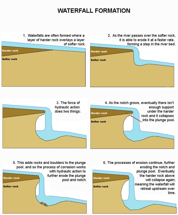
Waterfalls often form in the upper stages of a river where it flows over different bands of rock. It erodes soft rock more quickly than hard rock and this may lead to the creation of a waterfall. Often times, hard rock such as granite are located atop waterfalls and the soften rocks such as sandstone, which are located below the harder rocks, are eroded making the waterfall steeper beyond the hard rock. With the watercourse continuing to cut into the softer rock, the waterfall gets taller, the plunge pool (where the waterfall lands) gets deeper, and the soft rock directly beneath the hard rock gets undercut. As the undercutting continues, eventually the overhanging hard rock gets unstable and collapses into the base of the waterfall. The net result of this action is that the waterfall retreats further upstream to the remaining lip of the hard rock layer.
There are 10 waterfalls located in Shenandoah National Park. Dark Hollow Falls is not included in the list.
- Overall Run = 93 feet
- Whiteoak Canyon = 86 feet
- Cedar Run = 34 feet
- Rose River = 67 feet
- Lewis Falls = 81 feet
- South River = 83 feet
- Doyles River #1 = 28 feet
- Doyles River #2 = 63 feet
- Jones Run = 42 feet
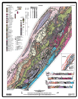
A higher resolution, PDF file can be found in the Related Webpage Link.
The Shenandoah National Park is underlain by three general groups of rock units:
(1) Mesoproterozoic granitic gneisses and granitoids,
(2) Neoproterozoic metasedimentary rocks of the Swift Run Formation and metabasalt of the Catoctin Formation,
(3) siliciclastic rocks of the Lower Cambrian Chilhowee Group.
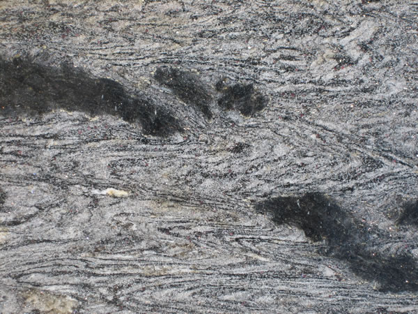 Mesoproterozoic granitic gneisses and granitoids
 Neoproterozoic metasedimentary rocks of the Swift Run Formation
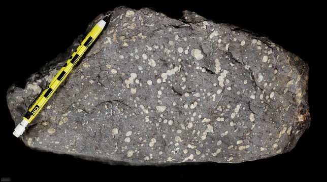 metabasalt of the Catoctin Formation
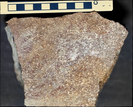
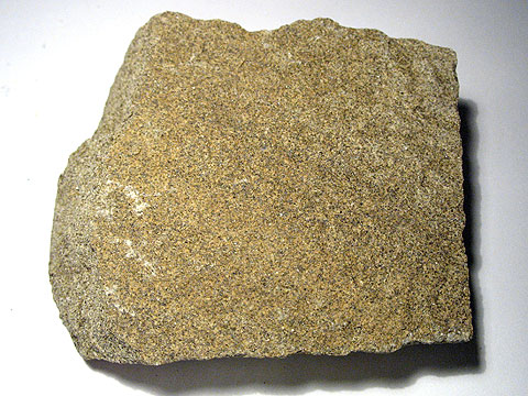 siliciclastic rocks of the Lower Cambrian Chilhowee Group
Sounds complicated? It really isn't, lets begin with the Mesoproterozoic granitic gneisses and granitoids, Mesoproterozoic is a geologic era that occured from 1,600 to 1,000 million years ago. Granitic gneisses are basically granite that has been metamorphosed into gneiss. Granitoids are a variety of coarse grained rocks similar to granite. When you put everything together, Mesoproterozoic granitic gneisses and granitoids simply means 1,600 to 1,000 million year old granite that has been metamorphosed into gneiss as well as coarse grained rocks similar to granite.
Neoproterozoic is the geologic era from 1,000 to 541 million years ago. Metasedimentary are sedimentary rocks that have been metamorphosed into metamorphic rocks. The Swift Run Formation is the name of the Neoproterozoic metasedimentary rock found in the area. Metabasalt is basalt that has been metamorphosed into metamorphic rock. The Catoctin Formation is the name of the metabasalt found in the area.
The siliciclastic rocks are clastic (contain broken pieces of older rocks) sedimentary rock that contain silicate minerals such as quartz. The Lower Cambrian Period began 541 million years ago, the word Lower means the earliest part of the Cambrian Period. The Chilhowee Group is the name of the siliciclastic rock from the Lower Cambrian Period found in the area.
The gneisses and granitoids are the oldest rocks in the park and are called the Basement Complex. They are exposed in the northern two-thirds of the park and underlie the lowlands east of Blue Ridge. They also make up rugged peaks like Old Rag Mountain (3291 feet) and Mary's Rock (3515 feet). Metabasalt underlies much of the highlands, like Stony Man (4011 feet). The siliciclastic rocks underlie linear ridges from 800 to 400 meters in elevation. The Page Valley is underlain by Cambrian and Ordovician carbonate rocks. Siliciclastic rocks are mostly west of the South Fork of the Shenandoah River and underlie Massanutten Mountain. Surficial deposits in the highlands include colluvium and debris fans. The lowlands have broad alluvial fans, alluvial plains, and fluvial terraces. Ridges underlain by siliciclastic rocks have abundant boulder fields. Numerous sinkholes and caves in the valley are due to the dissolution of the carbonate bedrock.
"Please remember that waterfalls take thousands of years to create and can also be very dangerous, especially in the areas closer to the falls that stay continuously wet, making them extremely slippery! Be safe....respectful of the area do not climb on the falls and view from a safe distance at designated viewing areas. Practice the "leave no trace policy".
Logging Requirements
- Record the elevation at the top of the falls by the sign. DO NOT LEAVE THE TRAIL TO TAKE THE ELEVATION MEASUREMENT. STAY ON THE TRAIL AT ALL TIMES. Then make your way to the bottom of the main falls and record the elevation. Compare the height of the falls to the other 9 waterfalls in Shenandoah.
- Using the information on the cache page as a guide, which of the three main rock groups found in Shenandoah National Park (Mesoproterozoic granitic gneisses and granitoids, Neoproterozoic metasedimentary rocks of the Swift Run Formation and metabasalt of the Catoctin Formation, and siliciclastic rocks of the Lower Cambrian Chilhowee Group) can be found at the falls? The waterfall has formed at the boundary between two ancient lava flows. The upper lava flow is highly resistant to erosion, thereby forming a steep slope. The lower lava flow is less resistant to erosion forming a gentle slope. From the bottom of the falls, can you identify the approximate location of where the lava flows meet (by looking for the different slopes)?
- The volume of water flowing over the falls as well as the height of the falls affects the depth of the plunge pool. The greater the volume of water (as well as the taller the falls), the deeper the plunge pool will be. Make a few observations of the plunge pool as well as the volume of water flowing over the falls at the time of your visit (be sure to include the time and date of your visit), does the plunge pool appear to be deep? shallow? Combine this with your observation of the flow rate. What can those two pieces of information tell you about the formation of the falls?
- (Optional) Upload a photo of the falls or any wildlife you observed in the area.
Sources
http://pubs.usgs.gov/of/2009/1153/pdf/ofr2009-1153.pdf
http://img.geocaching.com/cache/a4409eab-5a52-409e-8bf8-4242a2b07754.jpg
http://geology.com/rocks/pictures/gneiss-folded-lg.jpg
http://geologyinshorncliffe.weebly.com/uploads/3/0/5/0/30505566/7770910.jpg