This is a tour along Portage Road, starting at Green Bay and ending at the Whau bridge.
Sadly no songs have been written about its importance, but whilst collecting information for this multi you will find out more about its history and maybe you might be inspired to write a verse or two (log)!
This multi has seven waypoints and the final. You will need to gather information at each, then with a few simple calculations create the final co-ordinates and find the log book.
There are five additional waypoints (optional) to other historical sites which you pass along the way:
- Motu Moana Scout Camp
- Titirangi Golf Club
- Portage Road Information Panels
- Train Tracks to New Lynn Station
- Welcome to New Lynn sign
This is the narrowest part of the Auckland istmus, in 1903 it was estimated the distance between the tides of the Waitemata and Manukau Harbours by this route was only a mile and a half (2.4 km).
The other Auckland Portage is at Otahuhu through the Tamaki Isthmus.
Portage Road follows the Whau River now hidden behind private homes, reserves, and industrial areas.
The Whau River is formed by the smaller streams feeding into it:
- Whau Stream
- Avondale (Wai Tahurangi) stream (source Crum Park)
- Parahiku Stream (runs through Brandon reserve, La Rosa Park and private properties)
- Fairburn Stream
Waypoint A
Green Bay Beach
A = Number of wooden panels on table top - 13
This bay was the southern exit for Māori and early European, a vital portage/transport route between the Waitemata and Manukau harbour.
Motukaraka is the Māori name for the land to the west, once a large Māori Pa, now called Karaka Domain (end of Harrybrooke Road).
The area was originally called Karaka Bay, but was renamed to avoid confusion with other bays named Karaka.

Additional Waypoint 1
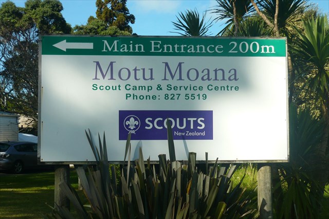
Motu Moana Scout Camp
This is the Scout Association's property purchased in 1941.
A brief history can be found at these links:
- Māori Motukaraka
- Scouting Motu Moana Camp
The camp is available for hire: bunk rooms, camping, hall, seminar rooms and Chaple.
Camp activities include: challenge valley, flying fox, campfire circles, waterslide, abseil tower, walks, kayaking and swimming.
Waypoint B
Craigavon Park
B = On Plaque number of letters in month - 4
An Auckland draper, William Henry Smith, acquired the land during the years 1897 to 1905.
The family used the park for playing, camping, picnicking and other recreational pursuits.
On William’s death in 1912, the property was left to his widow, Mrs W.H. (Caughey) Smith, who gifted the land to the City of Auckland in 1929 on condition that it be used “as and for a public park”.
The park is named after the Prime Minister of Northern Ireland, Lord Craigavon.
Waypoint C
Sister René Shadbolt Park
C = Last digit ID number X 2
Named in honour of Sister René Shadbolt (1903-1977), who began nursing training at St Helens maternity hospital in Auckland in 1927. She later undertook general nursing training, graduating in 1932, and completed her midwifery training in 1935.
She is the only New Zealander who served in the Spanish Civil War to have a Memorial.
The New Lynn Borough Council renamed this local reserve in her honour on 23 February 1942.
Following her death on 16 August 1977 at Henderson, she was widely mourned as a brave and remarkable woman.
Additional Waypoint 2
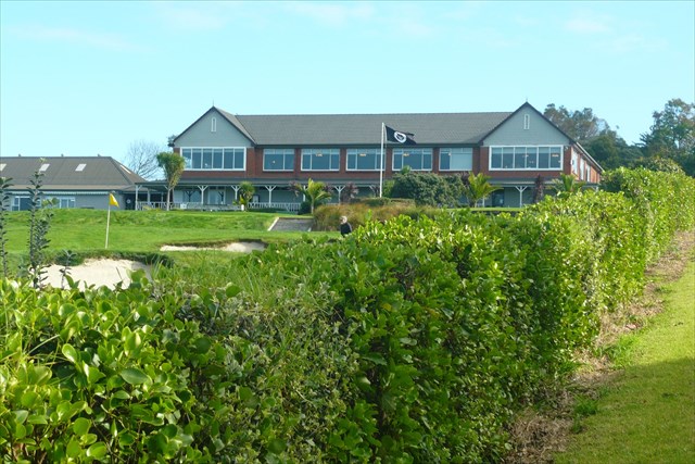
Titirangi Golf Club
Founded in 1909, Titirangi Golf Club began on a course at One Tree Hill (called the Maungakiekie Golf Club).
In 1919 it added its own course at New Lynn to the leased land on the Hill.
The New Lynn course was re-designed by the great golf course architect Dr Alister MacKenzie in 1927, who had designed Augusta, Cypress Point and Royal Melbourne courses.
Here is a link to more information about the Titirangi club and its history.
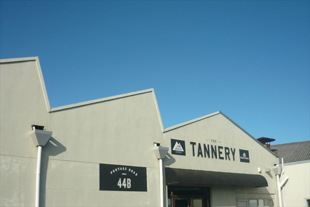
Waypoint D
E Astley and Sons
D = 4th digit Power Pole code
Where makers of leather products, and operated on this site for 120 years (44 Portage Road) from 1888-2008.
Staff numbers reached 450 in the 1990's as exporting peaked.
Eventually closing its doors, part of the business relocated to China in 1998 along with company’s chromium-based tanning technologies and equipment.
Additional Waypoint 3
Portage Road Information Panels
These panels contain information on local history, aerial pictures, and shows the changes that have occurred around Portage Road between 1940 and 1955.
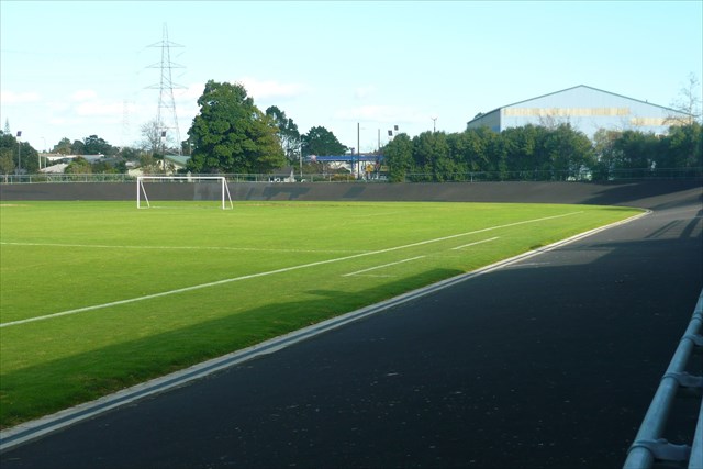
Waypoint E
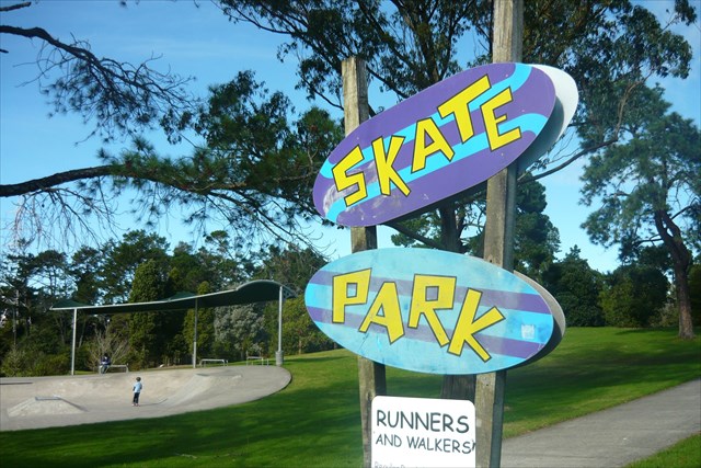
Olympic Park Velodrome
E = Large painted mural on the side of the building: number of black pentagons on the football - 5
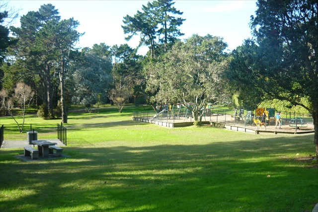
Olympic Park is a seven hectare recreational reserve in New Lynn.
The park was established in 1918 as the New Lynn Domain, and was originally 2.8 ha in size, over the years increasing in size as land was donated or purchased by council.
A velodrome and running track were constructed in the park in 1938 under a Government subsidised labour scheme.
Over the years the velodrome has been patched, and had been closed for safety reasons due to ground instability and poor construction.
Thankfully after an upgrade the velodrome is now able to be used by both cyclists and runners.
Nearby is the the EcoMatters bike hub (1 Olympic Place) which provides free access to tools and advice on basic bike maintenance, with secondhand bikes for sale too. So why not give it a go?
Additional Waypoint 4
Train Tracks to New Lynn Station
The co-ordinates take you to a level crossing, where trains enter/exit the New Lynn station.
The Western Line, was a single rail line built in 1880.
In December 2006, 126 years later, double-tracking between New Lynn and Avondale was approved by the central government. This allowed increased frequency of trains to every ten minutes.
Costing $120 million, the package included a 1 km long and up to 8m deep trench and tracks (from Portage Road to Titirangi Road).
Plus a new station with below-ground platforms eliminated two level crossings, which improved traffic safety and reduced congestion around New Lynn station (Totara Ave and Clark St) and Veronica Street.
All works where completed in June 2010
A book was published in 1992 written by Maurice Gee "Going West" about a steam train journey, from Loomis (Henderson) Station to the Auckland station. Whilst the buildings might have changed, the tracks follow a well worn path. Today this journey is now incorporated into the Going West Writers Festival complete with a train journey thru the West.

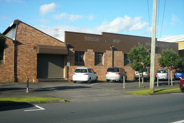
Waypoint F
Brush and Mop Manufacturers
F = Year of picture of premises on hanging sign: Last digit / 2
Fourth generation of brushmakers since 1879.
Relocating from the city in 1938, to this site, with the Art Deco stucco offices added in the 1950's.
The business has had a few name changes over the years, but is still a family business: J F Brown & Sons (now called Browns Brushware and Browns Clean Solutions).
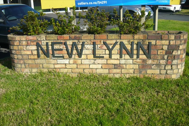
Additional Waypoint 5
Welcome to New Lynn sign
New Lynn was named by Frederick Utting who surveyed the area in 1863.
From Kings Lynn in Norfolk, East England, Utting was struck by the similarity of the undulating creek cut country covered in low vegetation.
During the 1860s and for some time afterward, the city side of New Lynn was often referred to as ‘The Whau’.
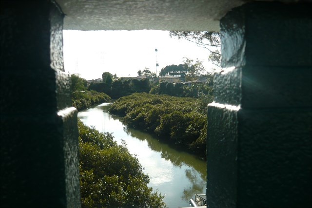
Waypoint G
Whau bridge and Waitemata Harbour
G = Year on plaque, last digit
This is the end of your Portage Road tour, you have arrived at the Whau, an entry point to the portage route between the Waitemata Harbour (Great North Road) and Manukau Harbour (Green Bay Beach).
Originally, the Whau Creek penetrated up as far as the Astley Tannery in Portage Road.
In 1907 this was the proposed site of a canal linking the two harbours.
Test holes were dug, later becoming swimming holes for the local children.
There is a 3 1/2 hour tidal difference between the two harbours, a problem the proposed canal would have had to overcome.
This was the old Council Boundary between Waitakere City and the Auckland Council (now amalgamated into the "Supercity").
Today it is still the boundary between Waitemata DHB and Auckland DHB.
During World War II, the area was considered strategic due to the Whau River and the railway: machine gun posts and tank traps were built into the creek (concrete tank barriers), the bridge mined with explosives, and the creek banks steepened.
South 36° 5 A . B C D ... East 174° 4 E . F G 2
CHECKSUM
South: sum of digits (all numbers added together) = 34
East: sum of digits (all numbers added together) = 25