 FRANÇAIS
Le plateau d'Helfaut :
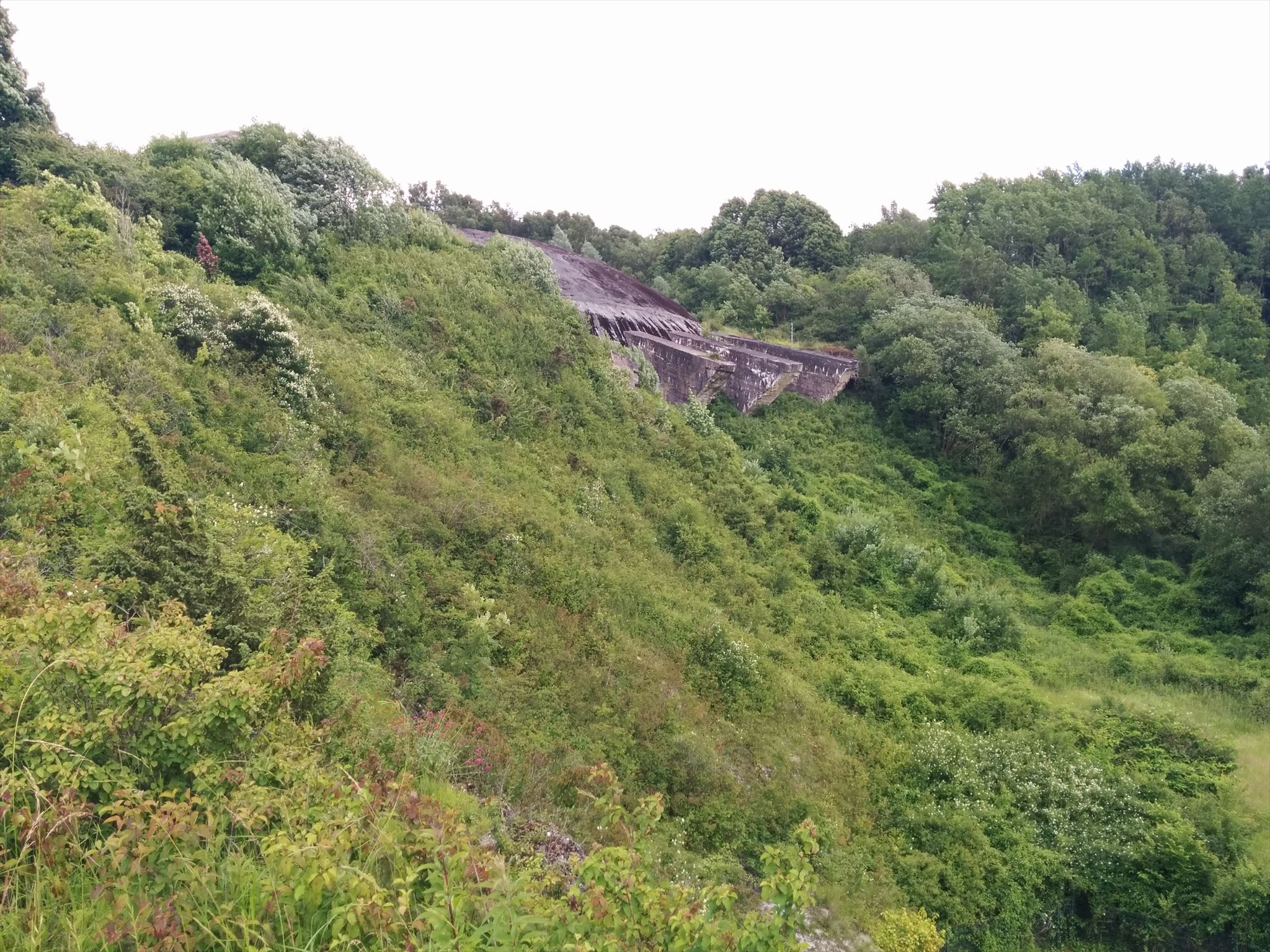
Le Plateau d'Helfaut s'étandant sur 300 hectares près de Saint-Omer est un site géologique remarquable où l'on peut trouver une couche superficielle d'argile à silex dilivium d'Helfaut ainsi que des couches géologiques inversées.
Bordé par l’Aa, le plateau des Landes est un espace naturel plusieurs fois modifié par l’empreinte humaine. L’événement le plus caractéristique est bien entendu celui lié à la construction de la Coupole par L’Organisation Todt en 1943-1944. L’Allemagne Nazie avait choisi cette ancienne carrière de craie pour sa proximité avec la voie ferrée Saint-Omer-Boulogne, la protection que pouvait constituer ces collines de l‘Artois et la facilité à creuser dans cette roche friable.
La carrière Maquart :
Peu après avoir retenu le site d'Eperlecques, les ingénieurs du festung Pi. stab 27 avaient repéré, des février 1943, une carrière à chaux à Wizernes. Cette dernière appartenant à monsieur Maquart était accessible par le rail et elle était voisine d'une autre carrière utilisée pour l'exploitation de la marne. Un éperon crayeux séparant les deux carrières. Toutes deux étaient adossées au flanc du mont d'Helfaut et parallèles à la ligne férroviaire Saint-omer / Boulogne.
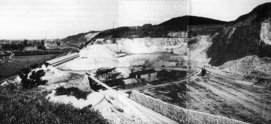
La carrière avant l'occupation
Rappel concernant les « Earthcaches »: Il n'y a pas de conteneur à rechercher ni de logbook à renseigner. Il suffit de se rendre sur les lieux et d'exécuter les requêtes du propriétaire de la cache. Loguez "Found it" et envoyez-vos réponses au poseur soit par mail ou soit par la messagerie geocaching.com (Message Center), je vous contacterai en cas de problème. Bon Earthcaching!
Pour valider votre visite:
1. À quelle altitude vous trouvez-vous d'après le panneau ? Dans quelle couche se trouve-t-on à cette altitude au niveau de la falaise ?
2. Quelle couche géologique trouve t'on vers Blendecques et qui n'est pas présente à Helfaut ?
3. Quels sont les 2 noms des séparations entre 2 couches ?
Option : une photo de vous et/ou de votre GPS avec la falaise en arrière-plan. Pas de photo du paneau avec le texte visible s'il vous plait !
 ENGLISH
The plateau of Helfaut:
The Plateau d'Helfaut stretching over 300 hectares near Saint-Omer is a remarkable geological site where you can find a superficial layer of clay to fluvial diluvio of Helfaut as well as geological inverted layers.
Bordered by the Aa, the Landes plateau is a natural space modified several times by humans. The most characteristic event is of course the construction of the Dome by the Todt Organization in 1943-1944. Nazi regime chose this old chalk quarry for its proximity to the Saint-Omer/Boulogne railway, the protection provided by the Artois hills and the facility to dig into this friable rock.
The Maquart Quarry:
Soon after retaining the site of Eperlecques, the engineers of the festung Pi. Stab 27 had spotted, in February 1943, a lime quarry at Wizernes. The latter belonging to Mr. Maquart was accessible by rail and it was next to another quarry used for the exploitation of the marl. A chalky spur separates the two quarries. Both stand against the flank of the Mont d'Helfaut and are parallel to the Saint-Omer/Boulogne railway line.
The quarry before the occupation
Reminder on "Earthcaches": There is no container or logbook on the given coordinates. Just visit the site and answer the questions by e-mail or by the Message Center.There is no need to wait for my reply, feel free to log immediately after. If the answers are incorrect, I will let you know. Happy caching!
To valid your visit:
1. What is the altitude according to the information board? What is the layer of the cliff at this altitude?
2. Which geological layer can be found in Blendecques and which is not present in Helfaut?
3. What are the 2 names of the separations between 2 layers?
Option: a photo of you and/or your GPS with the cliff in the background. No picture of the panel with visible text please!