Intro:
The foothills of the Colorado Piedmont is the location where two major geologic regions meet, the Great Plains and the Rocky Mountains to the west. The complex interplay of geology and climate has resulted in a dramatic landscape of great beauty, making the Front Range foothills a desirable place to visit and live. Today, most of Colorado’s residents live in cities along these foothills so let’s explore a bit of the geology of the region from one location.
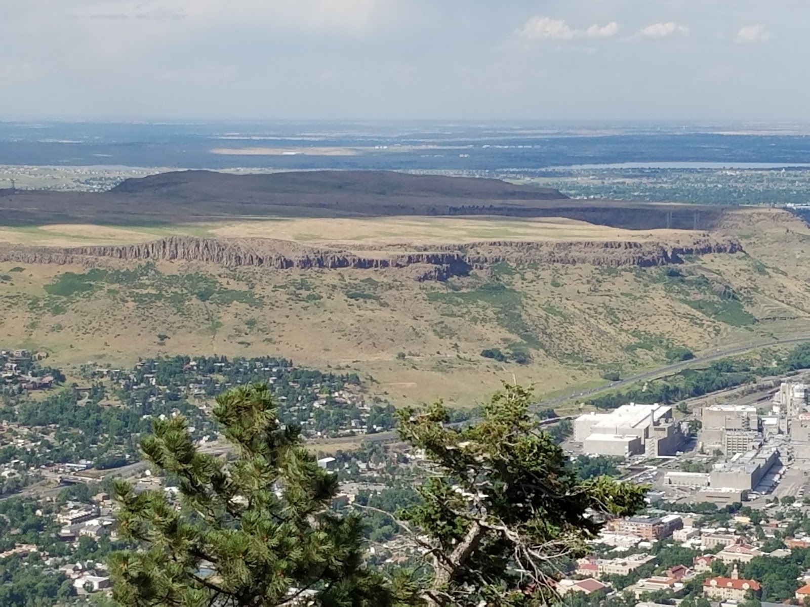
Although the landscape here looks timeless, it is not at all dormant. The foothills region is slowly but actively changing due to a number of geologic and climatic processes. Its mountains and mesas are wearing down, and water is eroding sediment from the rock, these processes are natural, and they have been occurring for millions of years. The dividing line between these two regions is the steep escarpment that marks the east edge of the hard Precambrian rocks of the mountains,west of the escarpment, hogbacks and valleys formed on the upturned sedimentary rocks of Paleozoic and Mesozoic age make up the foothills. East of the foothills most of the area is terraced and slopes eastward, this general eastward slope is broken only by the lava-capped mesas of North and South Table Mountains. Many of these features can be seen from here on Lookout Mountain a front range mountain that rises to 7,377 feet (2,249 m) .
You can park at the Buffalo Bill Museum and Lodge Parking lot and after visiting the overlook, walk up to Buffalo Bill's grave and from there go westward through the woods to the parking lot road and back to the parking lot. Look carefully at some of the rocks and eventually you will find some containing garnets unfortunately, these garnets are NOT gem quality and please leave them as they are for others to enjoy. You do not need to do the walk, this earthcache is at the overlook on the northeast end of the parking lot.
Lava and Erosion

Looking northeast we see the flat tops of North and South Table Mountains dissected by Golden Freeway and Clear Creek. So, how did these two form as they appear now?
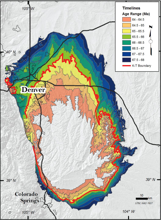
The end of the Cretaceous period (63 to 64 million years ago), apart from an asteroid collision, was marked by a high level of volcanic activity associated with the rise of the Rockies. Here near Golden, lava flowing from several miles to the northwest would flow down a broad shallow valley and solidify into a now 1,000 foot high formation overlooking the surrounding area.The lava flows were then buried by younger sediments as uplift of the Front Range continued. Along the mountain front the upper surface of this sedimentary apron was at approximately the same level as the Rocky Mountain erosion surface.
Subsequent erosion has removed the sediments above them and the connection with their up-valley lava source. Predecessors to Clear Creek have cut the formation into four separate structures that are all that remain of the original formation: Ralston Dike, North Table Mountain, South Table Mountain, and part of the north and northeast slopes of Green Mountain. (Most of Green Mountain is made of conglomerate from eroding mountain peaks to the north and west, not the basalt flowing from Ralston Dike.) They stand as mountains because the hard lava has protected the underlying sand and gravel from erosion but the flows protected the older sediments beneath them, leaving the flows standing as flat-topped mesas. This type of geomorphic feature is known as a topographic inversion.
Denver Basin and the Great Plains

Looking east, you can see the city of Denver and the Great Plains stretching out in front of you. Hidden beneath this is the Denver Basin which is a major regional asymmetric bowl-shaped structural depression on the east side of the Front Range. Sedimentary material shed from the rising Front Range uplift during the Laramide mountain building event filled the basin as it developed. The basin has an east-west width of about 140 miles and, a north-south length of about 350 miles. Most of the Denver Metropolitan Area is underlain by the gently dipping, eastern limb. In contrast, the foothills area is underlain by the steeply dipping, western limb which reached is maximum depth of about 13,000 feet beneath east Denver and the rocks underlying eastern Jefferson County that dip eastward toward that point. The steep to nearly vertical dips found near the Dakota hogback and the Golden fault abruptly flatten three to four miles east of the hogback. Beneath the central and eastern parts of the project area the eastward inclination of the beds amounts to only a few degrees.
The Front Range Uplift
Looking north, we see the jagged peaks and slopes of the foothills of the front range which mark the end of the plains and the beginning of the Rocky Mountains which rise in the distance to the west. We can see the distinctive hogback of the Dakota Sandstone at both ends of the valley. But why is this hogback missing at the valley center? The answer is the Golden Fault, a large, Laramide thrust fault that weaves along the valley and marks the eastern boundary for the Front Range in Jefferson County it extends from Ralston Dike to Mount Carbon, a distance of about 15 miles. The trace of the fault can be seen as it cuts up the side of the first large sediment terrace to the south of Clear Creek. There is a distinct break in the vegetation between the Fountain Formation to the west (covered with mountain mahogany shrubs) and the Pierre Shale to the east (covered with grasses).
When the Cretaceous seaway was beginning to recede about 70 million years ago, the first stirrings of the episodes of four mountain building that laid the foundations of the Front Range and most of the other major Colorado ranges began. Plate movements along the western edge of the continent began to buckle the Earth’s crust, raising domes and elongate welts of basement rocks and their sedimentary cover to 1,500-2,500 feet above the Piedmont along the mountain front. Many of the uplifts were bounded by folds or by faults along which slabs of rock were uplifted and moved several with respect to the rocks beneath them.
Along the Golden Fault basement rocks of the range have been uplifted and carried several miles eastward, while the once-horizontal beds of sedimentary rocks beneath the overriding block bent upward so that they generally slope eastward. Here, the fault has displaced nearly 8,000 feet of the Paleozoic and Mesozoic, sedimentary section, its effects are most profound west and southwest of Golden.
The Golden fault is commonly portrayed on maps and diagrams as a single west-sloping fault, but in reality it is probably a complex zone of many interlaced faults of various orientations. The Laramide orogeny (a process in which a section of the earth's crust is folded and deformed by lateral compression to form a mountain range) ended about 50 million years ago. During the orogeny, movement along the Golden fault and other Laramide folds and faults raised the basement rocks in the highest parts of the range by as much as 20,000 or 25,000 feet relative to the basement rocks beneath Denver and the surrounding plains.
While this may seem like an enormous amount of uplift, spread over the 20 million years or so that the orogeny was active, the average rate of uplift would have been less than a hundredth of an inch per year. However, the uplift probably occurred in a series of discrete episodes at different times in different parts of the range, so that the actual rates of uplift were probably much faster. The total uplift does not mean that the Front Range peaks were ever 25,000 feet high! Remember that the height of a mountain at any given time is determined by the balance between the rate the rocks that form it are uplifted and the rate at which they are being eroded. Thus the Laramide Front Range may never have been higher or more rugged than the range we see today.
In order to get credit for this Earthcache, please email me the following information. Failure to do so will result in a deletion of your log/find.
-
Why is Table Mountain flat?
-
What rock type do you find on top of Table Mountain and how did it get there?
-
Why do we find Garnets on top of Lookout Mountain? Did you locate any while visiting?
-
What type of fault is the Golden fault and what does it displace?
-
What type of rock is found on top of Lookout Mountain in Golden and how did it get there? (HINT: Garnet is not an answer)
-
**Optional**Take a picture of you at the park with a feature in the background.
Sources for this earthcache:
Geologist's Guide to Jefferson County Open Space
Geologic Overview of Jefferson County, Colorado
Bouncing boulders, rising rivers, and sneaky soils: A primer of geologic hazards and engineering geology along Colorado's Front Range D. C. Noe, J. M. Soule, J. L. Hynes, and K. A. Berry Areas
http://www.periclespress.net/GreenMountain.html