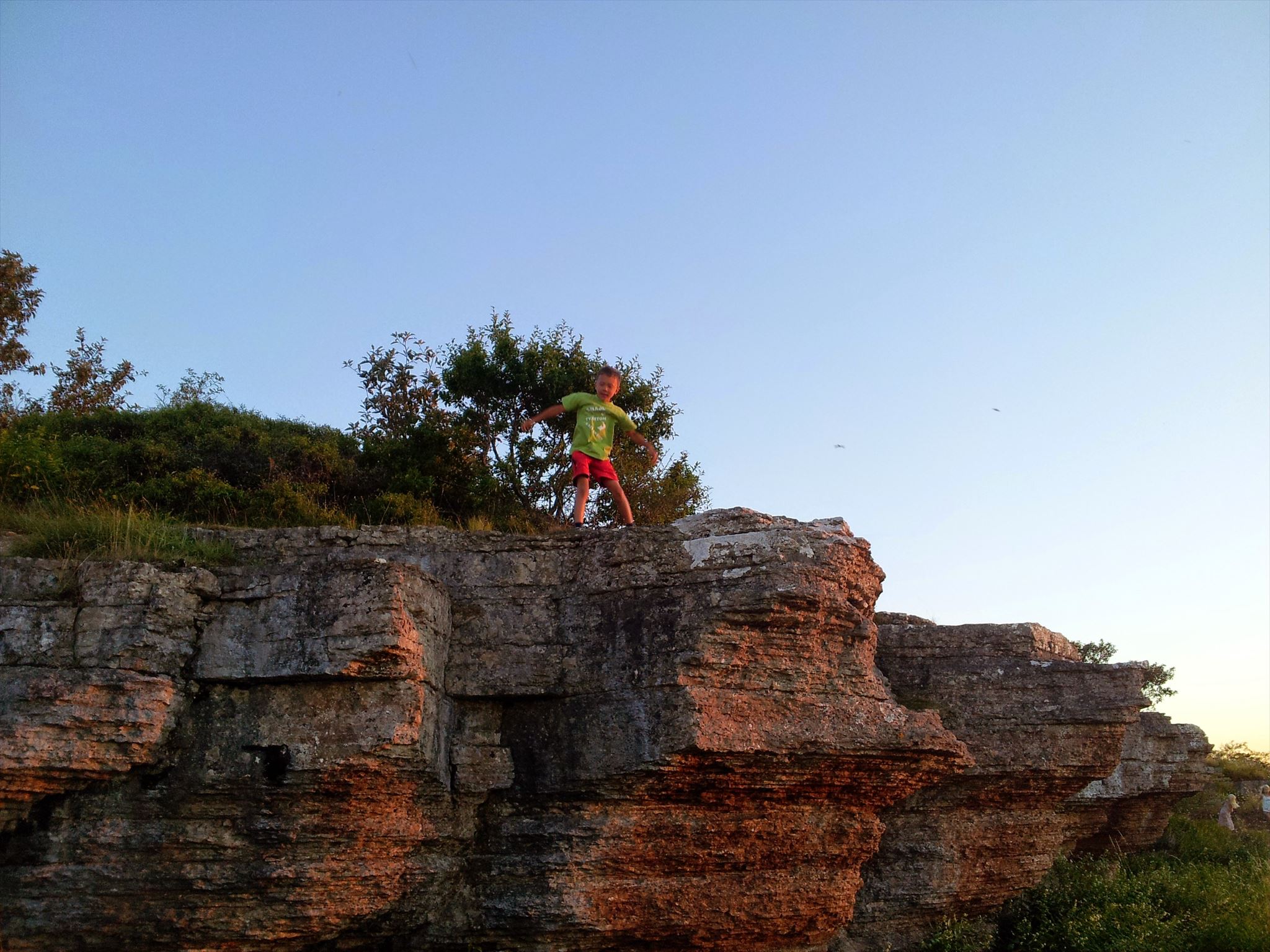
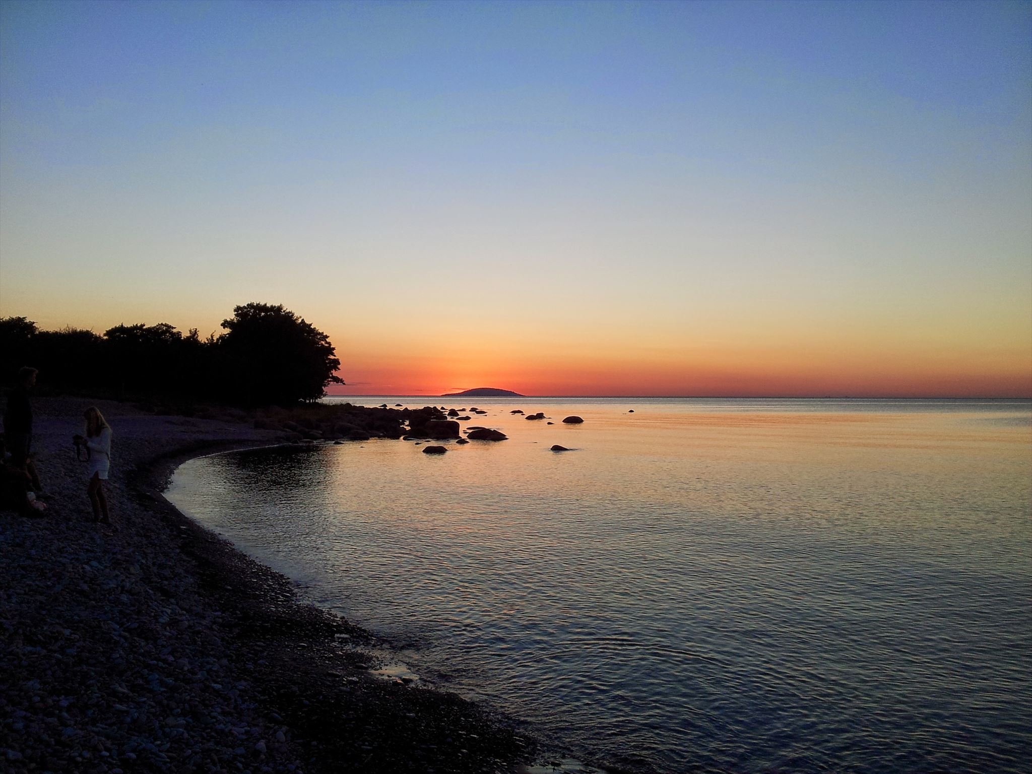
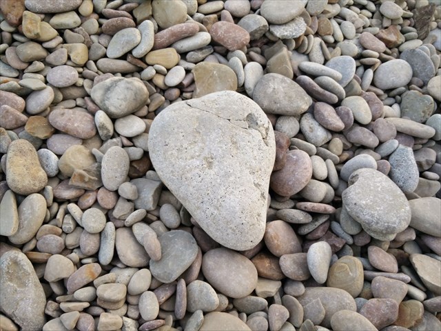
Horns udde med sin klapperstensstrand och sin flera meter höga, dramatiskt utskulpterade strandklint, eller landborg, är en magiskt vacker plats längs den slingrande kustvägen genom naturreservatet Horns kungsgård. Här kan du vandra över släta klapperstenar som havet slipat i årtusenden, leta fossiler och klättra på branta kalkstensklippor som bär tydliga spår av istiden och för länge sedan gångna geologiska perioder. Utsikten över Kalmarsund är storslagen, kanske allra mest när solen går ned i havet bortom Blå Jungfrun. I reservatet finns klintkust, alvarmarker, våtmarker, ädellövskogar, ekhagar och slåtterängar med orkidéer som salepsrot, brudsporre och jungfru Marie nycklar. Här finns gott om fågel och tolv av landets arton fladdermusarter. Området ingår i EU:s ekologiska nätverk av skyddade områden, Natura 2000.
Här möter spår av uråldriga geologiska processer lämningar från järnålder och medeltida boskapsskötsel, fiske och stenbrytning och idag bedrivs ett naturvårdsanpassat jordbruk på kungsgården. Människans nyttjande av naturen och den kulturella utvecklingen är tätt knuten till de geologiska förutsättningarna på ön. "Ölandsmarmorn", den karakteristiska, ofta röda kalkstenen, har brutits här sedan 1500-talet och har försett bl a Stockholms slott och Borgholms slott med byggmaterial. Stenen exporterades även till Europa och återfinns på många platser runt Östersjön. Kanske finns några plattor av Ölandssten i din egen trädgård?
En gång i tiden stod hela Öland under vatten, men genom landhöjningen reste sig Sveriges näst största ö ur havet, med början för drygt 12 500 år sedan. För närvarande är landhöjningen i Sverige upp till 9,2 mm/år, så Öland kommer sannolikt fortsätta att växa ytterligare lite grand - om inte klimatförändringarna gör att medelhavsvattenytan höjs i ökande takt och minskar effekten av landhöjningen. Idag kan olika lager av kalksten studeras i klinten som sträcker sig kilometervis längs stranden, upp till Byrums raukar och längre, även om delar av den har rasat ned p g a havets påverkan (erodering).
Ölands kalksten bildades under den geologiska perioden ordovicium för drygt 480 miljoner år sedan. På havsbotten föll ett kalkslam med lerpartiklar och skalfragment från koraller, snäckor och andra djur till vila. Det var inga snabba processer. Geologerna räknar med att det tog ca 1 000 år för 1 millimeter kalksten att bildas. Kalkstenen är i sina undre delar betydligt hårdare än kalkstenen uppe i lagerserien. Detta tyder på att allteftersom tiden gick i det ordoviciska havet, desto mer skal och mindre andel lerpartiklar tillfördes bottensedimenten. Kalkstenen är alltså betydligt porösare i ytan än kalkstenen mot djupet. Detta förklarar delvis varför vissa stentäkter måste göras djupa – stenen är helt enkelt för porös i de ytliga lagren.
Kalkstenen varierar i färg från plats till plats. Färgen beror på syreförhållandet i det ordoviciska havet under tiden då stenen bildades. Den röda färgen vittnar om järnutfällning som antagligen skett då solljus och syre nått ner till bottnen i ett grunt hav. Stenen har ”rostat” och blivit röd. Motsatsen råder vid bildandet av grå sten som finns på andra delar av Öland. Sedimentationen har då skett i ett djupt, syrefattigt hav. Flera varianter finns: spräcklig, blodröd, gröngrå osv.
Kalkstenen skiftar också till sin struktur och uppbyggnad. Eftersom kalkhalten varierar har kalksten från olika platser kommit att användas för olika ändamål. Längst söderut på Öland krossas t ex kalkstenen till foderkalk för höns. Bara någon mil längre norrut omvandlas kalkstenen till cement, vilket inte vore möjligt i Horns Udde eftersom kalkhalten i stenen där inte är tillräckligt hög för cementframställning. Även sprickförekomsten varierar. Orsaken är bl a att inlandsisen, som långt efter det att kalkslammet stelnat till bergart, med sin tyngd, tryckte sönder kalkstenen. Står man vid brotten på Horns udde ser man hur sprickfrekvensen minskar mot djupet. Detta bidrar också till att man i vissa fall måste söka sig djupare ned för att finna stora, sprickfria block för bearbetning på industrierna.

Fortfarande idag pågår samma processer i havet: På vissa håll döda, syrefattiga bottnar, på andra håll syresatta levande bottnar – allt går igen i ett evigt kretslopp med samma processer och skeenden över tiden, även om den mäts i miljontals år. Var därför rädd om det känsliga ekosystemet!
Grilla gärna och ha trevligt på stranden, vi gör det varje sommar - men använd medhavd grill, elda mycket försiktigt och ta med allt skräp hem! Vill du släppa upp Thailandslyktor (Khom Loy), så välj en miljövänlig modell som naturen kan ta hand om. Hittar du en fossil? Fota gärna, men lämna kvar den på stranden så de inte tar slut!
För att logga denna EarthCache ska du besvara följande frågor:
- Studera den stora, överhängande klippan vid koordinaterna, det djupaste överhänget på denna strand. Hur ser kalkstenen ut just här? Vad säger det om hur den kan ha bildats? Vad skulle den här kalkstenen kunna användas till? Berätta vad du ser och vad du tror!
- Det syns tydligt hur porös kalkstenen är här, eftersom havet genom erodering har format ett så djupt överhäng. Hur djupt bedömer du att överhänget är (från väggen längst in till längst ut vid kanten av "taket")?
- Försök uppskatta höjden på klinten. När kan toppen av klinten ha börjat bli synlig ovanför vattenytan? Redogör för din beräkning!
- Frivillig uppgift: Posta gärna en bild på dig själv i din logg med den finaste stenen du hittar! (Visa ej överhängets djup eller klippans höjd på bilden)
Svaren skickas i meddelande till CO - INTE i loggen. Du kan logga cachen som hittad när du skickat in uppgifterna, du får meddelande om de behöver kompletteras.
VÄLKOMMEN TILL HORNS UDDE!

Horns udde, with its shingle beach and its dramatic, sculptured cliff is an amazing place along the coastal road through the nature reserve Horns kungsgård. You can walk over smooth pebbles, find fossils and climb the steep limestone cliffs with obious signs of the Ice Age and other since long time ago passed geological eras. The view of the Kalmarsund is magnificent, especially when the sun goes down beyond the Blå Jungfrun island. The nature reserve has coastal cliffs, limestone soils, wetlands, hardwood forests, oak pastures and hay meadows with orchids as salepsrot, fragrant orchid and heath spotted orchid. There are plenty of birds and twelve of the country's eighteen species of bat.
On this site, traces of ancient geological processes and remains of the Iron Age meet remains of medieval farming, fishing and quarrying and today's conservation custom farming. The human use of nature and the cultural development is closely linked to the geological conditions on Öland. "Ölandsmarmorn" ("The marble of Öland"), the characteristic, often red limestone has been mined here since the 1500s and has provided among others, the Royal Palace and Borgholm Castle with material. The stone was also exported to Europe and is found in many places around the Baltic Sea. Maybe there is some Öland limestone in your own garden?
Once upon a time, Öland was completely covered with water, but land uplift made this Sweden's second largest island, starting to rise from the water more than 12,500 years ago. Currently, the uplift in Sweden is up to 9.2 mm/year, so Öland is likely to continue to grow even a little bit more - unless climate changes make the waterline rise, and reduces the effect of uplift. Today, different layers of limestone can be studied in the cliff that stretches miles along the beach, up to the sea stacks of Byrum and longer, although parts of it have fallen down because of the sea influences (erosion).
The Öland limestone was formed during the Ordovician geological period, just over 480 million years ago. On the seabed clay particles and shell fragments fell to rest. The process wasn't quick. Geologists estimate that it took about 1000 years for 1 millimeter limestone to form. The limestone is in its lower parts considerably harder than the limestone up in stock series. This suggests that as time went on in the Ordovician sea, the more scalable and less proportion of clay was added to the sediment. The limestone is therefore significantly more porous at the surface than the limestone at depth. This partly explains why some stone quarries must be deep - the stone is simply too porous in the superficial layers.

The limestone varies in color from place to place. The color depends on the oxygen ratio in the Ordovician Sea during the time when the rock was formed. The red color testifies that ferric probably occurred when sunlight and oxygen reached down to the bottom of a shallow sea. The stone has become "rusty" and red. The opposite is the formation of gray limestone found in other parts of Öland. Sedimentation has since been in a deep, oxygen-poor sea. There are several variants: speckled, blood red, greenish-gray and so on.
Although we experience the limestone as fairly homogeneous and similar everywhere on Öland, it shifts, not only in color but also in its structure and construction. Since even the lime content varies, it has come to be used for different purposes in different places. At the south of Öland, limestone could be crushed to feed for chickens. Only a few miles north, limestone is converted for cement which would not be possible, for example at Horns Udde, because the lime content of the stone is not high enough for the cement production. Even the presence of cracks vary in limestone packs. The reason is probably that the ice sheet, long after the lime mud hardened into rock, with its weight pressed down the limestone. If you stand at the quarry of the Horns udde, you can see how the fracture frequency decreases with depth. This is also a reason why, in some cases, you need to seek the depths to find large, crack-free blocks to be processed in the industries.
The processes in the sea are still ongoing: Somewhere dead, anoxic bottoms. Elsewhere live, healthy, oxygenated bottoms - everything goes back in an endless cycle of the same processes over time, even if it is measured in millions of years. Please, be mindful with the fragile ecosystem!
Enjoy the beach, we do it every summer. Bring your own barbeque, be very careful with the fire and take all your litter home again. Do you want to release some Thailand lanterns (Khom Loy), please use an eco-friendly model that nature can take care of. Did you find a fossil? Take a picture, but please, leave the fossil on the beach so they do not run out!
To log this EarthCache, please, answer the following questions:
- At the coordinates, study the big, overhanging cliff carefully. What does the limestone look like right here? What does it say about how it was formed? How could this very special piece of limestone be used? Tell what you see and what you think about it.
- Here you can easily see how porous the limestone is, as the sea erosion has formed a deep overhang. Try to estimate how deep the overhang is (from the wall at the back to the edge of the "ceiling").
- Try to estimate the height of the cliff. When could the whole cliff have begun to raise above the water? Explain your calculation!
- Optional: Post a picture of yourself with the most beautiful stone you find! (Please, don't show the depth of the overhang or the height of the cliff)
Please, send the answers in a personal message to CO - do NOT post them in the log. You can log the cache as found when you have sent all your answers. You'll receive a notification if there is any completion needed.
WELCOME TO HORNS UDDE!