Fire Island is an outer barrier island on the Atlantic Coast. It is 31 miles long and ranges from 520 feet to 1310 feet wide.
Barrier islands are long narrow islands that run parallel to the coast. They occur along the Atlantic and Gulf coasts from New Jersey to Texas. They are built up by the actions of waves and currents and help protect the coastline from erosion by surf and tidal surges. Elevations on the barrier islands typically range from sea level to about 25 feet, although individual dunes may be higher. Topography of the islands is typically characterized by broad, nearly level areas interspersed with low, gently sloping ridges. Islands and portions of islands that are of more recent origin may be characterized by steep, parallel dune ridges.

Open Water -Barrier Islands are found in areas where the sea floor slopes away gently to the continental shelf. The shallow angle of incoming waves makes it very easy to transport sediments in and out with waves, tides, and storms.
Beach -This part slopes up from sea level (the foreshore) but often reaches a flat aspect at some distance from the sea (the backshore). The energy of incoming waves is spent rolling up the gentle slope of the foreshore and the backshore is typically only inundated during storms when storm surge pushes water up further.
Dune -The action of wind and wave tend to push sand grains landward and these sediments accumulate in the backshore environment forming sand dunes. These dunes soon become home to opportunistic plant species, such as sedges and grasses, which then trap more sand allowing more plants to take root. This feedback can create quite substantial dune which can provide quite a bit of protection to the more landward parts of the island.
Overwash -Strong storms, such as hurricanes, can push sand all the way over the dune. These sediments come to rest in this area and eventually become stabilized by grasses and other plants. This area is also called a mud flat or backwash.
Salt Marsh -Salt marshes are regions on the landward side of the island that gets flooded regularly with seawater. High Marshes get flooded twice a month by spring tides. Low Marshes get flooded twice a day by normal high tides. These marshes are very biologically rich areas, supporting a vast array of species of plants and animals.
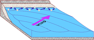
The biggest force that effects barrier islands is the prevailing wind and the tide which cause a never ending cycle of erosion and deposition. The prevailing wind blows towards the shore, creating waves. The waves then move sediment towards the shore at an oblique angle. Retreating waves (backwash) then carry sediment away from the beach at a 90° angle, perpendicular to the shore. The effects of these processes are beach drift (longshore transport) of sediment parallel to shore in the general direction of the prevailing winds.
The never ending cycle of erosion and deposition brings us back to the topic of dunes. As sand accumulates on the beach, prevailing onshore winds blow it inland where it becomes trapped by obstacles such as vegetation and pebbles. As the sand grains get trapped they begin to accumulate and start of formation of dunes. The winds then begins to erode the growing mound of sand by moving particles from the windward side and depositing them on the leeward side. Gradually this action causes the dune to “migrate” inland, accumulating more and more sand in the process.
Logging Requirements
- Go to the Dune waypoint. Please do not leave the boardwalk, doing so causes deterioration of beach grass and other vegetation that helps to prevent erosion. Estimate the height of the dune. Is vegetation dense, sparse, or non-existent? Do you see any evidence that the dune is growing, or shrinking? Do you see any evidence that the dune is moving? If so in what direction?
- At the Boardwalk waypoint, observe the surrounding vegetation. Please do not leave the boardwalk, doing so causes deterioration of beach grass and other vegetation that helps to prevent erosion. Which of the five different "zones" are you standing in (open water, beach, dune, overwash, or salt flat)? What lead you to that conclusion?
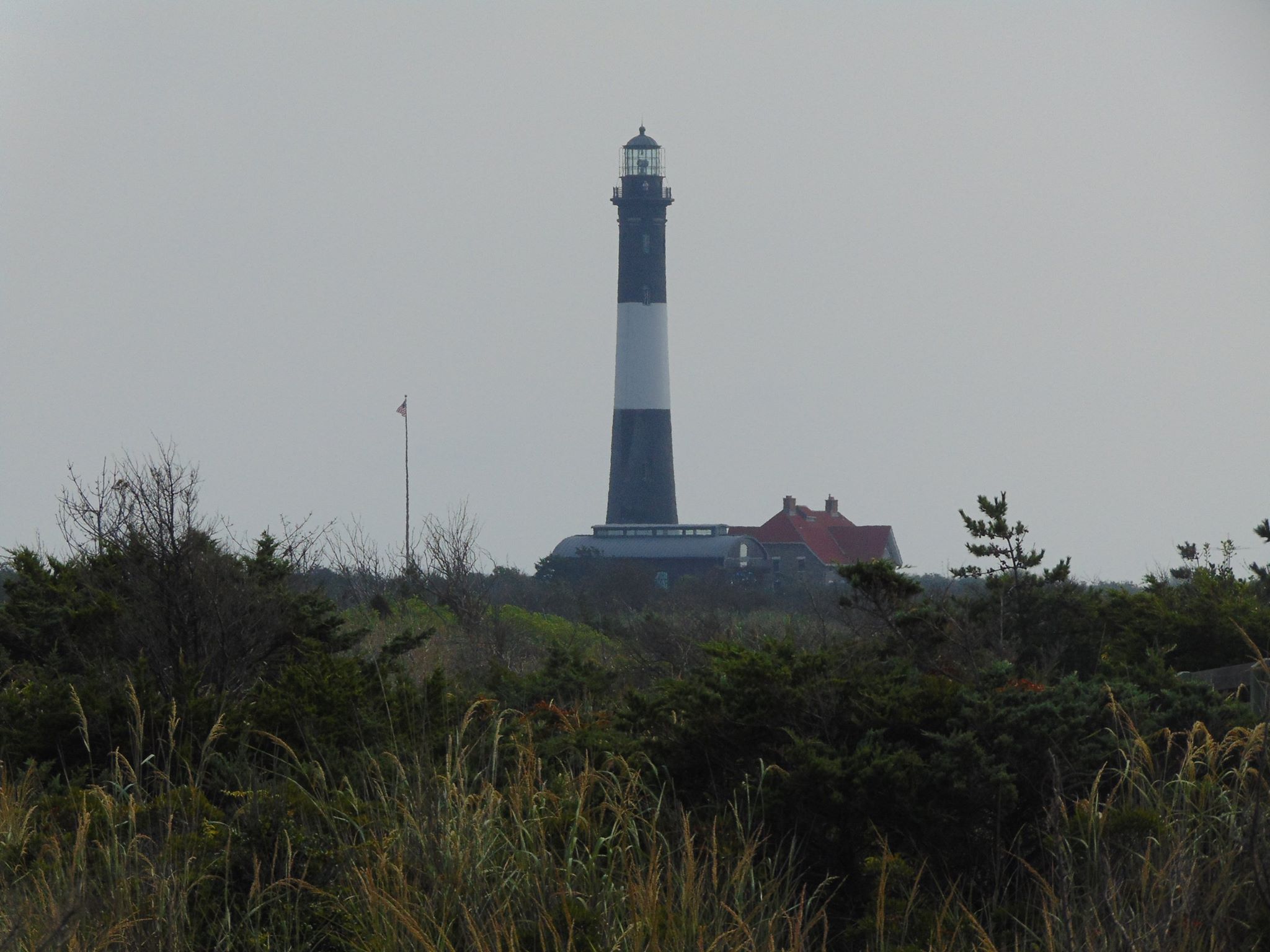
- Continue up the boardwalk to the Lens Building. To the left of the building are the foundation of the original lighthouse which was built in this location in 1826 at what was then the Western tip of the island. Today, the Western tip is more than 5 miles away (N 40° 37.697 W 073° 18.949 ). Calculate the rate of deposition in feet/year (number of years divided by distance). After you are done, I recommend that you go check out the lighthouse!
- (Optional) At the Boardwalk Station, using the "picture frame", take a photo and upload it in your log!
- (Optional) Climb the Fire Island Lighthouse and upload some pictures in your log.