At 0340 in the early morning of 1 March 1954 at an estimated depth of 4km a magnitude 5.6 earthquake occurred along the Eden-Burnside fault line. The listed coordinates are considered to be directly above the earthquake epicentre.
South Australia is relatively stable geologically, however, South Australia still has around 3 to 4 earth tremors every day. Most are of a magnitude below 2.5, noteworthy only to seismologists, and since they are dispersed fairly evenly across the state, most take place well away from centers of human population. The 1954 Adelaide earthquake was different because of its magnitude, which made it the fourth most intense earthquake reported in the state, and because it took place in an area of dense human settlement, the city of Adelaide.
The 1954 earthquake happened because intense pressures underground caused the Eden-Burnside fault to crack and move. The fissure caused by the 1954 earthquake is estimated to have been about 6km long and 4km deep. In 1954 due to lack of instrumentation the details of the earthquate are uncertain. Widespread minor damage occurred across the city. Considerable damage occurred to many buildings. In cost of damage the 1954 earthquake was Australia's most destructive until it was eclipsed by the 5.6 Richter magnitude Newcastle earthquake in 1989. The magnitude of the earthquake was estmated from the resulting building damage.
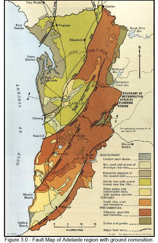
Eden-Burnside fault line is essentially the Adelaide Hills face zone. The fault is typically the first rise of the foothills from the Adelaide plains. From GZ at Darlington the Eden-Burnsile fault is a scarp feature runing from O'Hallaran Hill towards Marino Rocks in the west, and along the line of Bedford Park, Lynton, Skye and Anstey Hill to the north. Locally the fault is represented in the slope of many eastern Adelaide foothill roads including Brighton, Flagstaff, Sturt, Alyffes, Springbank, and Belair Roads.
At the listed coordinates you are on the intersection of Arthur St and Main South Road.
Please send your answers to the following questions.
Q1. Estimate the slope of the road? What direction is the slope? Are there any features that show this is fault?
Q2. Do you seen any earthquake damage? Why not?
Q3. What is the depth of the earthquake epicentre?
"Found it" logs for which answers have not been received, will see that log discreetly deleted.