
RUTA CIRCULAR POR LA SIERRA DE CALLOSA
Esta serie de 10 cachés tiene por objetivo realizar una ruta circular de montañ a lo largo de la Sierra de Callosa, con inicio y final en la Ermita del Pilar en Callosa de Segura, visitando los dos picos más emblematicos de la misma: el Pico Cortado o de San Bernardo y el Pico del Águila, el punto más alto de la Sierra. Para ello seguiremos en la mayor parte del recorrido la Ruta PR-CV-54 primeramente en su Variante 2 y de regreso la vía principalLas vistas son absolutamente espectaculares.
ATENCION: Se trata de un recorrido de dificultad media-alta, fisicamente exigente y que requiere tener experiencia en la montaña, así como el equipamiento adecuado. NO ES APTA para menores de 12 años o personas con vértigo o problemas respiratorios o cardiovasculares.
LA SIERRA DE CALLOSA

La Sierra de Callosa es una escarpada mole caliza que se eleva en el seno de un llano aluvial convirtiéndose así en un hito paisajístico para la comarca del Bajo Segura, en pleno sur de la provincia de Alicante. Su abrupta orografía, la naturaleza de sus materiales rocosos, la aridez del clima y una situación geográfica muy cercana al mar, hacen de ella un espacio natural capaz de albergar valores ambientales de gran singularidad.
Junto con su hermana, la vecina Sierra de Orihuela, constituyen dos macizos calizos espectaculares en donde domina lo vertical de manera admirable. Derrumbes, grietas, farallones, profundas ramblas.., campan a sus anchas a lo largo de estas moles. Ambos dominan egregios la singular Vega Baja del Segura.

La sierra de Callosa, junto con su vecina, la sierra de Orihuela, constituyen dos impresionantes moles calizas que se elevan bruscamente en medio de la extensa llanura de la Vega Baja del Segura. La sierra de Callosa, que alcanza su máxima elevación, 572 m., en el pico del Águila, posee un relieve muy accidentado, caracterizado por grandes desniveles, fuertes pendientes, muy descarnadas por efecto de los procesos erosivos, y sobre todo por la presencia de grandes farallones rocosos y profundos barrancos y ramblas.
Geológicamente, estas sierras forman parte del Bético, estando formadas por un tramo superior de calizas y dolomías del Triásico medio-superior y un tramo inferior de pizarras atribuibles al Permo-Triásico. La sierra de Callosa se presenta enmarcada por dos fallas ortogonales, una situada al este y de dirección noroeste-sudeste y otra al oeste de dirección sudoeste-nordeste.

La vegetación del paraje viene condicionada por la aridez del clima. La Vega Baja del Segura es un territorio de ombroclima semiárido, lo que unido a lo abrupto del relieve de la sierra de Callosa y a la acción del hombre conducen a un predominio de las formaciones de matorral, con prácticamente ausencia de cobertura arbórea. Así, encontramos las formaciones denominadas corniales, dominadas por el cornial (Periploca laevigata, subespecie angustifolia) y por el oroval (Withania frutescens), que son arbustos de porte elevado y que dominan en las pendientes rocosas, secas y más soleadas de la sierra de Callosa. Merece destacarse asimismo la vegetación casmofítica que aparece en las pendientes rocosas, ampliamente representada en la sierra de Callosa, representada por la asociación Centaureo-Sideritis glauca, de carácter endémico ya que se localiza únicamente en las sierras de Callosa, Orihuela y el Cantón, destacando las especies Centaurea saxicola; subespecie saxicola; Sideritis glauca; Genista valentina, subespecie murcica, y Lafuentea rotundifolia.

Merece citarse también las formaciones de espinar mediterráneo alicantino, que aparece en las zonas de mayor humedad y donde la potencia del suelo es algo mayor. Se encuentra en estos enclaves una vegetación de transición a maquias semiáridas, con especies como espino negro, palmito, bayón, acebuche o lentisco, acompañadas por lianas como la rubia o la zarzaparrilla y algunas especies raras como Clematis cirrhosa o Carthamus arborescens. Por último cabe referirse a la única formación arbórea existente en el paraje. Se trata de una repoblación de pino carrasco realizada en 1957 y cuyo objetivo era hacer frente a los problemas de erosión en la sierra de Callosa.


En cuanto a la fauna, las aves son el grupo mejor representado, destacando la presencia del águila perdicera (Hieraetus fasciatus) y águila real, especies gravemente amenazadas y que nidifican en la zona, búho real (Bubo bubo), el búho chico (Asio otus), cernícalo vulgar (Falco tinnunculus), gavilán (Accipiter nisus) y el halcón peregrino (Falco peregrinus). En las formaciones de cornial albergan aves raras como el camachuelo trompetero (Bucanetes githagineus) y la carraca (Coracias garrulus).


Entre los mamíferos cabe destacar la presencia del del zorro, el gato montés (Felis sylvestris), la cabra montesa y la liebre.

El valor paisajístico de este enclave es muy alto, al constituir una referencia visual para todo el entorno de la comarca, siendo un elemento fundamental en la conformación del paisaje de la zona. Las partes altas de la Sierra de Callosa ofrecen magníficas vistas de los territorios circundantes.

En lo referente al patrimonio histórico en el ámbito del paraje se incluyen elementos patrimoniales de alto valor como el castillo de Callosa de Segura, islámico del siglo X, aunque permaneció funcional hasta el XVI y que está declarado Bien de Interés Cultural; el yacimiento del Barranco del Diablo, de época tardorromana (s. IV-VIII d.C.); el aljibe islámico de la Casica de la Tía Ana y el importante yacimiento de Laderas del Castillo. Este poblado-necrópolis se inscribe en el periodo Argárico (1800-1000 a.C.) y ha producido gran cantidad de material arqueológico de gran interés, sobre todo cerámica. Merece destacarse también la Cueva del Ojo de San Bruno, utilizada como lugar de enterramiento en la época del Calcolítico (3000-2000 a.C).

LA RUTA
Iniciamos el recorrido en el área de recreo paraje municipal ermita la Pilarica en la explanada que hay en la puerta de la ermita y junto a un monolito que recuerda el día de la inauguración del sendero. detrás de este monumento hay un pino con una marca de PR y a su lado una fuente. A continuación nos encontramos con un poste indicdor de la Ruta PR-CV-54. Tomaremos la Variante 2, hacia la derecha. ES IMPORTANTE SEGUIR EN TODO MOMENTO LAS MARCAS DE PINTURA BLANCA Y AMARILLA que delimita la ruta.


Al principio la senda discurre entre arboles hasta llegar a uno de los depósitos de agua, donde tenemos sitiado el primer caché. A partir de este momento el recorrido discurre en esta primera parte por zonas piedras sueltas y hay que llevar precaución con ellas. El camino por momentos se puede llegar a perder pero el destino es evidente y además está señalizado con las clásicas marcas amarillas/blancas. Nos acompañan algunos árboles, de los pocos en toda la sierra. Al final de este tramo encontramos el caché 02.

Es una subida fuerte, sin treguas que nos lleva a la base de una inmensa pared vertical y llegado a este punto la senda gira primero a la izquierda y posteriormente a la derecha irremediablemente para tener alguna oportunidad de seguir ascendiendo a través de pequeñas (y grandes) trepadas usando las manos, si se lleva bastón por momentos hasta estorba por necesitar las dos manos libres.

Finalmente y tras un pronunciado asceso, llegamos a la Intersección que nos dirigirá, a la derecha hacia el Pico Cortado o de San Bernardo, nuestro primer objetivo, y a la izquierda, cresteando, hacia el Pico del Águila, al que iremos más tarde. En este punto se encuentra el caché03. Comienza aquí una fase de la ruta mas divetida y con excepcionales vistas. Importante no perder las señales, pues la ruta no es recta hacia el pico, dado que nos encontrariamos con un cortado en forma de V de dificil superación. La ruta marcada nos lleva un poco a la izquierda, donde tendremos que afrontar la parte mas dificil y delicada de la ruta, pues hay que utilizar los cables de acero y cordadas que existen para poder llegar al pico. Por esta razón el caché 04, situado junto a la cima, tiene dificultad de terreno 5. Es algo más complicado, pero las vistas en el alto bien lo merecen.


Llegar a la cima del Pico Cortado ya es cuestión de otras pequeñas trepadas sin cables pero sin complicación, las vistas desde aquí son sublimes debido a la verticalidad de la cima. El lugar perfecto para ver la grandiosidad de la sierra, sus vertientes, poblaciones como Cox, Albatera ... y el posterior objetivo, el Alto del Águila. Su altura es de 454 m. Buen lugar para un descanso y reponer fuerzas para nuestra siguiente etapa.


Toca desandar el camino , bajando nuevamente por la zona cordada que superamos a la subida, y crestear de regreso a la intersección que vimos al principio de la cima, pero en este caso continuamos recto, por una senda que recorre la cresta y que está indicada con marcas VERDES pues no pertenece como tal a la PR-CV-54. Se trata de un tramo de menor dificultad técnica. Lo mas complicado son los grandes cubos de piedra que hay que cruzar por su cúspide, en un tramo bastante aéreo y que requiere precaución, aunque tiene menor desgaste físico. En este tramo nos encontramos los cachés 05, 06 y 07 de la ruta. En este punto volvemos a enlazar con la Ruta PR-CV54 en su sendero principal, que nos lleva al cercano Refugio, donde podemos hacer una nueva pausa.

Desde el refugio, seguimos ascensión, ahora mucho mas suave, hasta el cercano Pico del Águila, la mayor cota de la Sierra de Callosa, de 575 m. Aqui la vista hacia el sur nos permite alcanzar Orihuela y Murcia, y hacia el este divisamos toda la Vega del Segura hasta Guardamar y Torrevieja. A unos 50 metros se encuentra el caché 08.

Iniciamos desde aquí el descenso que nos conducirá al punto de origen, dejando a nuestra izquierda el Barranco de Enmedio, y siguiendo en todo momento las indicaciones de pintura de la Ruta PR-CV-054. El descenso, por momento muy pronunciado, requiere cierto cuidado y medir bien el terreno que se pisa, pero se supera sin excesiva dificultad. En este tramo encontramos los cachés 09 y 10 (último de la serie). Hay que llevar extrema precaución de no tomar sendas equívocas durante el descenso porque pueden llevar a tramos de barrancos con dudosas posibilidades de continuación, ante la duda mejor volver unos metros atrás y ver si nos equivocamos antes que continuar por barrancos de vértigo. La parte final del barranco es bastante vertical y el ritmo llega a ser algo pausado por ello. Cuando se llega a zonas con muros de contención de piedra se intuye el final del barranco y del descenso. Finalmente se llega por la parte posterior a la Ermita del principio de la ruta y así a la zona de recreo y al coche.
FICHA TECNICA DE LA RUTA

- Actividad: Ruta de Media Montaña con trepadas, filos y pasos "aéreos"
- Sierra: Sierra de Callosa de Segura
- Posición Geológica Regional: Cordilleras Béticas - Zonas Externas - Prebético
- Comarca: Vega Baja del Segura, Alicante
- Distancia: 5.7 km
- Punto de Partida: Ermita del Pilar, Callosa de Segura.
- Punto de Llegada: Ermita del Pilar, Callosa de Segura.
- Circular: Si
- Desnivel superado: Inicial 67m. máximo 575 m.
- Caminos Homologados: Ruta PR CV 54 y variante 2
- Itinerario: Localidad de Callosa (Ermita del Pilar) - Pico Cortado (454 m) - Collado de la Plana - Cruz de Enmedio (491 m) - Refugio - Alto del Águila (575 m) - Entronque con la PR CV 54 - Barranco de Enmedio - Localidad de Callosa (Ermita del Pilar)
- Calificación Técnica: Media - Alta. Los tramos aéreos y el tránsito por los filos requiere y conocimiento y cuidado especial.
- Calificación de exigencia Física: Media - Alta.
-
Recomendaciones: Esta ruta y en general el senderismo de montaña requiere una adecuada preparación física, una buena planificación previa de la ruta en el sentido de conocer a donde se va y por donde, una buena reserva alimentaría y liquida (no confiarse nunca en que nos podamos encontrar fuentes) y desde luego ir provisto del material adecuado (prendas, calzado…). E incluso aspectos tales como la meteorología y el saber seleccionar la ruta según la época del año son importantes tenerlos en cuenta a la hora de acometer una ruta de montaña de manera segura y por ende satisfactoria.
LOS CACHÉS
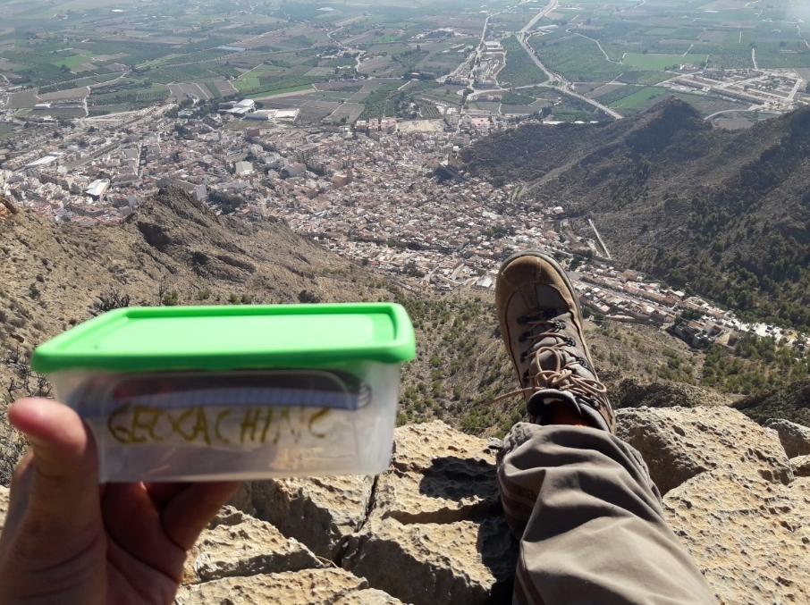
Se trata de UNA SERIE DE 10 cachés idénticos, formato tupper, tamaño pequeño, unos 14 x 9 x 5 cm, en cuyo interior encontramos una LIBRETA para logs, FOLLETO EXPLICATIVO de en que consiste en geocaching, LAPIZ (Gracias de todo corazón a IKEA), SACAPUNTAS y algún pequeño REGALO. Inicialmente en los cachés nº 03, 04, 05 y 06 se depositan TRAVEL BUGS para ser movidos a otros cachés. Todo el contenido se encuentra protegido por bolsa de cierre hermético.POR FAVOR, UTILIZAR EL MINIMO ESPACIO POSIBLE DE LA LIBRETA PARA LOS LOGS, de esta forma durará más. Es muy importante volver a dejarlo tal como se encontró. En todos los listing hay FOTOS SPOILER correspondientes a cada uno de ellos.

Gracias y FELIZ BUSQUEDA!!


SORRY ABOUT THE POOR TRANSLATION. IT WAS GOOGLE.
CIRCULAR TRAIL IN SIERRA DE CALLOSA
This series of 10 caches aims to make a circular trail along the Sierra de Callosa, with start and finish in the Ermita of Pilar in Callosa de Segura, visiting the two most emblematic peaks of the same: the Pico Cortado or San Bernardo and Pico del Águila, the highest point of the Sierra. To do this we will continue in most of the route PR-CV-54 Route first in its Variante 2 and back via the principal route. The views are absolutely spectacular.
WARNING: This is a route of medium-high physically difficulty demanding and requires having mountain experience and the right equipment. It is not suitable for children under 12 years old or people with respiratory or dizzy or having cardiovascular disease.
LA SIERRA DE CALLOSA
The Sierra de Callosa is a steep limestone mass that rises within an alluvial plain landscape thus becoming a milestone for the region of Bajo Segura, in the southern province of Alicante. Its rugged terrain, the nature of its rocky materials, arid climate and very close to the sea geographical location, make it a natural space capable of accommodating environmental values of great singularity.
Along with his sister, the neighboring Sierra de Orihuela, are two spectacular limestone massifs where dominates the vertical admirably. Landslides, cracks, cliffs, deep ravines .., amok along these moles. Both dominate the singular Vega Baja del Segura.
The Sierra de Callosa, together with its neighbor, Sierra de Orihuela, are two impressive limestone moles rise sharply in the midst of the vast plain of the Vega Baja del Segura. The Sierra de Callosa, which reaches its maximum elevation, 572 m., At the Pico del Águila, has an outstanding very rugged terrain characterized by steep slopes, strong, very gaunt as a result of erosion processes, and especially by the presence large rocky cliffs and deep ravines and gullies.
Geologically, these mountains are part of Bético, being formed by an upper section of limestones and dolomites of the Middle Triassic and a lower section of whiteboards Permo-Triassic attributable to. The Sierra de Callosa is presented framed by two orthogonal faults, one located east and northwest-southeast direction and another west southwest-northeast direction.
The vegetation of the place is conditioned by the arid climate. Vega Baja del Segura is a semiarid territory ombroclima, which together with the abruptness of the relief of the Sierra de Callosa and human action leading to a predominance of scrubland formations, with virtually no tree cover. Thus, we find the corniales formations called, dominated by corneal (Periploca laevigata, angustifolia subspecies) and the oroval (Withania frutescens), which are shrubs of large size and dominant in the rocky, dry and sunniest slopes of the Sierra de calloused. Deserves also highlighted the chasmophytic vegetation appearing on the rocky slopes, widely represented in the Sierra de Callosa, represented by Centaureo-Sideritis glauca, association endemic as it is located only in the mountains of Callosa, Orihuela and Canton, highlighting saxicola Centaurea species; saxicola subspecies; Sideritis glauca; Genista valentina, murcica subspecies, and Lafuentea rotundifolia.
Among the mammals include the presence of the fox, wild cat (Felis sylvestris), ibex and the hare.
The landscape value of this enclave is very high, to provide a visual reference for the whole environment of the region, being a key element in shaping the landscape of the area. The upper parts of the Sierra de Callosa offer magnificent views of the surrounding territories.
Regarding the historical heritage in the area of setting high value assets such as Castle Callosa de Segura, Islamic tenth century they include, but remained functional until the XVI and is declared of Cultural Interest; the site of Barranco del Diablo, from the late Roman period (s A.D. IV-VIII.); Islamic aljibe of Casica Aunt Anna and the major source of Laderas del Castillo. This village-necropolis is part of the Argárico (1800-1000 B.C.) period and has produced lot of archaeological material of great interest, especially ceramics. It is also worth mentioning the Cave of the Eye of San Bruno, used as a burial site at the time of Chalcolithic (3000-2000 A.C.).
THE ROUTE
The route starts in the playground Municipal chapel Pilarica place in the forecourt at the door of the chapel and next to a monolith that recalls the opening day of the trail. behind this monument there is a pine with a mark of PR and beside a fountain. Here we find a indicdor post of PR-CV-54 Route. We will take the Variant 2, to the right. IT IS IMPORTANT TO FOLLOW ALL THE TIME MARCHES WHITE AND YELLOW PAINT delimiting the route.
At first the path runs between trees to reach one of the water tanks, which have beleaguered the first cache. From this point the route runs in this first part by loose stones areas and must take caution with them. The road at times may lose but the destination is clear and is also marked with classic yellow / white markings. We accompany some trees, of the few in the entire mountain. At the end, we can find the caché 02
It is a steep climb, without truces that leads to the base of a huge vertical wall and at this point the path turns first left and then right irretrievably to have any chance to continue climbing through small (and large ) you trepadas using hands, if cane at times leads to clogs by need both hands free.
Finally, after a asceso pronounced, we reached the intersection that will lead us right into the Pico Cortado or San Bernardo, our first goal, and left, crested, to Pico del Águila, which we will later. Here is the caché03. Here begins a phase of more divetida route with panoramic views. Important not to lose the signal, because the path is not straight toward the peak, as we would with a cut in the form of V difficult to overcome. The marked route takes us a little to the left, where we will face the most difficult and delicate part of the route, because you have to use steel cables and cordadas there to reach the peak. For this reason the cache 04 next to the top, difficulty of terrain 5. It is somewhat more complicated, but the views at the top well worth it.
Reaching the top of Pico Cortado is already a matter of other small climbs wireless but without complication, the views from here are sublime because of the verticality of the top. The perfect place to see the grandeur of the mountains, its slopes, towns like Cox, Albatera ... and subsequent target, the Alto del Aguila place. Its height is 454 m. Good place for a rest and regain strength for our next stage.
Touch backtrack, down again by the roped area surpassed the rise, and crestear back to the intersection we saw at the beginning of the summit, but in this case continue straight, along a path that runs along the ridge and it is indicated with green markings as such it does not belong to the PR-CV-54. It is a stretch of lower technical difficulty. The most complicated are the great stone cubes that must be crossed by its height, in a fairly air section and requires caution, although it has less physical wear. In this section we find the caches 05, 06 and 07 of the route. At this point we return to link to the route PR-CV54 its main trail, which leads to the nearby Refugio, where we can make a new pause.
From the hut, we continue to climb, now much softer, to the nearby Eagle Peak, the highest elevation of the Sierra de Callosa, 575 m. Here the view to the south allows us to reach Orihuela and Murcia, and eastward we saw all the Vega del Segura and Torrevieja to Guardamar. About 50 meters away is the cache 08.
We started from here the descent that will lead us to the point of origin, leaving to our left the Barranco de Enmedio, and always following the directions of painting PR-CV-054 route. The decline, however pronounced time, requires some care and measure the land is pressed well, but passes without undue hardship. In this section we find the caches 09 and 10 (last in series). Bring extreme care not to make misleading paths during descent because they can lead to stretches of ravines with dubious chances then in doubt better to return a few meters back and see if we're wrong before continuing ravines of vertigo. The final part of the gorge is quite vertical and the pace becomes somewhat slow for it. When it comes to areas with stone retaining walls the end of the ravine and drop is sensed. Finally you come from the back to the Chapel of the start of the route and thus to the recreation area and the car.
ROUTE´S DATA SHEET
- Activity: Middle Mountain Trail climbs, sharp edges and steps "air"
- Sierra: Sierra de Callosa de Segura
- Regional Geological -Position: Cordilleras Béticas - External Zones - Prebético
- Comarca: Vega Baja del Segura, Alicante
- Distance: 5.7 k
- Starting -point: Ermita del Pilar, Callosa de Segura.
- Point Arrival: Ermita del Pilar, Callosa de Segura.
- Circular: Yes
- Desnivel Exceeded: Initial 67m. maximum 575 m.
- Roads Approved: Route PR CV 54 and option 2
- Itinerary: City of Callosa (Ermita del Pilar) - Pico Cortado (454 m) - Collado de la Plana - Cruz de Enmedio (491 m) - Refuge - Eagle Alto (575 m) - intersection with the PR CV 54 - Barranco Enmedio - Location of Callosa (Ermita del Pilar)
- Calificación Technique: Medium - High. Air sections and transit through the edges and knowledge and requires special care.
- Calificación Physical demand: Medium - High.
-
Recommendations: This general route and mountain hiking requires adequate physical preparation, a good pre-planning the route in the sense of knowing where you are going and where, good food reserves and liquid (never trusted to we can find sources) and certainly go provided with suitable material (clothes, shoes ...). And even issues such as weather and know how to select the route according to the time of year are important them into account when undertaking a mountain path safely and therefore satisfactory.
THE CACHES
This is a series of 10 identical caches, Tupperware format, small size, about 14 x 9 x 5 cm, within which found a notebook logs, prospectus, that is geocaching, LAPIZ (Heartfelt thanks to IKEA ), pencil sharpener and a small gift. Initially caches No. 03, 04, 05 and 06 are deposited TRAVEL BUGS to be moved to other caches. All content is protected by hermético.POR seal bag please use the smallest possible space NOTEPAD FOR LOGS, thus last longer. It is very important to re-leave it as it was found. In all there are corresponding PHOTOS SPOILER listing each of them.
Thanks and happy hunting !!