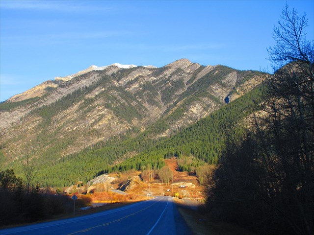
Anklebiter Ridge from Highway 1A:
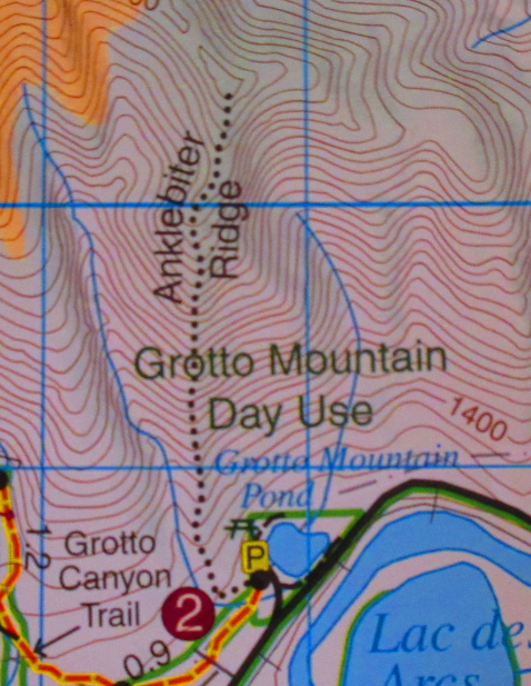
"Anklebiter Ridge" is the official name of the ridge just south of Gap Peak, according to the GemTrek trail maps. The trail is generally quite steep and loose, and is mostly undefined. The most reasonable ascent route follows the SW ridge. Park at the Grotto Pond parking area and hike up the Grotto Canyon Trail. Take the first major right turn onto the Steve Canyon trail and turn right at the provided trailhead coords for the beginning of the Anklebiter Ridge trail.
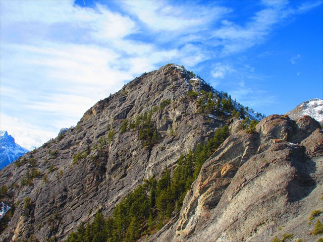
The trail follows up the ridge - you'll probably find and lose the trail a dozen times as you continue upwards. Sticking to the ridge offers moderate scrambling on mostly solid rock, while gleaning off to the left or right of the ridge will give a more loose ascent with easier scrambling. Eventually you will reach a major junction about halfway to Anklebiter Ridge's Southwest Summit. Turning left will take you to an interesting rock climbing crag called "The Sanctuary" in about 5 minutes. It offers very difficult rock climbs, many of which in the 5.12 range. If you aren't in any rush, it's neat to see the steep cliffs and bolted climbing routes. Turning right at the junction, you will continue up typical terrain to the southwest summit. Go up and over and reach the summit of Anklebiter Ridge. Descend via the ascent ridge, or continue over to Bluemat Hill if conditions and energy permits. Though I have heard reports of parties ascending Gap Peak from Anklebiter Ridge, I don't recommend it as I've heard it's a sketchy and very exposed difficult scramble.
The Impressive South Face of Anklebiter Ridge:
The GemTrek Map insists it's called Anklebiter Ridge: