
The Maryland Geocaching Society welcomes you to the 2017 edition of Cache Across Maryland! This is one of eleven geocaches placed throughout the ‘Old Line State’ in locations specifically chosen to showcase its diverse beauty. From the mountains of Western Maryland to the wetlands of the Eastern Shore, CAM 2017 will demonstrate that Maryland truly is ‘America in Miniature’.
Each Cache Across Maryland 2017 geocache contains a code which you will use to determine the location of the CAM 2017 Picnic to be held on May 6th. The code can be found on the inside of the cache container and on the inside front cover of the logbook. Don't forget to record this code! Any geocacher who has completed TEN of the eleven CAM 2017 geocaches and attends the CAM Picnic on May 6th will receive a Certificate of Completion and a CAM 2017 Geocoin. We hope you enjoy a very special CAM 2017!

Black Walnut Point
Tilghman Island is located north of where the Choptank River meets the Chesapeake Bay. The island is about 3 square miles in size. Its population is about 800 people.
According to the Tilghman Watermen’s Museum (link), the first English settlers arrived in 1656. It became known as Tilghman Island after Matthew Tilghman inherited it in 1741. In the 1830’s, the island’s population began to grow as people moved in to be close to the Chesapeake Bay and the seafood industry, especially oysters. In the 20th century, boat building also became important. Then, the seafood and boat building industries declined towards the end of the 20th century. Today, the main activities on Tilghman Island are recreational: hunting, fishing, and heritage tourism.
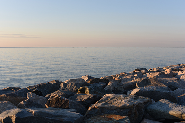
Go to the farthest point south on the island and you’ll find Black Walnut Point Inn, a private B & B located in a 52-acre bird sanctuary. Owners Bob Zumer and Tracy Staples call themselves “curators” of the historic farmhouse. According to Chesapeake Living (link), it’s actually two houses that have been joined together over the years. As the tip of the island fell into the bay, the houses kept getting rolled back on logs and were eventually connected.
The road to the Inn goes past the WWII-era Naval Research Laboratory that is still in use by the federal government. There is a turnaround just before the Inn, and photographs from that point are welcomed, but please do not venture past the entrance to the Inn as it is private property.
The Geocache
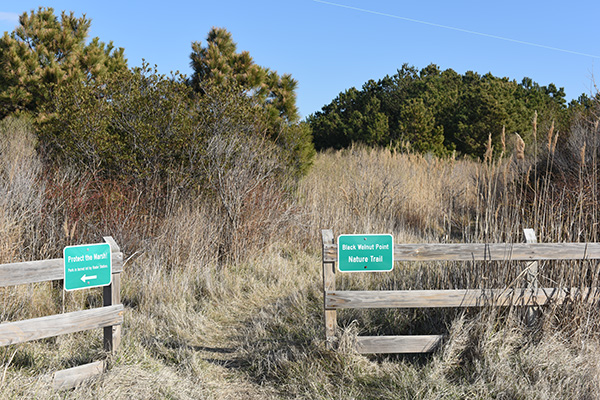
This geocache is a three stage multi-cache. The first stage of the cache will bring you to the Naval Research Laboratory. The second and final stages of the cache will take you into Black Walnut Point Natural Resources Management Area, a park on the southern end of the island. Parking is in the large lot just before you reach the Naval Research Laboratory. You may drive past the Laboratory through the gate but there is no parking and you will need to turn around at the Inn driveway. The round-trip hike is about .9 mile.
Stage 1
Begin at the published coordinates. Complete the answers below using the nearby sign, then use the values to complete the coordinates for the second stage.
- A = In the second row of text, how many letters in the second word?
- B = The first digit in the number of acres originally occupied by the site.
- C = The number of acres currently occupied by the site.
- D = This number appears three times in a single row of text.
- E = Second digit in the height of the tower.
The coordinates for Stage 2 are N38° 40.ABC', W076° 20.DEC'
The checksum of A+B+C+D+E = 25.
Stage 2
Proceed down the road, past the gate to the trailhead on your left. Please note the park hours posted at the gate. The second stage is a small lock-n-lock container with the coordinates for the final stage. The trails are marked with red blaze.
Final
Proceed to the end of the trail where it meets the water, then proceed to the coordinates to find the geocache. The container is a regular size lock-n-lock.
The park is open from 9am to 5pm. Sorry, no pets allowed.
This geocache was placed by permission of the Black Walnut Point Natural Resources Management Area. The MGS thanks the Maryland Park Service for approving this cache placement.