The following links contain additional information on the Islington Sewage Farm.
"Alert: You are about to download files that contain further details needed to find this geocache. As the cache owner, I represent that these files are safe to download although they have not been checked by Groundspeak or by the reviewer for possible malicious content. Download the files at your own risk.
The History of Islington Sewage Farm
Research the history of the Islington Sewage Farm and find the numbers represented by:
ABCDEFGHIJK
The land taken up for the sewage farm was in the region known as Tam O'Shanter Belt, named after the barque Tam O'Shanter which ran aground in the Port River in December 18AB.
The sewage farm was designed to operate on a broad irrigation principle. After passing through revolving strainers in the straining shed to remove the solid waste, the effluent passed through filter beds and was then spread over the farm by means of a network of cement concrete channels and wooden troughs.
All the sewage that had previously been discharged into the River Torrens was taken to the sewage farm from C January 18DE. This was the first water-borne sewerage system in the Southern hemisphere.

Straining Shed (S 34° 52.427 E 138° 34.742) and Channel.
The restored Straining Shed, with the building with the brick arches, can be seen from Pedder Cres. West of the railway bridge.
The restored buildings below are located in Sunnybrae Estate.
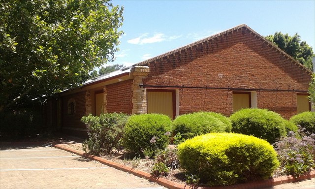
Cow Shed (S 34° 52.231 E 138° 34.510) Built 188F.
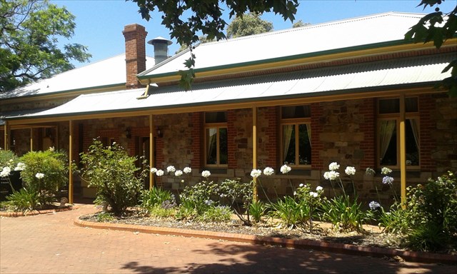
Homestead (S 34° 52.253 E 138° 34.474) Built 18GH.
The Islington Sewage Farm was closed in 1I6J, when the Bolivar Sewage Treatment Works became operational. Between KL75 - 81 the area was subdivided for light industry and renamed Regency Park.
The cache is hidden at South 34° 5 F.(C - A) L K East 138° 3 A.I D (B - E)
