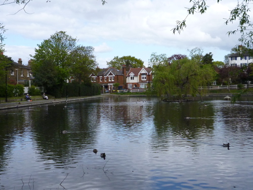
Prickend Pond, Chislehurst
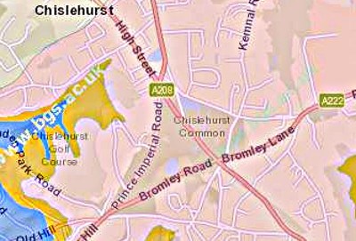
At the given co-ordinates you will be in front of one of the two permanent ponds on Chislehurst Common. These ponds are not natural, but were formed by sand and gravel extraction in the 19th century for use in road making and concrete. There were originally at least 4 or 5 ponds, but Webster’s Pond at the junction of Kemnal Road and Ashfield Lane has been filled in and is covered by scrub and trees, and the Overflow Pond north of the Bromley Road only emerges at times of high rainfall.
The pond nearest to the coordinates is Prickend Pond, named after the original name of this area, is a much-photographed feature of Chislehurst. At the second set of coordinates is the Rush Pond. Both ponds are fed by run-off from the surrounding area, with the overflow from Rush Pond feeding this pond through an underground drain. After a drop in the water table and a long dry spell in the early 2000s both ponds were in a poor state, but this has now been solved by a borehole and pump which can be used to top up the Rush Pond.
Sand and Gravel
Sand and Gravel are naturally occurring unconsolidated rock fragments caused by weathering and erosion of rocks - their chemical composition depends on the original rocks. Most sand and gravel are formed of silica, mainly in the form of quartz. However, other materials can be the base rock, for example:
- Aragonite (calcium carbonate), formed from reefs in the Caribbean
- Gypsum (White Sands National Monument in New Mexico, USA) generates a very white sand
- Basalts, obsidian and magnetite form black sands
The individual particles can be of varying shapes with either rough corners, where the erosion is recent, or very smooth, where the particles have been transported over a long period, for example sand grains blowing in the desert, gravel being swept down a river or pebbles being tumbled in the sea.
Sand comprises particles sizes of up to 2mm (with a lower limit of 0.0625mm, at which point it is classified as silt). Gravel can be classified into granular gravel, between 2 and 4mm in size, and pebble gravel, up to 64mm. One cubic metre of dry sand weighs about 1.6 tonnes, while the same volume of gravel weighs about 1.8 tonnes.
Sand and Gravel are both important commercial products, with many applications. In much of the world most of the roadways are surfaced with gravel, especially where there is little traffic. Overall there are far more gravel roads than concrete or tarmac ones. Apart from the obvious uses of sand in building materials, sand is also the main ingredient in the manufacture of glass and is used to form moulds for metal casting. Both sand and small gravel are also important for the manufacture of concrete.
The largest producer of gravel is the USA. In places where gravel does not exist in large enough quantities it can be manufactured by artificially crushing hard rocks in large mills.
Transportation
Sand and Gravel are formed by weathering and erosion. The process of weathering does not involve movement of the resultant material, whereas erosion also implies an element of movement, or transportation. There are several mechanisms for transportation:
Wind – wind can be a major source of erosion in very dry areas, such as deserts. Typically the material transported is lightweight particles such as sand or even finer silt, since the wind is low density and low viscosity. Newly eroded sand particles can have sharp edges, but long periods of transport by wind can smooth the grains, as can be found in some deserts.
River –material moved by rivers can be larger than that moved by wind, since water has a greater density and viscosity. There are four different mechanisms by which material can be moved in rivers – traction, being pushed along the bottom; saltation, the bouncing of sand being continuously picked up and dropped; suspension, normally only for very fine particles; and solution, for example dissolved salts. The bed load of a river – the pebbles, gravel and sand – help erode the river bed and banks by abrasion – in turn they become smaller and more rounded.
Sea – erosion and transportation by the sea are very similar to the processes in the river, but using the movement of the tides rather than the falling of water along a river.
Glacial – material can be picked up and carried great distances by glaciers. As the glacier melts and retreats it will deposit the transported material in the form of terminal (at the far end of the glacier) or lateral (along the edges) moraines.
Gravity - the most obvious examples of gravity transporting material are avalanches or cliff falls. Generally the material will only travel a short distance under gravity and will be rough in appearance. Material generated in this way can then be picked up by other mechanisms to move it further and alter its appearance.
Local Geology
Reproduced with the permission of the British Geological Survey ©NERC. All rights Reserved
Chislehurst sits on the Harwich Formation of sand, gravel and clay, sedimentary bedrock deposited about 47 to 56 million years ago (Ypresian Age of Palaeogene Period), shown in pink in the above map. At the time this area would have been under a shallow sea. The Harwich Formation is sitting on the Thanet Formation of sand, which was laid down 56-59.2m years ago. These layers then sit on the Chalk of the late Cretaceous period, laid down more than 66m years ago.
A borehole was drilled near the Rush Pond to provide a water source to keep the pond topped up. It showed that the make-up of the ground here is:
| Material |
Thickness |
| Top Soil |
0.3m |
| Black Pebbles |
0.9m |
| Dense Sand |
4.7m |
| Grey Clay and Shells |
8.2m |
| Grey Clay |
6.0m |
| Green Sand |
2.4m |
| Thanet Sand |
18.6m |
| Chalk/Flint |
44.0m |
Based upon a Borehole Log (April 2013), with the permission of the British Geological Survey
Gravel extraction would have been opencast, as shown in the painting below of gravel extraction in Kensington, painted in 1812. Assuming the gravel being removed here was the “Black Pebbles” and “Dense Sand” layer from the borehole there would be over 5m of material to be extracted, with very little covering to be removed.
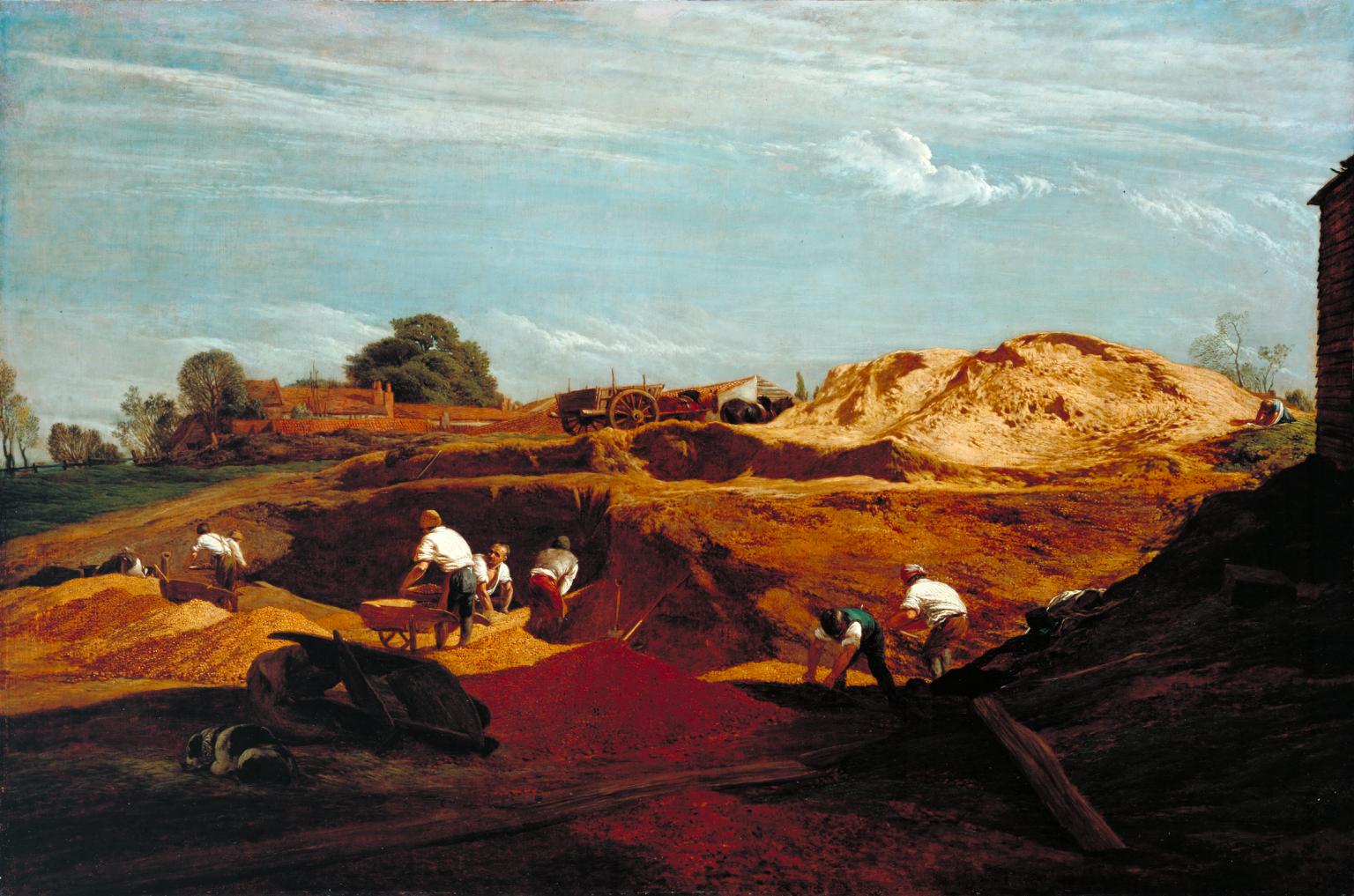
John Linell; Kensington Gravel Pits ; © Tate (2017), CC-BY-NC-ND 3.0 (Unported)
Local History
Chislehurst Common is owned by the Lord of the Manor of Chislehurst and Scadbury. In the 19 Century the Lord of the Manor allowed the extraction of gravel from the commons, as happened on other commons. An Act was passed in 1866 – The Metropolitan Commons Act – which assigned management of commons to a group of conservators to protect the commons and control activities such as gravel extraction. This act did not apply to Chislehurst commons, so the local residents got together and managed to get the Metropolitan Commons (Chislehurst and St Paul’s Cray) Supplemental Act through parliament in 1888, which still regulates the management of the area.
Logging Requirements
In order to log this EarthCache please send me the answers through my profile, using either E-mail or the Message Centre, the answers to the following questions. Please do not put the answers in your log.
1) Assuming the current surface area of the Prickend pond is the size of the original extraction area and 3 metres deep of gravel were extracted, how many tonnes would that have been? (Assume the pond is a rectangle with the length of sides measured along the two tarmac paths.)
2) Around the edge of the pond there are some areas where the pebbles are quite visible. Please describe the pebbles in terms of colour, size range and shape. This will require you leaving the tarmac paths - be careful as the area can get muddy and slippery.
3) Based on your answer to 2 do you think the pebbles were formed locally or have travelled some distance to get here? Suggest a possible type of transportation that the pebbles may have experienced and explain your choice.
4) The drain from the Rush pond can be seen where it enters the Prickend Pond. Please describe the way in which the water enters this pond? On which side of the pond is the inflow?
5) You can't have too many pictures of such a nice pond - please feel free to add one to your log, preferably with you or your gps in the frame. (Optional)
References
Wikipedia - Gravel
Wikipedia - Sand
The Geological Society
British Geological Survey (BGS) Web Site
Chislehurst Commons
Background Image: Martin Olsson