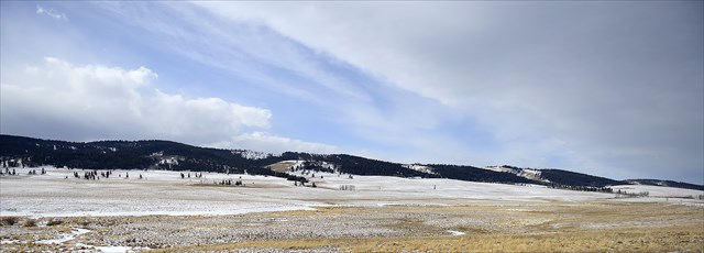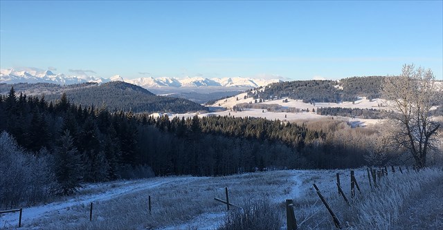
If you are standing at this earth cache, you are at the south end of the Wildcat Hills in the heart of the Alberta Foothills. But how did these foothills (and mountains) form?
You have probably heard the words plate tectonics....In this case, the Pacific plate was crashing into the North American plate during the late cretaceous period (~60 million years ago). As these plates collided, great compressional forces were causing horizontal formations to buckle , break and stack on top of each other.
Think of shoveling fresh snow. As you start pushing, the snow closest to the shovel starts to pile on top of the snow further away. As you continue to push, more and more snow piles up, creating higher mounds near the shovel, medium mounds further away, and undisturbed snow even further away. We have just described the Rocky Mountains, Foothills and Prairies.
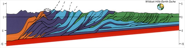
In the case of the Alberta Foothills, Mississippian aged carbonates (think of them as stiff beams), were compressed and shortened. As the stress increased, low angle thrust faults were formed and the carbonate beams stated to ride over top of each other. As the beams stacked, the foothills were formed. Shallow clastics (sandstones and shales), being less rigid, became even more deformed and in extreme cases, pushed up almost vertical. The model below shows a geological cross section through the Bow Valley. The blue and purple colors are the carbonate formations and the green colors are the clastic formations. (Cross section from the Geological Atlas of the Western Canada Sedimentary Basin)
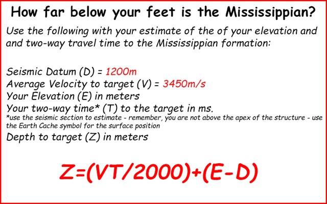
How do earth scientists determine depths and structures of different formations?
The starting point for depth and structure determination is by evaluating any wells that may be drilled in the area. Wireline logs are run in these wellbores, and various rock properties are measured. From these logs, lithology and depth are determined (amongst other parameters). In order to interpolate between wells, geophysicists use surface seismic (think of it as a giant ultra-sound). Sound waves are created at the surface and bounce off the various formations, returning to the surface. The seismic section is in time and is measured in milliseconds (1/1000th of a second -ms.). By knowing the travel time and the velocity to the formation (velocity can be obtained from the wireline logs or the seismic itself), the depth can be determined. Simple....right?
Below is a seismic section from the Wildcat Hills area. You are standing at the very east end of this profile. The image shows the Mississippian structure and the thrust that carried the formation up and over itself. In this section, the height of the structure is several hundred meters and the greatest dip on the Mississippian is around 20-30 degrees.
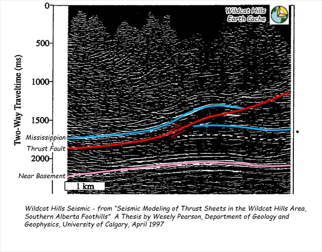
How deep is the Mississippian formation?....
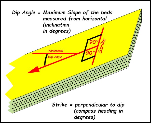
What is Strike and Dip?
Strike and dip are the measurements of the direction and tilt of a formation. Most formations are deposited horizontally. Through time, these formations can get deformed by both vertical and horizontal stresses causing them to bend, break and tilt. Think of dip as the inclination of the fall line. It is measured in degrees from horizontal. In Alberta, most undisturbed formations have a dip of around 2-4 degrees, depending on their geographical position and distance away from the Rocky Mountains. Local tectonics or depositional environments (stress and/or lithology) can change these dips dramatically. As one gets closer to the mountains, these dips become more extreme, sometimes becoming inverted. Strike is simply 90 degrees to dip, and is usually measured with a compass bearing. Think of strike as if you were walking on a tilted surface and were neither gaining or losing elevation. The direction that you are walking is the strike direction.
Why is strike and dip important? Geologists are often looking for hydrocarbons and these resources tend to be lighter than water. Most perspective formations have a certain amount of water associated with them. If there is oil or gas in the formation, it tends to rise to the top. By looking for the up-dip structures, geologists can be successful at finding these resources....
In order to log this cache, e-mail -Safari Cachers- the answers to following questions:
1) What is your elevation at the cache in meters?
2) How many meters below you is the Mississippian formation? (Use the formula above with the included seismic section).
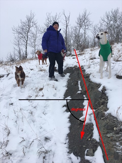
3) What is the apparent strike and dip of the sandstone beds at GZ? (located on the north side of the road allowance). Bonus: Why is the dip so much different than the Mississippian?
Bonus: Head west 100m (N 51° 16.243 W 114° 38.155) and take a photo of the beautiful view. Include yourself or your GPS.