
| ES |
En cada uno de los waypoints encontrarás una de las imágenes del lado derecho. Pon el número de la imagen en el campo correspondiente de la tabla y suma hasta llegar a las coordenadas finales.
|
|
DE
|
An den obigen 12 Wegpunkten findet man jeweils eines der obigen 12 Bilder. Durch die Übertragung der Zahlenwerte auf den Bildern in das Formular lassen sich die Finalkoordinaten berechnen.
|
|
EN
|
On each of the waypoints you will find one of the pictures on the right side. Put the number of the picture in the corresponding field of the table and sum up to get to the final coordinates.
|
|
FR
|
À chacun des points du trajet, vous trouverez l'une des photos ci-dessus [du côté droit]. Mettez le numéro de l'image dans le champ correspondant de la table et faites l'addition pour obtenir les coordonnées finales.
|
|
NL
|
Combineer de afbeeldingen met de 12 waypoints. Vul het schema in en maak de berekening voor het eindcoördinaat.
|
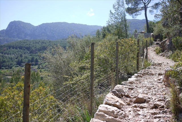
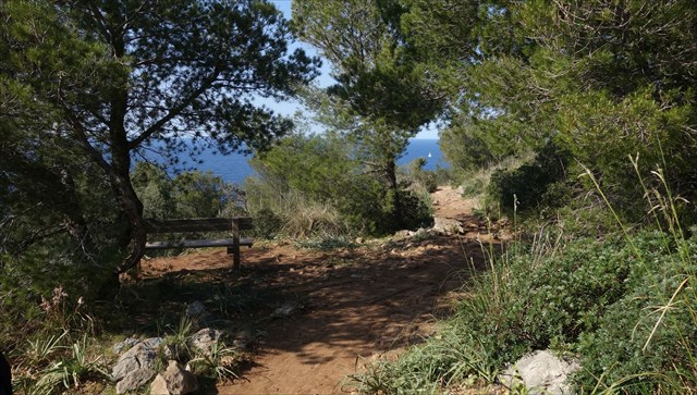
The Golden Track / Goldsteig arround Port de Soller
The most famours part of the hiking course on Mallorca GR221 is the area arround Port de Soller. Here you can find a good impression of multiple aspects of this great hiking course, Olive trees, Orange plants, view to the See and a nice port.
The track starts in Port de Soller, first track is with focus on Oranges towards Soller, on the way back to Port de Soller it orients along the GR221 and leads through Olive areas and has nice views on the coast line of the island.the track closes with a helicopter view on Port de Soller which will invite you after the hike with its beach and restaurants.
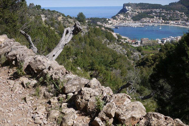
This track will lead you though protected areas of nature, no need to leave the track to find the pictures or the final at any time.
Track Information
- approx. 14 km length
- approx 370 meter total elevation
- 4-5 hours of pure walking time
- approx 3 km street (low traffic)
Arriving in Port de Soller
- The GPX Track starts at one (pay) parking in Recip, the right exit to take to get to this parking is Recip beach.
- Beside this, there are a few more (pay) parking areas in Port de Soller.(see map on GPSIES), but due to the car-free seefront you might need to drive into the city on another course.
- There is also a unique chance to get to Port de Soller with its historic Tram starting in Soller
Attention:
- This hike leads though nature parks. You do not need to leave the official tracks at any time.
- The links on this web page will help you to download tracks and more details on this course. As the owner we guarantee, that the files will not harm your PC or GPS.The files are not reviewed by Groundsprak or the Geocaching reviewers and you will download them on own risk.
Downloads:
We wish you a successfull hiking experience.
Ohrenbaer