LIFE'S A BEACH #45 - ST MARY'S
************************************************
If you would like to add more caches to this series, please feel free to do so!
Please contact heartradio through his profile first so that he can keep track of numbers and avoid duplications. Caches can be any type except Traditionals
************************************************
There are so many beautiful beaches on the Isles of Scilly - too many to place a Life's a Beach cache at each one. So, I am placing one cache per island with information to be found at some of the main beaches. There is also a final bonus cache which you will be able to find when you've completed all 5 other caches.
~~~~~~~~~~
To find this cache you'll need to visit each of the following beaches on St Mary's, and collect the following information. It doesn't matter what order you collect them in. Unfortunately I didn't get a chance to go round all the beaches, so the multi is predominantly in the southern bit of the island. If in August I find some information to use from the other beaches I'll add it to here. Anyway...the show must go on!
Quay:

St Mary's quay is the largest quay on any island and where you may find yourself landing, slightly dizzy and nauseatic, after a bumpy voyage on the Scillonian. Or alternatively you could have had a lovely trip and seen some dolphins! :) Now, many will have you believe that the clock is very important as it had N49'55 and W6'19 engraved on it, however the clock is just a clock, the degree confluence is not actually on that clock. N49'55 and W6'19 puts you in the harbour just off the Old Quay. The original quay was built in 1593 and an extension (or offshoot) began in 1836 to Rat Island. The contractor resigned and our old favourite Augustus Smith, of Samson Deer Park fame, organised the completion. In 1889 Augustus Smith's successor extended the pier a further 250 feet eastwards, at his own expense. It has just again been extended in 2016. Now the headline coordinates take you to the original, Old Quay where the boatmen (plus yours truly when I'm on the islands) stand around each morning deciding what to do. At the coordinates the number of metal 'eye hooks' on the end of the wall equals A.
The Garrison:

Puff puff puff all the way up the hill to the Garrison. Oh well never mind I thoughtfully positioned this stage at a bench so you could sit down, rest your weary legs and admire the views. Star Castle, above you now, is at the centre of the Garrison. The walls of the castle take the shape of an eight-pointed star. The Star Castle was built in 1593 by the Surveyor of the Royal Works and mapmaker Robert Adams under the direction of Francis Godolphin, following the Spanish Armada of 1588. Fearing another Spanish invasion, in May 1593 Queen Elizabeth I ordered the construction of a fort and two sconces as a lookout. Later, just before WW1 when Scilly was being considered as the naval base, the ramparts were constructed and guns added. Some trial shots were fired and the first shell went screaming across the Sound and shattered every window in Hugh Town. The next time a time was arranged and all windows were to be kept open. They shattered again, and the navy made their base at Scapa Flow instead. Right, take a look at the bench and the number of letters in the person's surname will give you B.
Porthcressa

Porthcressa is a beach on the south side of Hugh Town which is normally fairly sheltered and therefore popular with swimmers and sailors. Recently the Porthcressa Regeneration Scheme has been happening which has provided Scilly with a new TiC, but more importantly many benches along here - perfect for a multi! At the waypoint, locate Ann Elisabeth Hughes, who was born in 194C.
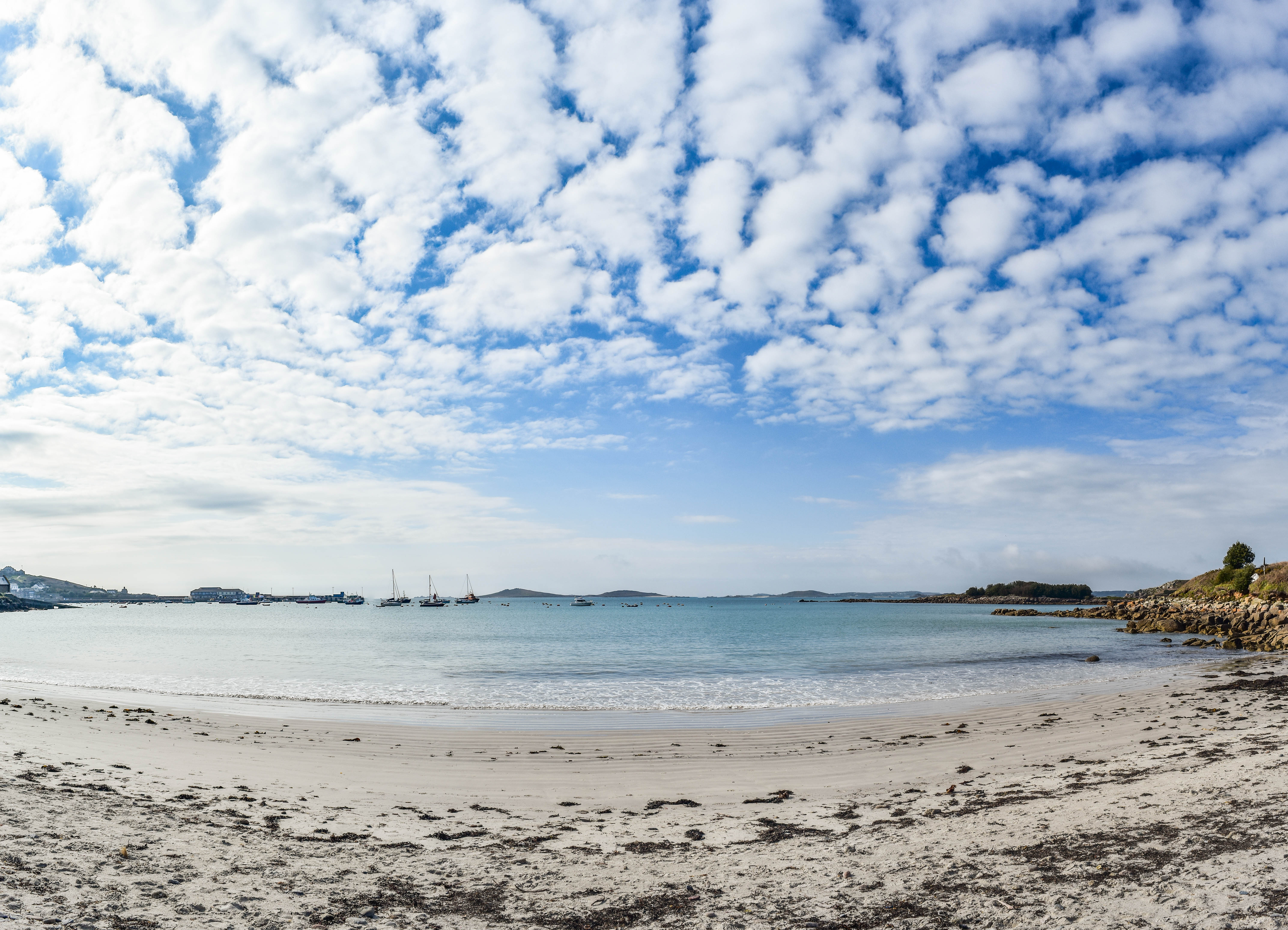
Town Beach:

Here's Town Beach and I bet you can't in a million years imagine why it was called that!! In my photo above you can see some large wooden boxes/crates, and many of the older fisherman will spend their afternoons sitting on these watching the world go by and discussing matters. You are specifically now standing on Holgates Green, and you will find a plaque about the Compass Rose. The number of words in the first two lines on the plaque equals D
Porthmellon:
Nothing to do with melons, I don't think! Porthmellon is home to the St Mary's Gig sheds, and as you will probably know, the World Pilot Gig Championships are hosted on Scilly every May, so this beach does get quite busy with boats! The waypoint will take you to the back of the gig shed and you'll see an air vent. The number of wooden slats on it equals E.
Shark's Pit (or Thomas Porth)

Shark's Pit, or Thomas Porth, is a rather smaller beach on the West coast of the island, but still overlooking the harbour - you've not got rid of that view yet!! Beachfield House overlooks the beach and looking at it you'll find a date - let that date be 190F.
Porthloo:

Here's Porthloo, which is not home to any public toilets contrary to the name! Now Porthloo is significant to the islands because it's where the boat park is on St Mary's. This week you've probably been on a few of the tripper boats between the islands, right? Now some of the fibreglass ones, Sapphire, Meridian, Kingfisher and Osprey, will sail to Falmouth every winter for maintenance but the old wooden ones, Sea King, Golden Spray, Guiding Star, Britannia and Surprise, will be hauled up here and will be painted and repaired in the boat park. So at the coordinates, you will find a bench. The number of wooden slats on the back (don't include the two at the very end) equals 2G.
Porthellick

Here you are at Porth Hellick beach, and this one's a long 'un so are you sitting comfortably? 22nd October 1707, in the pitch black out at the perilous Gilstone Ledges. HMS Association, Sir Cloudesley Shovell's flagship, struck the rocks and went down in three to four minutes - all 800 men on board drowned. Three other large ships were lost that night from that fleet - over 2000 sailors died and this is regarded as the worst maritime disasters in British history. Local legend has it that Shovell's body was washed ashore on Porth Hellick Beach, where a local woman found him and spied a nice ring on his finger. He was just still alive. So she killed him, evidently. and stole the ring off his finger. He was then buried in a grave at the top of the beach. On her deathbed she produced the ring and admitted to her sins. Shovell's body was then dug up (hopefully with shovels) and buried at Westminster. Now another interesting bit of this story is that the cause of the disaster was thought to be the sailors' inability to calculate Longitude correctly. So it is thought to be to do with this wreck that Parliament offered a reward to the man who could come up with a way of calculating it - that man was John Harrison who invented the marine chronometer, allowing Longitude to be calculated. So just think - where would Geocaching be without this, without this wreck? Right then, here you'll find a plaque to mark Mr Shovell's washing ashore - the number of words in the 3rd line equals H. The big rock you can see, pictured above, is called the Loaded Camel by the way.
Old Town

Old Town used to be the main settlement on St Mary's, back in medieval times when St Mary's was called Ennor. If you look inland from the coordinates you'll see a prominent rocky outcrop - this is Ennor Castle, which was cleared again recently. It's the only medieval castle on the islands and was made redundant by Star Castle. Much of the stone at Ennor Castle was then robbed for buildings at Old Town. At the coordinates you'll find a (slightly damaged) information board which basically repeats what I've just said, but it is slightly outdated as Ennor Castle is visible thanks to the clearing work that took place last year. You will see that Ranulph was obliged to keep 12 armed men there and pay a rent of 6s 8d. Or he could pay the crown J00 puffins!
Peninnis

Now Peninnis Head is home to a lighthouse, which was built in 1911 as a replacement for the 1680 lighthouse in the centre of St Agnes. The lighthouse was converted from gas to electricity in 1992 and the range of 17nm was reduced to 9nm in 2011. At the coordinates you'll be overlooking the lighthouse and will be by a bench, this time to Roy Harris who died in 19K4.
Buzza Tower

Now then, here you are at Buzza Tower, which used to be a windmill. The windmill was built in the early 1830s to replace Peninnis Mill, the only remaining part of which is the Millstone, which you may or may not have passed on your way from Peninnis. The tower was restored in 1911 for a visit from the King. It's now home to a Camera Obscura. You'll see from a plaque at the waypoint that the seats were restored in 2004 in memory of Ken Gandy, who was born in 191L.
By now you should have all the information you need to know that the final cache is at:
N49 5(C+F).(H)(B-G)(K-L) W006 1(A+H).(D-J)(E)(D-F)
Remember to make a note of the bonus information!
Cache placed with the kind permission of the Isles of Scilly Wildlife Trust.
Please be aware of livestock while you are on the island.
~~~~~~~~~~
St Mary's (Cornish: Ennor the mainland) is the largest and most populous island.
St Mary's has an area of 6.58 square kilometres — 40 percent of the total land area of the Isles of Scilly — this includes four small tidal islands which connect with St Mary's at low tide: Toll’s Island, Taylor’s Island, Newford Island and the island at Innisidgen.
With a population of 1,723 (out of a total population for Scilly of 2,203) St Mary's is relatively densely populated, with twice the population density than the Isles of Scilly average. The majority of St Mary's residents live in the western half of the island, with Hugh Town alone having a population of 1,097.
The main settlement, Hugh Town (Cornish: Tre Huw), was sold to the inhabitants by a cash - strapped Duchy in 1949.
Other settlements on the island are Old Town, Porthloo, Pelistry, Trenoweth, Holy Vale, Maypole, Normandy, Longstone, Rocky Hill and Telegraph. The island became the home of British Prime Minister Harold Wilson and his final resting place after his death in 1995. His grave is at the cemetery at Old Town Church.