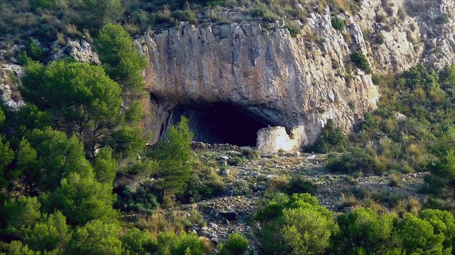
La Cova Negra o Cueva Negra se encuentra en la Sierra de la Fontanella en el término de Biar. Se trata de una cueva que pudo utilizarse como lugar de enterramiento durante la Edad de Bronce (según atestiguan diversos hallazgos que actualmente se conservan en el Museo Arqueológico de Villena); y que antiguamente fue utilizada como refugio natural de pastores, de ahí sus paredes y techos totalmente ennegrecidos que dan lugar a su nombre.
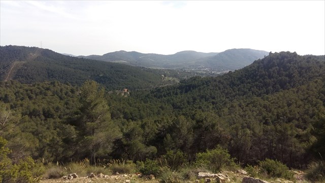
Para llegar a la cueva, seguiremos las indicaciones del sendero PR-CV 55 que sale desde el área recreativa de las Lomas de Jara situada en el paraje de Buenos Aires. El camino está perfectamente señalizado por las tradicionales marcas amarillas y blancas, y por postes con flechas que nos indican direcciones, distancias y tiempos de caminata.
CÓMO LLEGAR EN COCHE
Desde el Santuari de la Mare de Déu de Gràcia, seguiremos indicaciones para el área recreativa de las Lomas de Jara situada en el paraje de Buenos Aires cogiendo el camino asfaltado que desciende del santuario conocido como Camino de Benasait. Llegaremos a un cruce donde encontramos indicaciones para el área recreativa de la Cova Negra y el área recreativa de las Lomas de Jara.
ATENCIÓN: Tenemos que diferenciar los dos lugares que existen con el nombre de Cova Negra, uno es la cueva en sí a la que nos dirigimos y otro es el área recreativa que encontramos unos pocos km más adelante de este cruce. Para llegar a la cueva la dirección que debemos seguir es la que indica las Lomas de Jara. Allí aparcaremos para continuar nuestro camino hacia el caché a pie.
EL CAMINO HASTA LA CUEVA
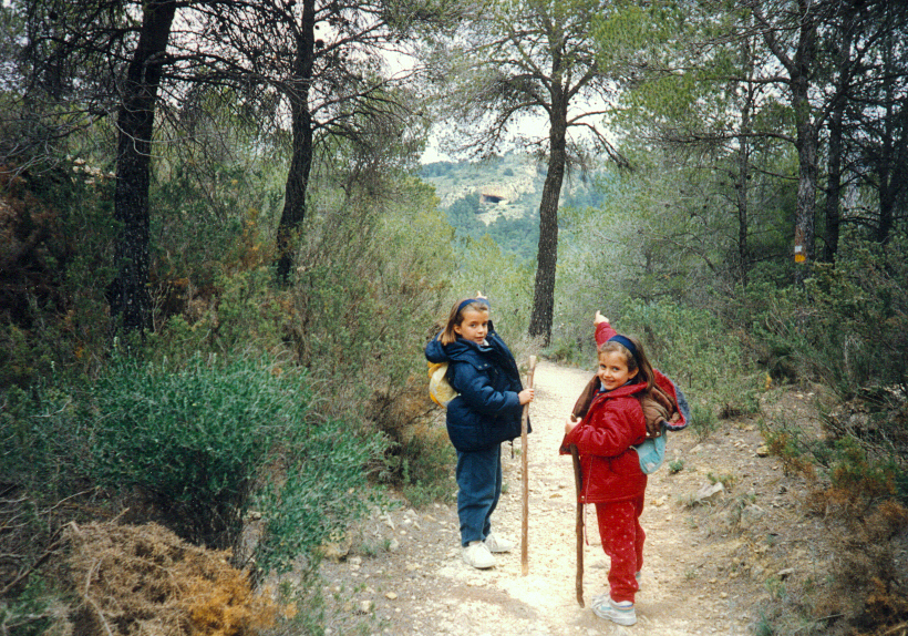
Para llegar hasta la cueva tomaremos el sendero que sale de la zona recreativa en su parte más alta, tras una barrera de madera. El recorrido es de aproximadamente 1 km y un desnivel de unos 100 m. Es un camino bastante sencillo que podemos recorrer aunque no estemos en plena forma o vayamos con niños.
En el camino encontramos las tradicionales señales amarillas y blancas que marcan el PR, así como postes con flechas que evitarán que nos perdamos. Para lo no iniciados: dos líneas paralelas indican el buen camino, y una cruz indica un camino incorrecto.
A 960 m del inicio del camino encontramos un desvío que nos indica el acceso a la Cova Negra.
bertismoris & pmorad. Cova Negra. 1995.
ENGLISH
La Cova Negra or Cueva Negra (the Black Cave) is located in the Sierra de la Fontanella in Biar. It is a cave that could be used as a burial site during the Bronze Age (as evidenced by various finds currently preserved in the Villena Archaeological Museum); and which was formerly used as a natural refuge for shepherds, hence its totally blackened walls and ceilings giving rise to its name.
To reach the cave, we will follow the indications of the PR-CV 55 trail that leaves from the recreational area of Lomas de Jara located in the place of Buenos Aires. The road is perfectly signposted by the traditional yellow and white marks, and by poles with arrows that indicate directions, distances and walking times.
HOW TO ARRIVE BY CAR
From the Santuari de la Mare de Déu de Gràcia, we will follow indications for the recreational area of Las Lomas de Jara (or Buenos Aires), taking the asphalted road descending from the sanctuary known as Camino de Benasait. We will arrive at a junction where we will find indications for the recreational area of the Cova Negra and the recreational area of Las Lomas de Jara.
ATTENTION: We have to differentiate the two places that exist with the name of Cova Negra, one is the cave itself which we are going to, and another is the recreational area that we found a few km later of this crossing. To get to the cave, the direction we must follow is that indicated by Lomas de Jara. There we will park to continue our way to the cache on foot.
THE WALK TO THE CAVE
To get to the cave we will take the path that leaves the recreation area in its highest part, behind a wooden barrier. The route is about 1 km and a drop of about 100 m. It’s a fairly simple route that you can walk even if you are not in good shape or go with children.
On the way you will find the traditional yellow and white marks from the PR trail, as well as poles with arrows that will prevent you from losing the path. For the uninitiated: two parallel lines indicate the right path, and a cross indicates an incorrect path.
At 960 m from the beginning of the road we find a detour that indicates the access to the Cova Negra.