
Drowned River Mouth
As the glaciers melted in Michigan 13,000 years ago, rivers formed and drained into lakes. One of these rivers flowed near where you stand today. Before Lake Macatawa existed, it was a river that drained glacial melt into what is now known as Lake Michigan.
Around 11,200 years ago, the water level in Lake Michigan dropped significantly due to new drainage channels that opened up to the north. When the water level of Lake Michigan dropped the flow of the river rapidly increased and gouged out the Lake Macatawa basin. A large amount of soil was washed out of the Lake Macatawa basin into Lake Michgian. Much of that soil was sand, which helped form the dune you are standing on today.
About 6,300 years ago, the drainage channels that drained Lake Michigan began to close and Lake Michigan began to fill back up close to its current level. The rising lake level also filled in the gouged out Lake Macatawa basin forming Lake Macatawa. The river that once existed here became a lake. This is known as a drowned river mouth because the river that once existed, after gouging out the basin, filled in with water and had been “drowned.”
Originally, the river that is now Lake Macatawa drained into Lake Michigan north of where you are standing. If you look east of your location you can see the natural depression behind the dune that contained the original drainage channel. This area most likely had a vibrant wetland dynamic and was a natural flood plain.
When the settlers arrived in the 19th century they dug a more direct channel into Lake Michigan for commercial reasons. Prior to this channel being dug, the natural channel was a shallow river that meandered north before emptying into Lake Michigan.
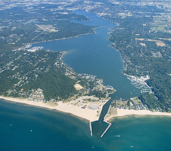
Lake Macatawa is not the only example of a drowned river mouth along the west coast of Michigan. White Lake in Whitehall, Kalamazoo Lake in Saugatuck, and Muskegon Lake in Muskegon are all examples of drowned river mouth lakes.
In order to log this Earthcache...
Please read the following questions and send me your answers.
- Why do you think Lake Macatawa isn't getting any bigger? Think about the original formation of the basin, but also note human intervention.
- Why do you think such a large area was carved out in the first place?
- Is there still water flowing in the natural channel or has it been closed off entirely?
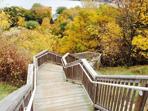
- Post a picture of you or a signature item at the posted coordinates. It’s a great view.
Sources:
https://www.michigan.gov/documents/deq/lwm-czm-land-lake_265869_7.pdf
Informational sign at the posted coordinates
Photos from Hollandsentinel.com
| I have earned GSA's highest level: |
 |