Location and PARK RULES
This cache is placed with permission in Independence Oaks County Park. The park covers over 1088 acres including 68 acre Crooked Lake. There are over 14 miles of hiking and biking trails. Other activities available are picnicking, hiking, fishing, swimming, nature study, and youth group camping. The park is also home to the Lewis E. Wint Nature Center.
Park hours are 1/2 hour before sunrise to 1/2 hour after sunset, unless otherwise posted at the entrance.
A vehicle permit is required.
A little history
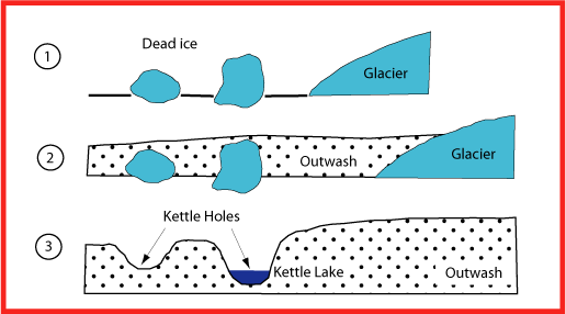
Around 12,000 years ago, the Wisconsin Glacier that once covered Michigan was retreating. A glacier is said to be retreating if it is melting faster than it is advancing. As it melted, whatever clay, dirt, gravel and boulders it was carrying was deposited on the land. The accumulation of this outwash debris made up a moraine. A kettle hole is formed within the moraine. While the glacier was melting, huge pieces of ice would break off. The outwash debris would continue to be deposited around the broken off pieces of ice until the pieces of ice became partially or completely buried in the moraine. At this point we have a huge piece of ice buried by dirt, clay and rocks. As the ice melted, the outwash debris that was covering it would fall into the cavity left by the melted ice. If the water from the melted ice was absorbed into the moraine, the end result was a dry kettle hole. If the water stayed in the cavity, the result was a kettle pond or kettle lake depending on the size.
Crooked Lake
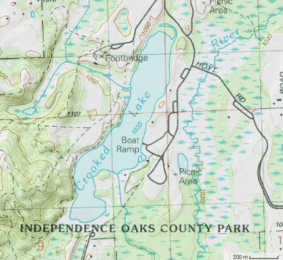
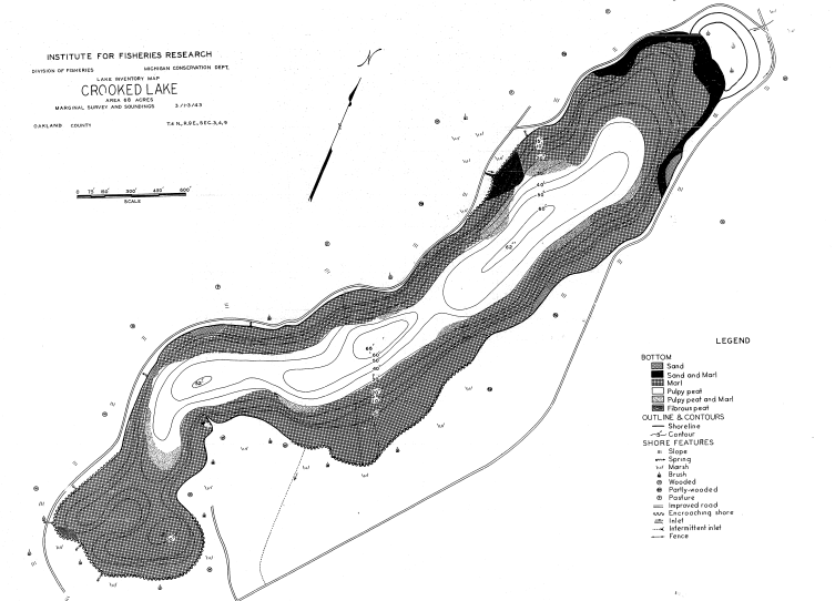
Crooked Lake is 68 acres in size and has a somewhat linear shape. The deepest point in the lake is in the center where it reaches 65 feet deep. The lake has a steep drop off close to shore. The water has a slight brown color and a Secchi disk reading of 8 feet for water clarity. During the summer, there are three distinct water layers. The upper layer, epilimnion, is warm and well oxygenated. The middle layer, thermocline, is intermediate in temperature and the amount of dissolved oxygen varies. The bottom layer, hypolimnion, is cold and lacks oxygen.
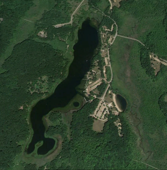
Crooked Lake is located in the headwaters area of the Clinton River. The surface geology is characterized by sand and gravel glacial outwash and end moraines of medium and course textured till. These areas are well drained and allow good infiltration to the ground water. There is an inlet that enters the lake from a wet area and springs west of the lake. There is one outlet on the lake, on the southeast side, which drains to the Clinton River.
Logging requirements
In order to log this EarthCache, send me your answers to the following questions either through email from my profile page or through messages on my profile page.
From the posted coordinates:
1) Describe the water clarity and color.
2) Describe the bottom of the lake as far as soil, rocks and any plants.
3) How deep is the water at the end of the dock?
4) Look at the shape of the lake and the above diagrams. Do you think Crooked Lake was formed by a single piece of ice or multiple pieces? Please give a reason for your answer.
Pictures are not required, but they are appreciated. Please post a picture of you, your GPS or anything you found interesting anywhere around the lake.
I have earned GSA's highest achievements:
  |