Mount Ruapehu
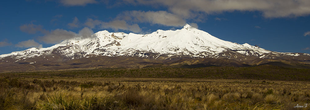
Mount Ruapehu from the Desert Road
Ruapehu is the Maori word for ‘pit of noise’ or ‘exploding pit’
Mount Ruapehu is the largest active volcano in New Zealand located at the southern end of the Taupo Volcanic Zone. Rising above the surrounding plains to 2797m, it is the highest peak in the North Island.
This volcano has three major peaks : Tahurangi (2797 m), Te Heuheu (2755 m) and Paretetaitonga (2751 m).
The glaciers on Mount Ruapehu are the only one in the North Island. They are all small (less than 1.6 km in length). There are eighteen glaciers including one within the crater. The largest are the Mangatoetoenui, Summit Plateau and Whangaehu Glaciers.
The last eruptive activity of Mount Ruapehu was on 25 September 2007. An explosion of ash, rocks and water across the summit area lasted 7 minutes and produced 2 lahars but no high eruption column.
Debris Flow
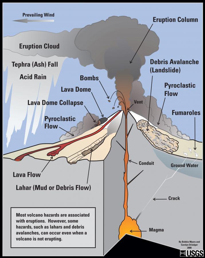
Debris flow
A debris flow is a moving mass of loose mud, ash, scoria, rock, water and air that travels down a slope funnel into stream channels under the influence of gravity. To be considered a debris flow, the moving material must be loose and capable of "flow," and at least 50% of the material must be sand-size particles or larger.
Some debris flows are very fast - these are the ones that attract attention. In areas of very steep slopes they can reach speeds of over 160 km/hour. Debris flows are extremely dangerous. They can be very fast, travel long distances, and completely fill valleys.
There are two types of debris flows, known as Lahar and Jökulhlaup.
The word Lahar is Indonesian in origin and has to do with flows that are related to volcanic activity. A variety of factors may trigger a lahar, including melting of glacial ice due to volcanic activity, intense rainfall on loose pyroclastic material, or the outbursting of a lake that was previously dammed by pyroclastic or glacial material.
Jökulhlaup is an Icelandic word which describes flows that originated from a glacial outburst flood. In Iceland, many such floods are triggered by sub-glacial volcanic eruptions, since Iceland sits atop the Mid-Atlantic Ridge. Elsewhere, a more common cause of jökulhlaups is the breaching of ice-dammed or moraine-dammed lakes.
Hummocks - Mounds
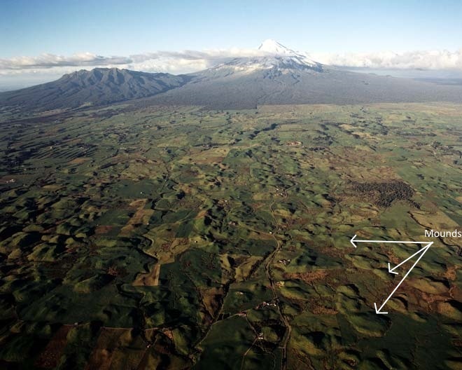
Debris flow mounds - Taranaki
Mounds are a visible feature of the landscape near the Chateau Tongariro on the northwestern flank of Mount Ruapehu. Hummocks are rounded or conical mounds within a volcanic landslide or debris flow deposit. Hummocks contain a wide range of rock debris, ash, lava... reflecting the variation of deposits that previously formed the flanks of the volcano. Some hummocks contain huge intact blocks tens to hundreds of meters in diameter.
Questions :
Q1 : By observing around you, what can you tell about the size of the blocks consisting the mounds ? Do you think that it is a small or powerful debris flow ?
Q2 : Where does the rocks that consist the Mounds where you stand come from ?
Q3 : According to the description there are two kinds of debris flow. Which one can you observe at Mount Ruapehu from where you stand ?
Q4 : According to the description, on which part of volcanoes debris flow are the fastest ?
A picture of you in front of the Ruapehu will be welcome in your log, but is optional and not mandatory.
You can log this cache "Found it" after sending your answers via my GC Profile or via Message Center. I will contact you if your answers are incomplete.
Bibliographical references :
Geology.com
New Zealand Journal of Geology and Geophysics
USGS
http://www.TeAra.govt.nz/