A hoodoo is a tall, thin point of rock sticking up from the ground. Hoodoos primarily form in arid regions such as deserts. There is a difference between a hoodoo and a pinnacle or spire. A pinnacle or a spire has a smooth profile and is a uniform taper from the ground upwards. A hoodoo fluctuates in shape and diameter as it climbs. The fluctuation in the shape of the hoodoo is caused by the difference in the compositional layers of sediments. Alternating hard and soft layers influence the erosion pattern, changing the shape.
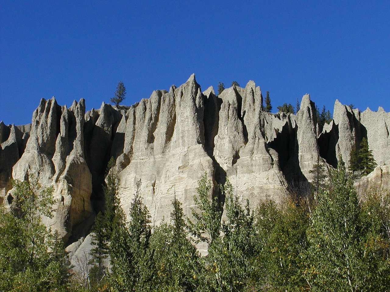
Image taken by werner22brigitte. Accessed from https://pixabay.com/en/hoodoos-landform-erosion-51108/ under Creative Commons License. No attribution required.
A hoodoo is formed when a hard rock or surface prevents the erosion of soft rock underneath. Originally, there are many layers of soft sediment, with a hard layer covering the soft sedimentary layers. As the hard layer cracks, erosive forces enter into the cracks and begin washing away the soft sedimentary layers. As the seams erode, a ridgeline will appear where the erosion is not occurring, called a fin. Eventually, parts of the fin collapse and erode. Where the hard layer remains in place, the downward pressure of the hard cap (called the capstone) prevents the soft sediment from eroding. As erosion continues, the capstone creates a long point, which is the hoodoo. As erosion continues, the soft sediment under the capstone eventually washes away, which causes the capstone to fall. Once the capstone falls, the hoodoo erodes much more quickly.

See page for author [Public domain], via Wikimedia Commons. https://commons.wikimedia.org/wiki/File%3AHoodoo_formation-Big.jpg
Two erosive forces primarily contribute to the breaking apart of the hard top layer and the erosion of the soft sediment. Frost wedging occurs when there is a freeze-thaw pattern. Water enters the cracks during the thaw stage, and is then formed into ice during the freeze stage. The force of the ice causes rocks to fracture and cracks to break, which exposes the soft rock underneath. Moving water then removes the soft sediments underneath through rain and/or thawing waters.
One of the world's most famous hoodoo locations is Drumheller, Alberta, where they are a major tourist attraction.

By Milorad Dimić MD (Intermedichbo (Milorad Dimić MD)) [CC BY-SA 4.0 (http://creativecommons.org/licenses/by-sa/4.0)], via Wikimedia Commons
Drumheller's hoodoos date back 70 to 75 million years, in the Cretaceous Period, when the clay and sand sediments were deposited. Information on the Drumheller hoodoos can be found by visiting the Royal Tyrrell Museum page at http://www.tyrrellmuseum.com/exhibits/1674.htm.
A closer example of pinnacles can be found in Pinnacles Park, located in Quesnel, BC. See http://www.env.gov.bc.ca/bcparks/explore/parkpgs/pinnacles/ for more information on Pinnacles Park, and don't forget to do the Earthcache The Pinnacles GC348R7 in Quesnel.
Questions:
1) Estimate the height of the canyon from the creek.
2) Estimate the average height of the hoodoos from base to tip. Do not include the fins.
3) How many are there as part of the fins? How many standalone hoodoos are there (not as fins)?
4) How many have capstones on them?
5) Describe recent signs of erosion.
6) What evidence is there nearby of humans trying to prevent erosion?
7) Hoodoo you love? We love pictures. Not required, but please send them. :-)
References:
BC Parks. (date unknown). Pinnacles Provincial Park. Accessed May 29, 2017 from http://www.env.gov.bc.ca/bcparks/explore/parkpgs/pinnacles/.
Royal Tyrrell Museum. (2010). Royal Tyrrell Museum: Exhibits. Accessed May 29, 2017 at http://www.tyrrellmuseum.com/exhibits/1674.htm
Wikipedia. (Last edited May 21, 2017 at 18:10). Hoodoo (geology). Accessed May 29, 2017 at https://en.wikipedia.org/wiki/Hoodoo_(geology)