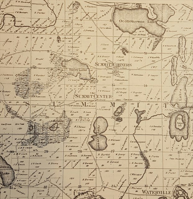
Settlers began to stake their claims, cut lumber and build their homes clustering mainly at Summit Corners and Summit Centre (present intersection of Dousman Road and Delafield Road). The first recorded land sales in Wisconsin came in 1839. To encourage development of the area, settlers were able to purchase whatever they could afford for $1.25 per acre.
The most important settlement was Summit Centre. It has always been confused with Summit Corners as these two closely burgs are within a mile of each other. Summit Centre achieved its prominence because of another road. In 1839, an old Indian Trail was turned into a territorial road. This road ran between Milwaukee and Madison, passing north of Waukesha, through Delafield, between Nemahbin Lakes and through Summit along the present Delafield Road. This was quite an improvement, as the early pioneers reached this area by cutting their way through muddy Indian trails prior to the luxury of dirt roads. History of Summit Centre and map courtesy of the book "The Summit of Oconomowoc 150 Years of Summit Town" by Barbara & David Barquist.
Permission for placement: Oconomowoc Utilities