Coordinates are fake. (It only takes you to the park entrance and there is nothing there).
Prairies are ecosystems considered part of the temperate grasslands, savannas, and shrublands biome by ecologists, based on similar temperate climates, moderate rainfall, and composition of plants. The prairies are a type of grassland dominated by herbaceous plants and grasses. Very few trees grow on the prairies and are usually widely scattered.
The French called the rolling plains of grass “prairie”, from the word for meadow grazed by cattle. Lands typically referred to as "prairie" tend to be in North America. The term encompasses the area referred to as the Interior Lowlands of Canada, the United States, and Mexico, which includes all of the Great Plains as well as the wetter, somewhat hillier land to the east. In the U.S., the area is constituted by most or all of the states of North Dakota, South Dakota, Nebraska, Kansas, and Oklahoma, and sizable parts of the states of Montana, Wyoming, Colorado, New Mexico, Texas, Missouri, Iowa, Illinois, Indiana, Wisconsin, and western and southern Minnesota.
Today very little of the original prairie survives, only an estimated one to two percent. Much of the land has been converted to agricultural use, urban areas are overtaking the land and the fires are suppressed. The huge herds of animals have been killed off or driven from the land. The natural ecosystem for sustaining the prairies has been all but destroyed.
Prairies of America

There are ten (10) ecoregions in Texas. Several of these are prairies or a form of a grassland. Texas is divided into 10 natural regions or ecoregions: the Piney Woods, the Gulf Prairies and marshes, the Post Oak Savanah, the Blackland Prairies, the Cross Timbers, the South Texas Plains, the Edwards Plateau, the Rolling Plains, the High Plains, and the Trans-Pecos.
Ecoregions of Texas

The Pineywoods region can be described as pine and pine-hardwood forests with scattered areas of cropland, planted pastures, and native pastures. Timber and cattle production are important industries in the region. Farms and ranches are relatively small in size compared to the state average.
The Gulf Prairies and Marshes region is a nearly level, slowly drained plain less than 150 feet in elevation, dissected by streams and rivers flowing into the Gulf of Mexico. The region includes the barrier islands lining the coast which protect the shoreline from the constant buffeting of harsher ocean waves, and the highly productive estuaries and marshes that support a thriving fishing economy.
The Post Oak Savanah region is a transitional area for many plants and animals whose ranges extend northward into the Great Plains or eastward into the forests. The region can be described as oak savannah, where patches of oak woodland are interspersed with grassland. Cattle ranching is the major agricultural industry in the Oak Woods and Prairies. Introduced grasses such as bermudagrass are grazed along with forage crops and native grasslands.
The Blackland Prairies region is named for the deep, fertile black soils that characterize the area. The landscape is gently rolling to nearly level, and elevations range from 300 to 800 feet above sea level. Crop production and cattle ranching are the primary agricultural industries.
The Cross Timbers ecoregion is named after the early travelers and their repeated crossings of these timbered areas that proved to be a barrier to their travel on the open prairies to the east and west. This area in north and central Texas includes areas with high density of trees and irregular plains and prairies.
The South Texas Brush Country is characterized by plains of thorny shrubs and trees and scattered patches of palms and subtropical woodlands in the Rio Grande Valley. Although many land changes have occurred in this region, the Brush Country remains rich in wildlife and a haven for many rare species of plants and animals. Today, the primary vegetation consists of thorny brush such as mesquite, acacia, and prickly pear mixed with areas of grassland. Livestock grazing and crop production are the principal agricultural land uses.
The Edwards Plateau region comprises an area of central Texas commonly known as the Texas Hill Country. It is a land of many springs, stony hills, and steep canyons. The region is home to a whole host of rare plants and animals found nowhere else on earth. Average annual rainfall ranges from 15 to 34 inches. Rainfall is highest in May or June and September. Soils of the Edwards Plateau are usually shallow with a variety of surface textures. They are underlain by limestone. The limestone of the Edward's Plateau is honeycombed with thousands of caves. Despite shallow soil and limestone, the area has grasslands, juniper/oak woodlands, and plateau live oak or mesquite savannah. Ranching is the primary agricultural industry in the region.
Rolling Plains can be described as a mesquite-shortgrass savannah. Stream floodplains are dominated by various hardwood species, and juniper is common on steep slopes along rivers. Steep slopes, cliffs, and canyons occurring just below the edge of the High Plains Caprock comprise the Escarpment Breaks area of the Rolling Plains. Crop and livestock production are the major agricultural industries in this region.
The High Plains region, together with the Rolling Plains comprise the southern end of the Great Plains of the central United States. Native vegetation of the High Plains is shortgrass prairie dominated by buffalo grass. Although historically a grassland, mesquite and yucca have invaded parts of the region. Shinnery oak and sand sage are common invaders on sandy lands, and juniper has spread from the breaks onto the plains in some areas. Today, the plains are mostly irrigated cropland and the native vegetation includes more mesquite and juniper. Although much of the shortgrass prairie and the vast prairie dog towns are gone, large flocks of wintering waterfowl still come to the playa lakes (shallow, round depressions which spot hold rainfall).
The Trans-Pecos region occupies the extreme western part of the state eastward generally to the Pecos River. This is a region of diverse habitats and vegetation, varying from the desert valleys and plateaus to wooded mountain slopes. Elevations range from 2,500 feet to more than 8,749 feet. Over most of the area average annual rainfall is less than 12 inches, but varies greatly from year to year and from lower to higher elevations. Due to the diversity of soils and elevations, many vegetation types exist in the region. Ranching is the primary industry in the Trans-Pecos region.
Ellis County where this prairie is located is in both the Cross Timbers and Prairies Region and the region of Blackland Prairies. The ecoregion of Kachina Prairie is however classified as a blackland praire.
Kachina Park

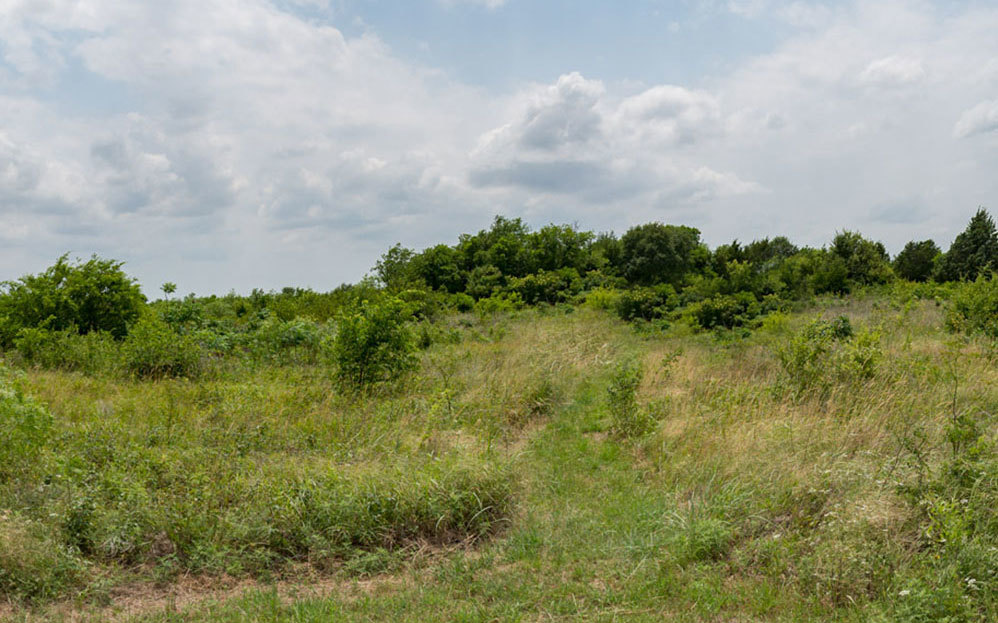
The Texas Blackland Prairie was once a 12-million-acre sea of grass stretching from San Antonio to the Red River. Farmeing, grazing and urbanization have reduced the tall grass prairie to small parcels of 3 to 15 acres. The Kachina Prairie is a 22-acre patch of undisturbed native prairie and is outstanding example of the complex prairie ecosystem. The Blackland Prairie collectively across the state, supports a wide diversity of plants and animals and is a source of unique genetic material that is available nowhere else on earth.
Topography of the Blackland Prairies region is gently rolling to nearly level and well dissected for rapid surface drainage. Elevation varies from 300 to 800 feet above sea level. Average annual rainfall ranges from 30 to 40 inches increasing from west to east. May is the peak rainfall month for the northern end of the region; however, the south-central part has a fairly uniform distribution throughout the year.
The soil of the blackland prairies, from which the "blackland" get its name, contains black or deep dark-gray alkaline clay which is further blackened by char from wildfires and controlled burns. "Black Gumbo" and "Black Velvet" are local names for this soil. In dry weather deep cracks form in the clay which can cause serious damage to buildings and infrastructure. Soil management problems also include water erosion, cotton root rot, soil tilth, and brush control.
The fauna of the blackland prairies includes fox, frogs, lizards, rattlesnakes, opossums, coyotes, white-tailed deer, and striped skunks. The blackland prairie was formerly home to animals such as buffalo, wolves, and jaguars before overhunting and the destruction of most tallgrass ecosystems.
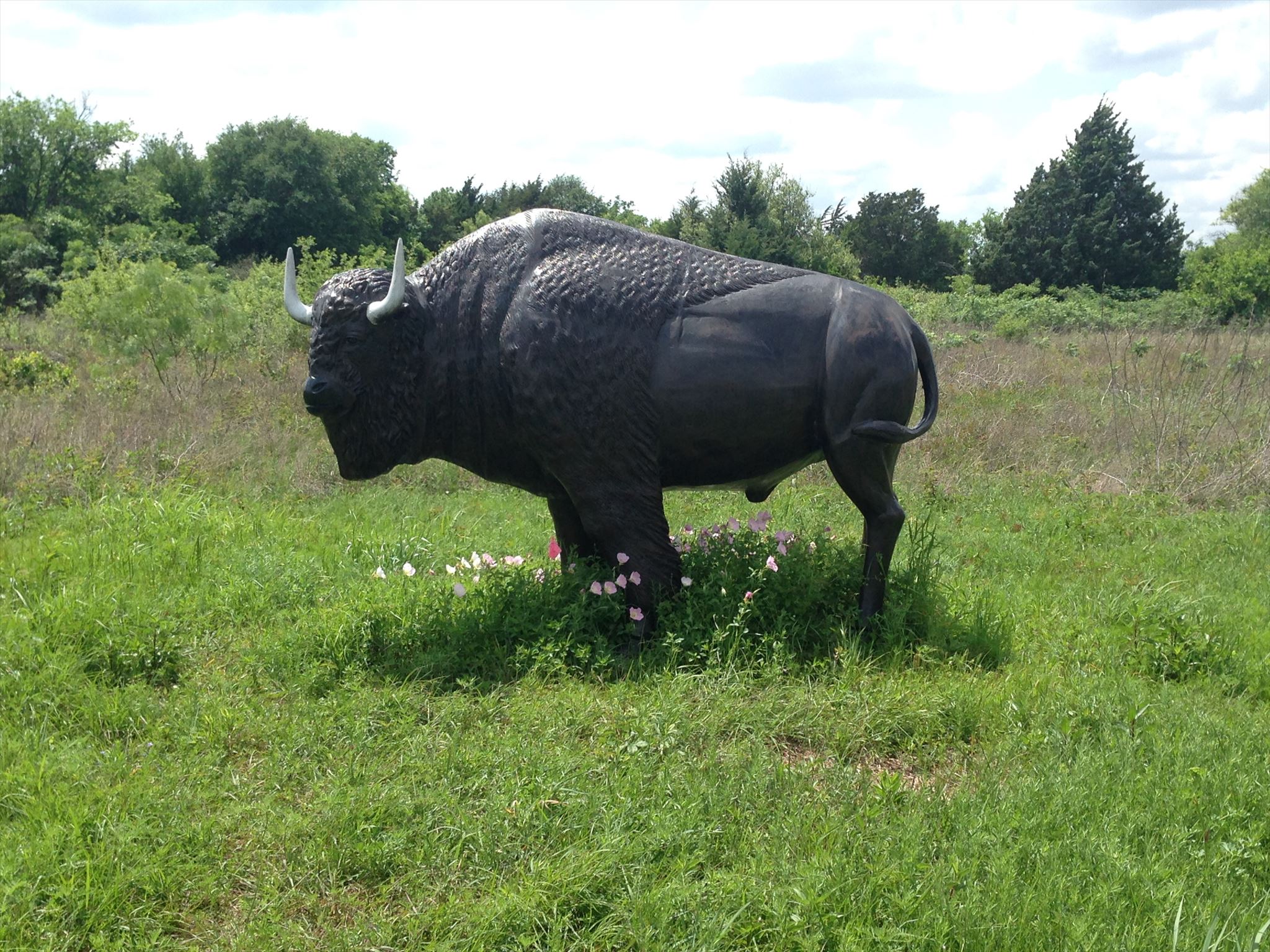
Buffalo Statute in the park
The Texas Land Conservancy attracts visitors to Kachina Prairie by describing it with the words, "While meandering through the prairie in spring or summer, listen for Western Kingbirds and Scisso-tailed Flycatchers twittering overhead. In winter, search the brambles and dense thickets for wintering sparrow such as Lincoln’s, White-throated and perhaps Harris’. In spring, the prairie comes alive with wildflowers that feed an array of attendant butterflies. Look for Pipevine and Spicebush Swallowtails, as well as Variegated and Gulf Fritillaries.”
This property was named “Kachina” for the Native American legend of the bluebonnet and was given to the Texas Land Conservancy (TLC) in 1985. This nature preserve is protected by a partnership between the TLC and the City of Ennis. It has a gravel parking lot adjacent to the entrance of the nature preserve. There is a sign depicting various organizations involved in protecting the area. The sign also has a display of all the wildflowers and animals in the area. Past the sign, is the prairie itself. There are benches along a grass mowed walking trail that goes in a circle around the park perimeter. There is even a Buffalo statue for you to enjoy while in this nature park.
Information for this cache has been extracted and adapted from several key sources.
· Native Prairies Association of Texas. Two specific articles were used. 1).“What is a Prairie?” and article 2). “Blackland Prairies” ( http://texasprairie.org ).
· Also from the article “Prairie type guides by Prairie Frontier.”
( http://www.prairiefrontier.com/pages/families/prairies.html ).
· The article published by Texas Almanac titled "Soils of Texas"( http://texasalmanac.com/topics/environment/soils-texas ).
· Texas Land Conservancy ( http://texaslandconservancy.org/ ).
· The article “Texas Ecoregions” published by Texas Parks and Wildlife.
( https://tpwd.texas.gov/education/hunter-education/online-course/wildlife-conservation/texas-ecoregions ).
Part of the Prairie
Puzzle to Solve for cache location:
1. Which ecoregion is this prairie part of?
“Blackland Prairie”-A=8
“Rolling Plains”- A=4
“Cross Timbers”- A=2
2. The meaning of the name of the prairie comes from the Native American legend about what? Number of letters minus 2 = B
3. How many Ecoregions are in Texas?
“Two”-C=4
“Nine”- C=8
“Ten”- C=6
4. This area was formerly home to three types of animals before being over hunted and the destruction of most tallgrass ecosystems. Count the letters in these animals, add them together, and then divide by the number of eco-regions in Texas. answer= D.
5. What percent of the original prairie is estimated to be left?
“1-2%”-E=4
“Less than 1%”- E=8
“9%”- E=0
“10%”- E=9
“12%”- E=6
“22%”- E=1
6. Number of states that include all or part of the land classified as prairie divided by 8? answer= F.
Take your answers and plug them into the coresponding location in the following format to get the cache location:
N 32° 19.ABC W 096° 39.DEF
All the answers can be gained from the information on the cache page. You must sign the log to claim the find. No exceptions and no excuses. Blank logs may be deleted without notice. Avoid the use of acronym only logs. It is optional but highly encouraged to take a picture of yourself at this location and post it with your log.
Please do not post answers to the questions within your log entry.
Congrats to TP-Conductor for the first to find.