You cannot drive to the waypoints - Do not try! / Conducir a los waypoints es peligroso, ¡no intentes! / Вождение к путевым точкам опасно, не пытайтесь! / 驾车前往航点是危险的。 不要尝试!
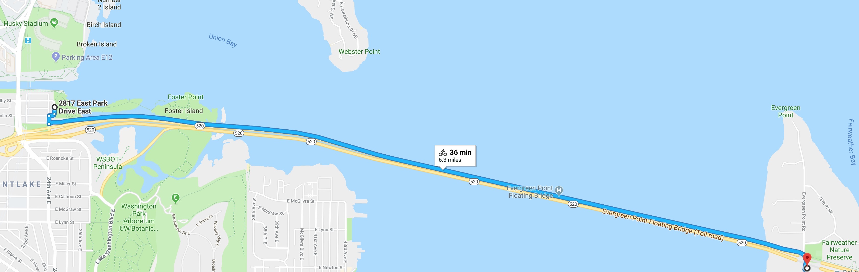
The route you'll enjoy today celebrates the opening (2017-12-20) of the pedestrian path along the world's longest floating bridge, approximately 6.5 miles round-trip.
The SR 520 Trail not meant for high speeds (paceline cyclists in matching accoutrement may find this depressingly slow). There are steel plates covering the expansion joints - yes, the bridge embiggens and debigulates with changing temperature and water levels! Also, people often have headphones on, may not hear you, and move the wrong way when snapped out of their reverie. Please be courteous, a generally great rule for life, but also extra-helpful on a shared use path.
Each waypoint has interpretive signs and benches offset from the trail so you may enjoy the unencumbered view north. You can do an out-and-back (hence the terrain rating), or continue around Lake Washington, North (Jim's preference) or South, or both, should you be inclined.
To successfully claim a find this virtual, please do these three things:
- Post to your log the numbers (today, year-to-date) displayed on the pedestrian counter (Waypoint 0) on the western entrance, heading east. The sign can be hard to photograph because the refresh rate is similar to your phone's. Just try to do your best here.
- Upload to your log a picture of yourself (or a personal item) at the posted coordinates with the sign in the background. The important thing is that the picture demonstrates you're a cacher logging a virtual cache at Points of Interest (Waypoint 3). A group photo is fine as long as all cachers in your party are identified. Virtual bonus points for rabbit ears, funny faces, serious faces, or impressive Haka.
- Message me (do not post, lest I must deploy the Sparkling Mallet of Log Deletion for Insufficient Achievement in the Art of Instruction-Following) the last three words of the last line -- also a good guideline for life -- from Joe's plaque near "Bridge Construction and Engineering" (Waypoint 5). Hint: You will be facing southbound. I will only respond if there is an issue.
Okay, now that business is out of the way:
- Parking is available on either side of the bridge. The west side has better public transportation options. There are usually several of the dockless rental bikes available, should you not have your own and don't want to walk.
- Waypoint 0: This is the trail counter sign. When I lived here the first time, there was a lot of doubt that the trail would see a lot of use. One opinion piece in Cascade Bicycle Club conjectured there would be fewer than 15 people a day. As a data geek, I'm interested in tracking the rate.
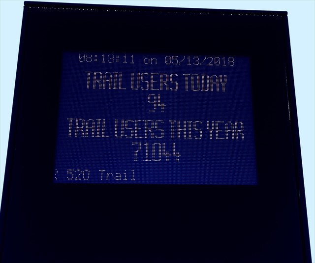 |
Trail Sign, as of 2018-05-13.
|
- Waypoint 1: "Lake Washington: A Look to the Past" Informational sign and a bench. Here, you'll learn more about how the lake was built (hint: glaciers) and the history of the region.
- Waypoint 2: "Nautical and Maritime" Informational sign and a bench. Here, you'll learn more about the types of ships plying the waters and why there was a surge in interest. Fun fact: the original bridge had a center drawspan to allow boats over 64' tall to pass through. While a technical marvel, it wrought havoc on my commute.
- Waypoint 3: "Points of Interest" Informational sign and a bench. The sign shows you the various landmarks and features you'll contemplate looking north. Please take your selfie here and be glad I didn't make you type in the native name for "Becomes added to."
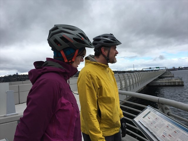 |
| Frau Potter and gsbarnes at Points of Interest. |
- Waypoint 4: "Ecology and the Environment" Informational sign and a bench. The plaque helps you identify the native (coho, lamprey) and non-native (carp-y) fish you may see.
- Waypoint 5: "Bridge Construction and Engineering" Informational sign and a bench. Here, you're looking for a small plaque as you face southbound, e.g., opposite all of the dedication ones facing northbound.
- Waypoint 6: "Connections to the Eastside" Informational sign and several benches. This viewpoint looks westward and is technically not on the trail. The sign provides a broader historical view.
Stay safe, have fun, enjoy your trek - this is only a game. / Mantenerse a salvo. Que te diviertas. Esto es solo un juego. / Оставайтесь в безопасности, получайте удовольствие, это просто игра. / 注意安全。 玩的开心。 这只是一场比赛。
Congratulations to Love for first to find.
Congratulations to Shmellis for her 500th find.
Kilo-congratulations to KirkGirls for her 1000th find.
Two Kilo-congratulations to Frau Potter on her 2000th find!
Happy birthday, Abby!
FTS (first to skate): Parkerpants!
First Unsheathing of the Sparkling Mallet of Log Deletion for Insufficient Achievement in the Art of Instruction-Following: 2023-07-23. Sigh.
Virtual Reward - 2017/2018
This Virtual Cache is part of a limited release of Virtuals created between August 24, 2017 and August 24, 2018. Only 4,000 cache owners were given the opportunity to hide a Virtual Cache. Learn more about Virtual Rewards on the Geocaching Blog.

Traffic data points May 2018 - August 2020.