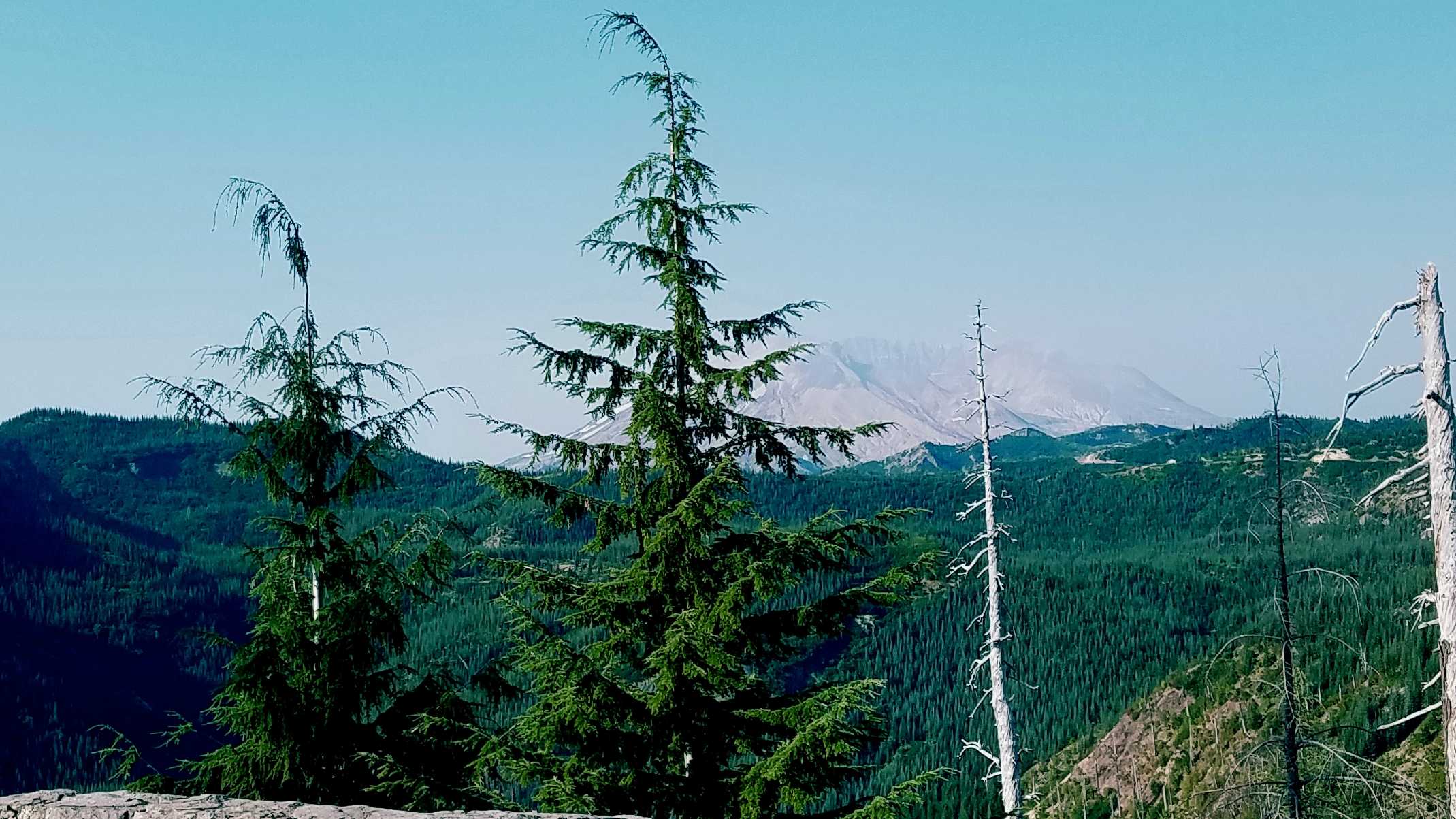
At this spot, you’re standing on the edge of the blast zone from the 1980 eruption. On a clear day you’ll have a view of Mount St Helens to southwest.
The 1980 eruption awakened Mount St Helens from 123 years of dormancy. The eruption was a lateral blast out of the north face of the mountain, and resulted in a huge landslide, pyroclastic flows, volcanic debris flows, and mudflows (lahars) as well as a large tephra plume that sent ash into the stratosphere for over nine hours.
While visiting the Volcanic Monument you will be able to see many features of the 1980 eruption. Here, you can see a very clear singe zone. During the eruption, the temperatures at this spot were estimated to be between 122ºF and 482ºF. The blast density flow and temperature was enough to singe the trees in the forest here, but not to knock them over. In the distance, you can see downed trees where the blast had more velocity. Even closer to the crater, the trees were completely covered and/or uprooted and splintered because of the blast.
For this EarthCache:
- Compare the forest floor outside the blast zone to the ground at this view point. What differences do you see in the rock size, texture, and color?
- What other evidence do you see in this area of the blast, compared to the road and area north of here (outside the blast zone)?
- The forest has been regenerating since the 1980 blast, but some young trees survived the blast bent under snow and where the blast had a less powerful velocity. As you look over the rolling hills between this point and the crater, describe how you think the terrain of the area impacted the blast and therefore impacts the current forest regeneration.


Enjoy your day exploring this amazing place!
Works Cited
Mount St Helens National Volcanic Monument. (2013, January 18). Retrieved from https://volcanoes.usgs.gov/volcanoes/st_helens/st_helens_geo_hist_106.html
Pringle, P. T. (2002). Roadside Geology of Mount St. Helens National Volcanic Monument and Vicinity. Washington State Department of Natural Resources .