Saturday, 18 November
8:00am - noon
Directions to the trail head: Take the 118 freeway to the Kuehner Drive exit. Head north (left if you’re coming from the west, right if from the east) to the very end, where there is limited parking. There is also secondary parking in a small lot northwest of the intersection of Kuehner Dr. and Mt. Sinai Dr. See additional waypoints for coordinates.
 Hummingbird Trail Map Hummingbird Trail Map |
 Hummingbird Trail Profile Hummingbird Trail Profile |
The Hummingbird Trail is a bit over two miles long. The western terminus is a trail head at the north end of Kuehner Drive, which is where we'll meet at the beginning of this CITO event. The eastern terminus is a trail junction with Rocky Peak Fire Road. The elevation gain from west to east is about 1,150 feet as the trail climbs through some gorgeous sandstone formations. This trail is primarily used for hiking, trail running, horseback riding, mountain biking, and of course, geocaching! There is little shade, so the best part of the year is from October until May. Dogs are allowed, but must be kept on leash.
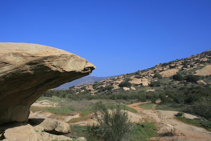 Hummingbird Trail Geology
Our tasks: We'll be working on the lower part of the trail at the western end. We will be improving the trail by doing trail grooming and widening, water bar reconstruction, and brush cutting. All tools will be provided. No experience is necessary; instructions on trail building, and the safe and proper use of tools/equipment, will be given.
Please bring your own:
- water
- snacks
- gloves
- hat
- sunglasses
- sunscreen
- smile
Boots are also recommended.

This event is hosted by the Rancho Simi Trail Blazers.