The purpose of this Earthcache is to provide people like me, who know very little about the environment, with an opportunity to increase their knowledge-base and to develop a deeper appreciation and respect for the world we live in. The lessons and related questions are brief, quick to answer and easy to remember for a lifetime! As with all Earthcaches, please be respectful of the land.
FOR THIS EARTHCACHE DO NOT GO TO POSTED COORDINATES. INSTEAD YOU WILL WANT TO TRAVEL BETWEEN THE TWO WAYPOINTS. PLEASE READ THIS DESCRIPTION BEFORE DOING SO.
This Earthcache is one of four related Earthcaches created by me that will bring you on a journey of exploration to several locations on Upper Cape Cod. Each location will introduce you to a geologically significant formation due to glacial impact.
They are:
- 1. GC7GMBX Part 1: Upper Cape Cod: Outwash Plains
- 2. GC7GMHO Part 3: Upper Cape Cod: Kettle Ponds
- 3. GC7H2YB Part 4: Upper Cape Cod: Placing the ‘Spot’light on Waquoit Bay
At the time of the inception of this Earthcache series, there are nine other Earthcaches located on the Cape and Islands (one of them is on Martha’s Vineyard and another on Nantucket); most of them on the outer Cape. Here is the list of the nine (in no specific order):
- 1. GC5J48R Wellfleet tombolo
- 2. GC4NEZE Cape Cod Changing Glacial Bluffs
- 3. GC69K0E The Magical Quartz of Cape Cod
- 4. GC3BNDF Brrr…Harding’s Beach and Glaciers
- 5. GC19J06 Cape Cod Kettle Ponds
- 6. GCZDAZ Doane Rock
- 7. GC1E67W Cape Cod Tidal Flats
- 8. GC7FWTQ PONDering Estuaries: Sesachacha Pond (Nantucket)
- 9. GC7ERCB Behaving ‘Erratically’ on Martha’s Vineyard
Although it is not necessary to visit all (and any future) earthcaches to get credit for this earthcache, in doing so your experience and knowledge will only be greatly enhanced and you’ll get to visit the entire Cape.
Much of the land on which the Cape Cod moraines are located is owned by the federal government for which there are many service roads that do not allow public access. Observations of the moraines is primarily limited to drive-by’s along major routes or, in the case of the Sandwich moraine, by visiting a state park that fortunately is open to the public and friendly to geocachers.
There is approximately 10 miles that separate the two waypoints by traveling Rt. 6A and a small section of Rts. 28 and 130. However the posted coordinates will lead you to a Visitor Center located about 2 miles down 130 from the first waypoint, should you choose to forego Rt. 6A and travel ‘the long scenic way’ between waypoints by following Rt. 130 S to Rt. 28 in Mashpee. The attendants there are very willing to answer any questions you might have about the Cape should you stop there. It doesn’t matter which route you travel or which stage you choose to do first, nor does it require that you do both stages on the same day (as long as you can adequately recall your observations of both moraines).
Here's some definitions that will help you with this earthcache.
Moraine: a mass of rocks and sediment carried down and deposited by a glacier, typically as ridges at its edges or extremity. Moraines often appear as cliffs when located at the shoreline, or morph into rugged hills inland. They are characterized by an irregular topography of hills and swales and an unsorted mixture of rock sizes, from giant boulders to silt and clay so fine that it is called rock flour
To get a better idea of what moraines are, picture yourself with a toy bulldozer on a lawn that has a bunch of dry leaves all over it. When you run the bulldozer through the leaves, some of them get pushed aside, some of them get pushed forward, and some of them leave interesting patterns on the grass. Now think of these patterns and piles of pushed-away leaves as ‘moraines’—stretching for miles on the Earth. (Oh, and while you’re at it, rake the leaves!)
According to National Geographic Society, moraines are divided into four main categories: lateral moraines, medial moraines, supraglacial moraines, and terminal moraines, and some sources identify a fifth one (ground moraine).
Lateral Moraine
A lateral moraine forms along the sides of a glacier. As the glacier scrapes along, it tears off rock and soil from both sides of its path. This material is deposited as lateral moraine at the top of the glacier’s edges. Lateral moraines are usually found in matching ridges on either side of the glacier. If a glacier melts, the lateral moraine will often remain as the high rims of a valley.
Medial Moraine
Medial moraines are formed when two glaciers meet. Two lateral moraines from the different glaciers are pushed together. This material forms one line of rocks and dirt in the middle of the new, bigger glacier. If a glacier melts, the medial moraine it leaves behind will be a long ridge of earth in the middle of a valley.
Supraglacial Moraine
A supraglacial moraine is material on the surface of a glacier. Supraglacial moraines are made up of rocks and earth that have fallen on the glacier from the surrounding landscape. Dust and dirt left by wind and rain become part of supraglacial moraines. If a glacier melts, supraglacial moraine is evenly distributed across a valley.
Terminal Moraine
A terminal moraine is also sometimes called an end moraine. It forms at the very end of a glacier. At a terminal moraine, all the debris that was scooped up and pushed to the front of the glacier is deposited as a large clump of rocks, soil, and sediment.
Ground Moraine
Ground moraines often show up as rolling, strangely shaped land covered in grass or other vegetation. They don’t have the sharp ridges of other moraines. A ground moraine is made of sediment that slowly builds up directly underneath a glacier by tiny streams, or as the result of a glacier meeting hills and valleys in the natural landscape. When a glacier melts, the ground moraine underneath is exposed. Ground moraines are the most common type of moraine and can be found on every continent.

Introduction to the Cape Cod Moraines
Cape Cod is of particular interest to geologists because it was formed by glaciers very recently in terms of geologic time. It’s history mostly involves the last advance and retreat of the ice in southern New England and the rise in sea level that followed the melting of the ice. These events occurred within the last 25,000 years. Sometime between 18,000 and 25,000 years ago the glacier reached its maximum advance, a position marked approximately by the islands of Nantucket and Martha's Vineyard.
There are two major processes that result in the formation of moraines:
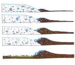
- 1. The rock fragments carried by the ice are piled up along the ice front in much the same manner as a conveyor belt carries along material and dumps it at the end of the belt. Minor advances of the ice front may rearrange the debris to form a larger and higher moraine.
- 2. Moraines may also form when the ice front advances and bulldozes the sand and gravel of an outwash plain into a ridge.
The moraines on Cape Cod were formed by a combination of these two processes.
The majority of the rock and boulders of both moraines (Sandwich moraine and Buzzard’s Bay moraine) is granite or granite-based. The Sandwich moraine also contains volcanic rock and a black and white quartzite derived from the Cape Cod Lobe.
The Sandwich Moraine runs west to east from Bourne to a little past Barnstable. It was created by the Cape Cod Lobe of the Wisconsin Glacier Stage. At its most western location it is joined by the Buzzard’s Bay Moraine, created by the Buzzard’s Bay Lobe, that runs North to South into Woods Hole and the Elizabeth Islands. These two moraines were formed differently than most other moraines. Rather than caused by the debris of retreating glaciers, they were formed during the glacier’s advancement stage. Much like a bulldozer, as the glaciers move forward their lobes pushed debris, sediment, drift and till upward and forward to form large ridges beyond the ice front.
Stage One: N 41 45.842 W 70 31.197 The Sandwich Moraine
The first waypoint will lead you to the very heart of the Sandwich Moraine off Route 130 at the Shawme Cromwell State Park. (There are several geocaches to find there, too!) (Please note: during camping season please be courteous and respectful of campers’ privacy.)
When you arrive at the waypoint coordinates, you will have an exciting experience ahead of you of negotiating your vehicle up and down some of the higher hills of the moraine. Notice the direction of the slopes of the majority of those hills. Notice just how numerous those hills are and how closely formed they are to each other…imagine what it must have been like while these were forming by the advancing wall of ice. Are there many boulders (glacial erratics) among the hills and valleys? What’s the average size of the erratics?
Imagine, too, being among the first natives to explore the area…how it must have been for them to walk up and down the landscape with its steep slopes. To get an even better sense of what that must have been like, pull over and park at any of the identified parking areas and make your way down to one or more of the several trails that make their way through the park. (That’s where the majority of the geocaches are hidden.) It’s like a step back in time.
Stage Two: N 41° 40.936' W 70° 35.137' The Buzzards Bay Moraine.
It took me a while to find a suitable place to observe the Buzzard’s Bay moraine. Many of the potential access points do not allow public access and there were no state parks reasonably close enough to the Sandwich moraine to provide comparison of the two moraines.
Instead, I found a road, Connery Avenue, off Rt. 28 that will provide you with excellent exposure to a representative sample of the Buzzard’s Bay moraine. The road is not heavily traveled: it leads past the National Cemetery and ends at the entrance to the Otis ANGB. Just before the checkpoint at the gate to the base there is opportunity to turn around and return to Rt. 28. You will obviously want to do this. Since the road is split into two one-ways, this will give you an additional view of the moraine. (Two views for the price of one! LOL)
Take your time up and down Connery Avenue. (I got to see an awesome buck standing atop one of the hills who, unfortunately, was camera-shy). Be aware of the size, slope and direction of the hills. Also, check out the erratics along the route. What you’ll be observing is typical of the majority of the length of the Buzzard’s Bay moraine.
To earn your smiley for this earthcache, please send the CO answers to the following questions. It will not be necessary to wait for a response from him to log your find. He will contact you if there are any concerns or questions with your responses.
- 1. Which of the five categories of moraines best describes what you encountered in Shawme Crowell State Park and on Connery Avenue? What evidence led you to that decision? If you note that the category for one is different from the other, what features did you observe that led you to that decision?
- 2. What are some observable and obvious differences between the Sandwich moraine and the Buzzard’s Bay moraine?
- 3. OPTIONAL: Post a picture of one of the stops you made that demonstrates a geological characteristic of either location that was of interest to you. It is entirely up to you whether you choose to include yourself in the photo.
Resources:
- Oldale, R. N. 2001a The Geologic History of Cape Cod, Massachusetts USGS, Woods Hole Field Center, Massachusetts. URL: http://pubs.usgs.gov/gip/capecod/index.htm
- LAURENTIDE GLACIATION OF THE MASSACHUSETTS COAST By: Margaret Martin ES 767, Quaternary Geology, Fall 2008
- https://www.nationalgeographic.org/education/teaching-resources/