The Maryland Geocaching Society welcomes you to the 2018 edition of Cache Across Maryland! This is one of eleven geocaches placed throughout the "Old Line State" in locations chosen to showcase Maryland's diverse beauty. From the mountains of Western Maryland to the Atlantic Ocean, Cache Across Maryland 2018 will once again demonstrate that Maryland truly is “America in Miniature”.
Each geocache contains a code which you will use to determine the location of the CAM 2018 Picnic to be held on May 5th, 2018. The code can be found on the inside of the cache container and on the inside front cover of the logbook. Don't forget to record this code! Any geocacher who has completed at least TEN of the eleven CAM geocaches and attends the CAM Picnic on May 5th will receive a Certificate of Completion and a Cache Across Maryland 2018 Geocoin in Antique Silver. We hope you enjoy CAM 2018!
Havre de Grace and
Concord Point Lighthouse
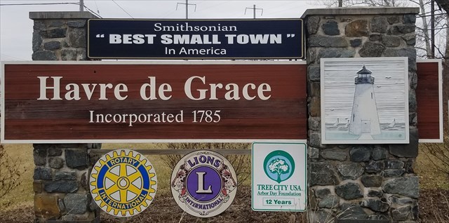
Welcome to Havre de Grace!
Havre de Grace is situated where the Susquehanna River meets the Chesapeake Bay. Teeming with numerous species of flora and fauna, and having highly navigable waters, this unique environmental setting has been the perfect backdrop for generations of inhabitants.
The modern day history of Havre de Grace begins with the voyage of Captain John Smith in 1608. The area was inhabited by the Susquehannock Indians. Maryland enacted a treaty with the Susquehannocks in 1652. A 200 acre tract of land in the present historic district was called Harmer’s Town.
The name Havre de Grace is attributed to the Marquis de Lafayette. Approaching our shores shortly after the Revolutionary War, he admired the location from the river. He was said to exclaim, “C’est Le Havre!” for it reminded him of the French port city Le Havre (originally called Le Havre de Grace - French for "Harbor of Grace"). Inspired by Lafayette's comments, the residents incorporated the town as Havre de Grace in 1785, making Havre de Grace the second oldest municipality in Maryland, after Annapolis. The city almost became the nation's capital, losing out to Washington by only one vote during the First Congress in 1789.
On May 3, 1813, during the War of 1812, Havre de Grace was attacked by British Rear Admiral George Cockburn who burned and plundered the city. The American Lieutenant John O'Neill single-handedly manned a cannon to help defend the town. He was wounded, captured by the British, and soon released. In gratitude, Havre de Grace made O'Neill and his descendants the hereditary keepers of the Concord Point lighthouse marking the mouth of the Susquehanna River.
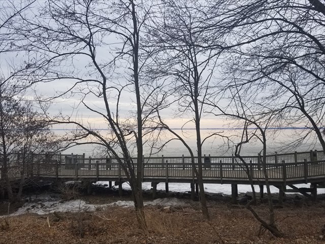
Havre de Grace is a designated city on the National Park Service's John Smith and Star Spangled Banner Trails. In 2014 Smithsonian Magazine voted Havre de Grace one of the 20 Best Small Towns to Visit. A good place to begin a tour of Havre de Grace is with the half-mile boardwalk (Promenade) along the bay, which connects the Millard E. Tydings Memorial Park to the Decoy Museum, Maritime Museum and Concord Point Lighthouse. Please note: Dogs are not allowed on the Promenade.
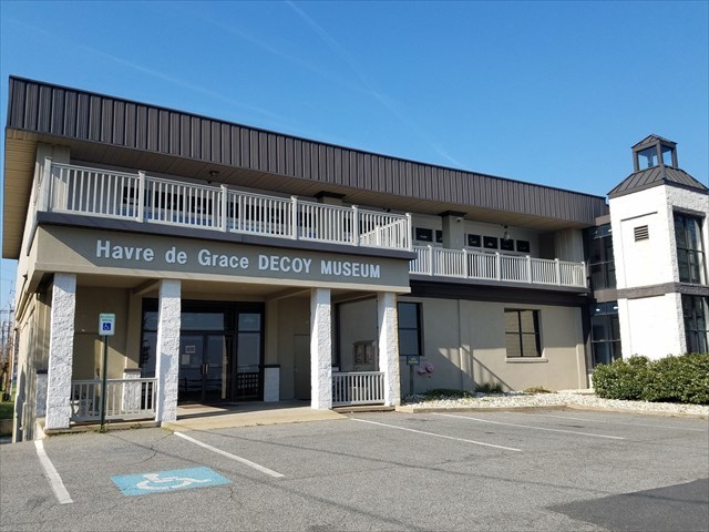
Havre de Grace Decoy Museum (215 Giles St., 410-939-3739) was established in 1986 as a private, non-profit institution existing to preserve the historical and cultural legacy of waterfowling and decoy making on the Chesapeake Bay. More than 1,200 duck decoys are on display at this museum, which also boasts realistic-looking figurines of renowned carvers, as well as an indoor boardwalk that takes visitors on a tour through duck-decoy history. Open Year Round. Monday - Saturday from 10:30a.m. to 4:30 p.m and Sunday 12:00pm to 4:00pm. Admission is $6 for adults, $5 for seniors, $2 for children (age 9-18), and children 8 and under are free.
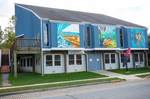
Havre de Grace Maritime Museum (100 Lafayette St., 410-939-4800) is situated on a freshwater wetland, tidal cove, and small forested area adjacent to the city waterfront promenade. The museum is a 10,000 square foot, three-story modern building, which includes two galleries on the main floor that also function as public and private event spaces. The ground floor supports a working boat shop as well as the Environmental Center, which houses a gallery, classroom and research/teaching laboratory. Hours (April 1st – October 14th) Wed. thru Sat. from 10AM-5PM, and on Sun. from 1-5PM. (October 15th – March 31st) Sat. from 10AM-5PM, and on Sun. from 1-5PM. Admission $3.00 per person or $7.00 per family.
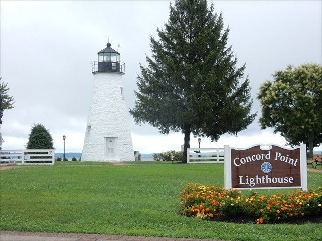
Concord Point Lighthouse (Concord and Lafayette streets, 410-939-3213) was built in 1827 and is the one of the oldest continuously operating lighthouses on the East Coast. The Friends of Concord Point Lighthouse, Inc. is a nonprofit organization dedicated to the preservation and promotion of the historic Concord Point Lighthouse and Keeper’s House in Havre de Grace, Maryland. Members and volunteers have been “keeping the light” for over thirty years. Fully restored, the Lighthouse and Keeper’s House are open to the public on weekends from April to October. Visitors can climb to the top for a sweeping view of the bay from April through October, on weekends from 1 p.m. to 5 p.m. There is no admission charge.
The Geocache
This geocache IS NOT located at the listed coordinates. The listed coordinates are for parking. You will take a walking tour along the Promenade to determine the coordinates to the final location. You will also determine the combination to a lock you will need to access the cache container. Additional waypoints have been provided for all the locations.
You will want to begin and end your tour at the listed parking coordinates next to Millard E. Tydings Memorial Park. From the Promenade Trailhead (N 39 32.300 W 076 05.328), proceed a short distance to the first sign.
Dogs are not allowed on the Promenade.
The geocache is located at N 39 32.ABC, W 076 05.DEF.
Sign 1 – “Home Base” (N 39 32.295 W 076 05.320)
A= # of letters in the name of the island used as “Home Base” divided by 2
Sign 2 - “Luxury at the Bayou” (N 39 32.355 W 076 05.205)
B= the last digit in the year that the city assumed ownership of the Bayou
Sign 3 - “Invasion at Dawn” (N 39 32.361 W 076 05.159)
C= the second digit in the year that the British fleet approached Havre de Grace
Sign 4 - “A Crucial Connection” (N 39 32.396 W 076 05.147)
D= # of crabs pictured on the sign
Sign 5 – “Welcome to Our Wetland Home” (N 39 32.390 W 076 05.116)
E= Add the digits in the number of minutes the muskrat can stay underwater
Sign 6 -“Dangerous Waters” (N 39 32.439 W 076 05.085)
F= the first digit in the number of years the lighthouse protected vessels from dangerous waters
The check sum of A+B+C+D=E+F = 26
You now have the coordinates for the final cache location. However, you will need to proceed across the street to obtain the combination for the lock in order to access the cache.
The lock combination is WXYZ
Sign 7 – “Hero’s Reward” (N 39 32.446 W 076 05.131)
W=the last digit in the year O’Neill first lived here
X= the last digit in the year O’Neill was honored with a sword
Sign 8 – “Adding On” (N 39 32.450 W 076 05.138)
Y= the last digit in the year that a structure was added to the coal shed
Z= the second digit in the year the image of the ice gorges was taken
The checksum of W+X+Y+Z=23
** After locating the 2018 CAM cache you may want to proceed to the nearby CAM 2018 Bonus: Duck Inside which can be easily completed on route back to your car or just follow the Promenade back to where you began.
This geocache was placed by permission of the Havre de Grace Government and Concord Point Lighthouse and Keeper's House. The MGS extends its thanks to the staff of the Concord Point Lighthouse and Keeper's House for approving this cache placement.