
When the first settlers moved to this area the Little Calumet River and Grand Calumet River made travel incredibly difficult. What is now northern Lake County was characterized by rivers, marshes and wetlands. In 1816, the year Indiana became a state, about half the surface area of Northwest Indiana ponded during six months of the year. In fact, it was one of the last areas to be settled because it was so wet.
As more people settled in Lake County they began to work hard to tame the land. Ditches were dug (like Cady Marsh Ditch to the south) to drain the wetlands and efforts were made to control the flow of water. It worked. A lot of land in Northwest Indiana became very productive for agriculture.
Over time, as more homes were built and land where the water could flood to became scarcer, water became a constant source of aggravation. Whenever there are large rainstorms roads can flood, rivers and ditches overflow, and property is damaged.
One project that was undertaken to help with water flow and increase travel ease was rerouting the Little Calumet River. Because of its winding nature and the possibility of flooding during heavy rainstorms, the Little Calumet River was rerouted in a few different locations. In one location a channel was dug starting west of Chase St. and going east of Grant St. This mitigated flooding on I-94.
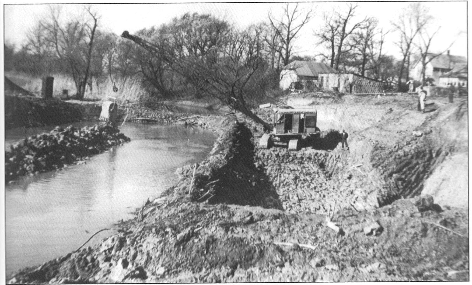
This is just one section that has been impacted by human intervention. Because of the addition of channels here and near Lake Michigan as well as ditches east of here some parts of the Little Calumet River now flow in the opposite direction from its historical flow which was east to west.
With this earthcache, you will explore a few places along the Little Calumet River to see how it was rerouted and the affects it has had on water flow and flooding in northern Lake County. In order to log this earthcache, send me the answers to the following questions. Optionally, please post a picture with your log.
Stage 1: Posted Coordinates
How wide is the river at this location?
Stage 2: N 41° 33.952' W 87° 22.611'
You will notice that the "river" ends at this location. The natural flow would have continued north and east from here, but it was cut off.
How wide is the “river” at this location?
What is located just to the west of the stage 2 coordinates? What is its purpose?
Note: If you intend to drive from the posted coords to near points 02 and 03, take 25th Ave. DO NOT take 29th Ave. as it is a mess.
Stage 3: N 41° 33.958' W 87° 22.523'
What is located at these coordinates?
What is its purpose?
From February 18-21, 2018 heavy rains fell in NW Indiana. So much so that the road that you are walking on between stages 3 and 4 was covered with water. The river had overflowed.
Stage 4: N 41° 33.758' W 87° 22.516'
How wide is the river at this location?
How does the river differ from stage 1?
Grab a stick and toss it into the river. Which direction is the water flowing?
Final Question: based on all that you have observed, how much work had to be done to ease flooding in this section of the Little Calumet River?
Optional: Post a photo of yourself along the trail
Sources:
Along the Calumet River by Cynthia L. Ogorek
Calumet Beginnings: Ancient Shorelines and Settlements at the South End of Lake Michigan by Kenneth J. Schoon
| I have earned GSA's highest level: |
 |