This cache has been placed here in memory of my dear friend and caching buddy Andy, who was also known by his caching name of Spacie46. Andy sadly passed away suddenly in February 2018 leaving a big hole in many people's lives, he will be sorely missed by all his family and friend.
Andy would have loved this location as it looks out over many of the areas we liked to frequent both for caching and also maybe just the odd pint or three. So while you're here take a few moments to look at the views and think about your friends and what they mean to you.
Access Restrictions
Please note: the cache is located on Open Access Land, however, there is currently a CRoW & Coastal Access Restriction in place until 21/11/2024, No Dogs (except guide, hearing or assistance dogs), please see link for more information: Bamford Edge Restrictions
Site of Special Scientific Interest
Please note: Bamford Edge is within the Eastern Peak District Moors Site of Special Scientific Interest (SSSI) please stay on footpaths, respect the area and wildlife. Further information regarding the SSSI can be found by contacting the Natural England on 0300 060 3900 or by visiting: Designated Sites
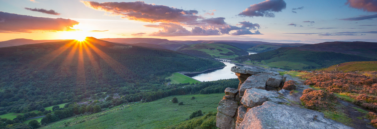
Bamford Edge Geology
Bamford Edge is one of the many prominent gritstone escarpments found in the Peak District in England. An area famous for climbing, the area was also quarried for grindstones. These rocks were formed in in vast river deltas that once covered the whole of the White Peak from the Roaches in the West to Kinder Scout in the north. The Peak District is dominated by a series of sedimentary rocks that formed 350 million years ago, in the Carboniferous Period. This sedimentary succession began with the deposition of limestone when the Peak District was submerged beneath a warm, shallow sea. Britain at that time was located on a palaeocontinent near to the equator, and the shallow sea abounded with life, with shellfish, crinoids and fish all living in vast coral reefs. It is in these conditions that limestone forms. Corals, shellfish, snails and eggs all have hard parts formed from calcium carbonate (CaCO3), a mineral which exists in solution in the oceans. Animals with hard shells and bones use dissolved CaCO3 in seawater to form their hard outer shells and bones. Where ocean life is abundant, the skeletal matter collects on the seafloor as organisms die and sink to the bottom of the water column. This accumulation of material creates limestone.

During the Carboniferous, a supercontinent in the South made up of modern-day Africa, Australia, India and South America, Gondwana, was moving due to the activity of plate tectonics and passed close to the South Pole. This caused the build-up of a large continental ice sheet on Gondwana. The buildup of ice on the supercontinent reduced the amount of water in the oceans which caused a global drop in sea level. This change in sea level meant that the Peak District emerged from being underwater and exposed the sediments to erosion and weathering. Much of Britain became coastline rather than being submerged under a sea and rivers became the dominant source of sediment. During this time, large rivers from continental Scandinavia started depositing fluvial material on top of the limestone. The silt, sand and gravel that was being washed in by the large rivers were compressed and lithified (formed rock). This coarse grained sandstone is called millstone grit and this is what makes up the prominent landscape feature at Bamford Edge. It has been used to grind grain in mills for the last 2000 years and was exported across Northern Europe until the 18th century.
As sea levels dropped further in ancient Britain, plant matter began to grow in the warm, swampy, coastal regions but the fluctuations in sea level meant that this large quantity of plant matter was frequently submerged and buried by tidal sediment. These repetitions are called cyclothems and are the source of the coal, found above the millstone grit in the Peak District and surrounding areas.

After this deposition, tectonic forces compressed this area of crust and the rocks responded by doming upwards. This is the result of the forces involved in the final stages of the formation of the supercontinent, Pangea. There was then further uplift and erosion of post-Carboniferous rock strata at the end of the Cretaceous (145 to 66 million years ago). This uplift and subsequent erosion has effectively sliced the top off the dome to reveal a concentric outcrop pattern. At the centre, the grit and shale has been eroded to expose the limestone layers but at the edge where Bamford Edge is located the grit is still intact and forming and escarpment above the limestone. These escarpments can still be seen at Bamford Edge, Stanage Edge, Derwent Edge, Windgather and others.
Archaeology & Moor
As you look out over the valley below don't forget to look behind you as well, Bamford Moor is full of archaeology. Stone circles, cairns, hut circles and more all feature on the moor. Most are now well hidden but if you look towards Stanage you may see a stone circle sitting on a slightly elevated earth platform. The cairn field and ancient settlement, thought to be Bronze Age are harder to see, the area has a great deal of historic and archaeological interest stretching from 358 Million years right up to present day and covering Neolithic, Bronze age, Roman, Medieval and modern-day industrial activity can be explored.

Logging Your Find
In order to log this cache answer the following questions, and ether email them to
Cache-answers@outlook.com or message me from the Geocaching website. Please do not post any answer in your log entry.
- In detail, describe what the Gritstone looks and feel like.
- The Gritstone of the Edge was formed in the Carboniferous Period, when did the Carboniferous Period end?
- From ground zero can you name two other locations (edges ,peaks, plateau, formations) that can be seen from GZ, where Gritstone is located?
- There are two predominant lichens growing on the rocks around GZ, what colour are they?
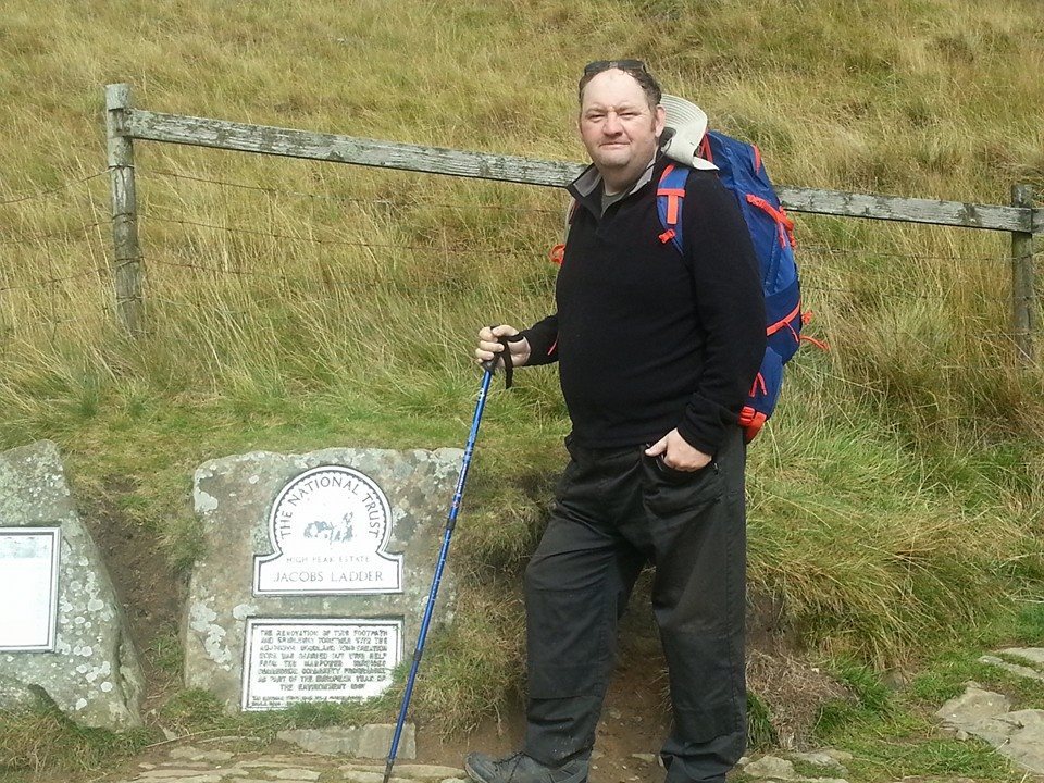
- (Optional) include a picture of yourself or your GPS and the great views.