Welcome to tranquil Koh Bulon Leh. While the Bat Cave and Nose Cave are certainly the larger and more popular caves on the island, I've opted to work with the smallest cave, as it is the only one that does not require a boat, and does not contain a fragile ecosystem. Mind the tides though!
The sea cave of Koh Bulon Leh
The sea caves of Koh Bulon Leh, also known as littoral caves, are a type of cave formed primarily by the wave action of the sea. The primary process involved is erosion.
The little-known sea cave at Koh Bulon Leh is a classic example of a littoral cave. Littoral caves may be found in a wide variety of host rocks, ranging from sedimentary to metamorphic to igneous, but caves in the latter tend to be larger due to the greater strength of the host rock.
It appears that all but one of the sea caves on this island should be considered hybrid caves. True littoral caves should not be confused with inland caves that have been intersected and revealed when a sea cliff line is eroded back, or with dissolutional voids formed in the littoral zone, as littoral erosion only represents a new phase of their enlargement.
For this EarthCache the focus lies on the only true littoral cave in the intertidal zone. The intertidal zone, also known as the foreshore and seashore, sometimes referred to as the littoral zone, is the area that is above water at low tide and under water at high tide (the area between tide marks).
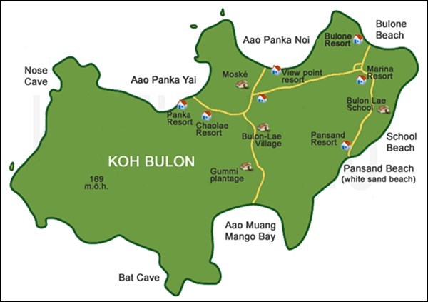
Island map.
Formation
In order to form a sea cave, the host rock must first contain a weak zone. In metamorphic or igneous rock, this is typically either a fault or a dike. The driving force in littoral cave development is wave action. Erosion is ongoing anywhere that waves batter rocky coasts, but where sea cliffs contain zones of weakness, rock is removed at a greater rate along these zones. As the sea reaches into the fissures thus formed, they begin to widen and deepen due to the tremendous force exerted within a confined space, not only by direct action of the surf and any rock particles that it bears, but also by compression of air within. This process often causes significant damage to the cave sealing at this particular point, and depending on the thickness of the overlaying rock surface, might lead to the creation of blowholes or complete failure of the sealing.
Adding to the hydraulic power of the waves is the abrasive force of suspended sand and rock. Most sea-cave walls are irregular and chunky, reflecting an erosional process where the rock is fractured piece by piece. However, some caves have portions where the walls are rounded and smoothed, typically floored with cobbles, and result from the swirling motion of these cobbles in the surf zone.
Rainwater may also influence sea-cave formation. Carbonic and organic acids leached from the soil may assist in weakening rock within fissures. As in solutional caves, small speleothems may develop.
Factors influencing size
Most littoral caves are small in relation to other types. A compilation of earlier sea-cave surveys (as of July 2014), shows 2 over 1000 metres, 6 over 400 metres, nine over 300 metres, 25 over 200 metres, and 108 over 100 metres in length. There is no doubt that many other large sea caves exist but have not been investigated due to their remote locations and/or hostile sea conditions.
Several factors contribute to the development of relatively large sea caves. The type of host rock is an undeniable given. Likewise, the nature of the zone of weakness itself is surely a factor, although difficult to quantify. A more readily observed factor is the situation of the cave's entrance relative to prevailing sea conditions. Caves in well-protected bays sheltered from prevailing seas and winds tend to be smaller, as are caves in areas where the seas tend to be calmer.
Time is another factor. The active littoral zone changes throughout geological time by an interplay between sea-level change and regional uplift. Recurrent ice ages during the Pleistocene have changed sea levels within a vertical range of some 200 meters. In regions of steady uplift, continual littoral erosion may produce sea caves of great height.
By far the majority of sea caves consist of a single passage or chamber. Those formed on faults tend to have canyon-like or angled passages that are very straight. The cave examined for this EarthCache is a classic example of a true littoral cave with a relatively small passage, with entrance light from the back of the cave visible from the entrance. By contrast, caves formed along horizontal bedding planes tend to be wider with lower ceiling heights. In some areas, sea caves may even have dry upper levels, lifted above the active littoral zone by regional uplift.
How to claim this EarthCache?
Send me the following;
1. The text "GC7MW3D Sea Cave at Koh Bulon Leh" on the first line.
2. The answers to the following questions;
- Examine this cavity (you might require some light), you will be ably to identify a weakness in the rock surface, it is the reason why this littoral cave exists. What is this feature?
- While wave action is the primary cause of erosion for this cave during high tide, several additional ongoing forms of erosion can be identified during low tide. Close observations will allow you to identify at least two visible forms of ongoing erosion during low-tide.
- This cave is relatively small in size. Can you explain why?
- Using your GPS, determine the length of this cave (in metres).
3. Provide a photo of yourself or a personal item to prove you have visited the site.*
References
* Effective immediately from 10 June 2019, photo requirements are permitted on EarthCaches. This task is not optional, it is an addition to existing logging tasks! Logs that do not meet all requirements posed will no longer be accepted.
For additional information, visit; Geosociety.org, Geocaching.com Help Center and Geocaching.com Forum.
Finding the answers to an EarthCache can often be challenging, and many people tend to shy away from these caches because of this. However, it is my opinion that geocaching is also meant to be a fun family experience that simply aims to introduce interesting and unique locations such as this one. Flexibility on logging requirements, however, can only be applied if it can be established that you have actually taken the time to visit the site. For this reason, a proper log describing your adventure accompanied by a good number of photos would be much appreciated.
ATTENTION
This is a low tide only cache! Access to the littoral cave is not possible during high tide!