Skukuza’s Intrusion.
Do not get out of your vehicle at this EarthCache!!
Getting out of your vehicle in the Park is unlawful except where it is clearly indicated.
Travelling North from Skukuza, taking the H1 towards Tsokwane and then Satara, you will cross the Sabie river after the turn off from the Skukuza-Lower Sabie road (H4). After crossing the low water bridge, you will find yourself in a road cutting where you will see a difference in rock formations.
Kruger Park’s geology is relatively simple, the western half of the Park consists mostly out of intrusive igneous rocks, of which the Nelspruit granite batholith, the oldest magnetite-series granite so far known at 3105 Ma-old, while the eastern half rests on a foundation of basalt.
The geology underlying the site is Archaean granite and gneiss of the Nelspruit suite, with frequent narrow doleritic dykes and some migmatite intrusions.
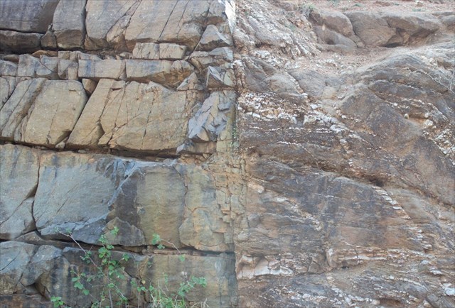
A dike or dyke, in geological usage, is a sheet of rock that is formed in a fracture in a pre-existing rock body. Dikes can be either magmatic or sedimentary in origin. Magmatic dikes form when magma intrudes into a crack then crystallizes as a sheet intrusion, either cutting across layers of rock or through a contiguous mass of rock. Clastic dikes are formed when sediment fills a pre-existing crack.
Sedimentary dikes or clastic dikes are vertical bodies of sedimentary rock that cut off other rock layers. They can form in two ways:
- When a shallow unconsolidated sediment is composed of alternating coarse grained and impermeable clay layers the fluid pressure inside the coarser layers may reach a critical value due to lithostatic overburden. Driven by the fluid pressure the sediment breaks through overlying layers and forms a dike.
- When a soil is under permafrost conditions the pore water is totally frozen. When cracks are formed in such rocks, they may fill up with sediments that fall in from above. The result is a vertical body of sediment that cuts through horizontal layers: a dike.
To log your find you have to answer the following questions and email them to me (do not post the answers in your log):
1. Is this a magmatic or sedimentary intrusion?
2. Is the dolomite on the north or south side of the intrusion?
3. What is the height of the road cutting at its highest point?
4. Uploading photos to the cache page and awarding the EC with a Favourite Point, are the best ways to say thank you to the cache developer and to encourage others to visit the location but is only optional.
You can sent me your answers in either Afrikaans or English.
Source:
https://koedoe.co.za/index.php/koedoe/article/view/530/556
https://en.wikipedia.org/wiki/Dike_(geology)