FR - Bec d'Allier (Gimouille)
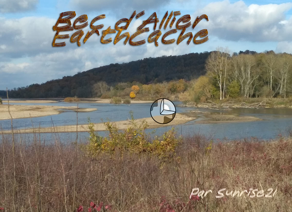
Une Earthcache, en complément de https://coord.info/GC6C2RZ , qui permet d’observer de plus près ce milieu géologique particulier, à savoir la confluence entre l’Allier et la Loire, appelé communément le Bec d’Allier.
D’ailleurs, bien que possédant un régime hydraulique très irrégulier, entre les embâcles d’hiver et les débâcles de printemps, la batellerie que la Loire a été active jusqu’au second Empire : le « coche d’eau » avec des services réguliers de voyageurs avant la Révolution, des bateaux à vapeur au XIXème siècle.
A travers le jeu des différentes failles, les eaux et leurs bancs de sables granitiques de la Loire et de l’Allier , apportés du Massif Central, se mélangent, provoquant un affleurement des terrains les plus anciens (notamment par rapport à ceux situés au Nord du côté de Nevers).
De cette rive ci, côté la plaine alluviale, il est est particulièrement possible d’observer les bancs de sable encombrés dans le confluent et qui se métamorphosent au grès des crues mais aussi les contours des terres de cette confluence.

---
EN - Bec d'Allier (Gimouille)
An Earthcache, in add with https://coord.info/GC6C2RZ, which allows to observe more closely this particular geological environment, namely the confluence between the Allier and the Loire, commonly called the Beak of Allier.
Moreover, although having a very irregular hydraulic regime, between the winter jams and spring break-ups, the shipping that the Loire was active until the second Empire: the "watermark" with regular services travelers before the Revolution, steamers in the nineteenth century.
Through the play of the various faults, the waters and their banks of granite sand brought from the Massif Central of the Loire and the Allier mix: causing an outcrop of the oldest grounds (especially compared to those located in the North of Nevers side)
From this shore, next to the alluvial plain, it is particularly possible to observe the sandbanks congested in the confluence and which are metamorphosed with the sandstone of the floods but also the contours of the lands of this confluence.
Rappel concernant les « Earthcaches »: Il n'y a pas de conteneur à rechercher ni de logbook à renseigner. Il suffit de se rendre sur les lieux et d'éxécuter les requêtes du geocacheur.
Loguez cette cache "Found it" et envoyez-moi vos propositions de réponses soit via mon profil, soit via la messagerie geocaching.com (Message Center), EN PRECISANT LE NOM ET CODE GC DE LA CACHE et je vous contacterai en cas de problème.
Il est aussi apprécié d'avoir des photos des géocacheurs sur les lieux de l''EarthCache. Sentez vous inspiré de poster des photos de vous lors de cette visite ( optionnelle mais sympathique)
---
Reminder concerning "Earthcaches": there is neither a container to look for nor a logbook to sign.
Log in this cache " Found it " and send me your answers proposals or via my profile or via geocaching.com messaging (Message Center ) , BY PROVIDING THE NAME AND GC CODE OF THE CACHE and I will contact you in case of problems .
We also enjoy seeing photographs of people visiting this EarthCache. Please feel free to log photos of your visit...(this is entirely optional but funny)
Grace à la lecture attentive du descriptif et de ses schemas, grâce à votre observation, répondez aux questions suivantes :
Thanks to the reading with attentin of the description and the draw, thanks your observation, answer the following questions:
Q1 - Allez au plus près de l’eau sans prendre de risque inutile : Comment se comporte les berges face à l’Allier ? Comment s’appelle ce phénomène, particulièrement visible ici ?
Q2 - Observez au-delà du Bec, côté Nièvre. Comment la Loire agit sur le versant raide ? Le phénomène produit il les mêmes effets que de ce côté-ci au niveau du sol? Pourquoi selon vous ?
Q3 - (Optionnel) Une photographie de vous/votre GPS et du lieu.
---
Q1 - Go as close to the water without taking any unnecessary risk: How is the banks behaving in front of the Allier? Whisnis this phenom ?
Q2 - Observe beyond the Beak, Nièvre side. How the Loire acts on the steep slope? Does the phenomenon produce the same effects as on this side at ground level? Why do you think ?
Q3 - (Optional) A photograph of you / your GPS and the location
JOYEUX & HAPPY EARTHCACHING !!