
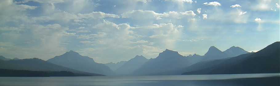
To many visitors to the park, this view is their first introduction to the spectacular scenery of Glacier National Park. Lake McDonald offers picturesque views and is an excellent place to picnic, hike along or just drive beside. But how did it get here?
Ten miles long and nearly 500 feet deep (152.4 m), Lake McDonald, the largest lake in the park, is a direct result of glacial carving. High peaks surrounding the lake all show evidence of the power of glaciers to carve even the hardest of rock. The powerful glaciers that carved the broad "u-shaped" valley that Lake McDonald sits in also carved smaller hanging valleys with wonderful waterfalls that are accessible by numerous hiking trails.
This valley was formed during the Pleistocene Ice Age. Starting about 2 million years ago and lasting until about 12,000 years ago glaciers would advance and retreat carving much of Glacier National Park. The large glacier that carved this valley (believed to be at least 2,000 feet thick) flowed out of the mountains where it had formed. As it worked its way down it began to carve the Lake McDonald valley out of the Quaternary Formation. The glacier would carve out rock which would be embedded in the glacier and would aid in carving out more rock. As the glacier moved down it carved the valley that would eventually hold Lake McDonald.
Some of the rock that was carved out was deposited on top of Howe Ridge across the lake on your left and Snyder Ridge to the right (behind the trees) as moraines. Some of it was left higher up in the valley where McDonald Creek flows and some of it was left where Lake McDonald now sits.
The Rocks of McDonald
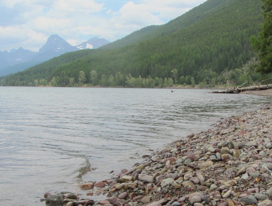
At the posted coordinates, as you explore the shore of Lake McDonald, you will notice an abundance of rocks. These rocks help tell the story of Lake McDonald's formation and they show how much work the glacier did in carving this valley. The rocks have varying colors because they have come from different places along the glaciers path and because they were formed in different geological eras, but they were moved by the glacier that carved this valley.
Each rock was ground up from somewhere along the glacier's path and deposited somewhere else. As the glacier began to melt, the rocks that were deposited higher up in the valley were moved by water that flowed down the valley. They were polished by the rushing waters and came to rest where Lake McDonald now sits.
In order to log this Earthcache...
Please read the following questions and send me your answers. Due to the location of this cache, when you submit your answers, they may not go through. Please ensure they have.
- What colors do you see in the rocks? Grab a handful and describe them to me.
- Why are there so many varying colors and designs?
- Dig your hand into the ground below the rocks and pull some soil out. Describe to me what this "beach" is made of.
- Post a picture of a rock that you find particularly beautiful or unique.
To see what is happening at Lake McDonald right now, check out this Webcam
Sources:
https://www.nps.gov/glac/planyourvisit/lakemcdonald.htm
Geology Along the Going-to-the-Sun Road 2018 Update by Teagan Tomlin
https://pubs.usgs.gov/pp/0294k/report.pdf
https://www.amusingplanet.com/2016/06/the-colored-pebbles-of-lake-mcdonald.html
https://www.nps.gov/glac/learn/education/geology.htm
| I have earned GSA's highest level: |
 |