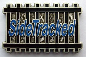
This two-stage multi geocache is part of the SideTracked series that is popular in the UK and throughout the world. It is designed to be a relatively quick cache find around train stations for travellers but, of course, anyone else can find it too! There's a pencil included but it's always good to bring your own writing implement to sign the log.
To learn more about the series, visit the website at the following link...
SideTracked Series
---------- << O >> ----------
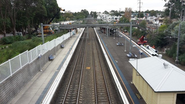
Thornleigh Station
Thornleigh was originally part of the land belonging to the Guringai people. The first non-indigenous people to explore the area of Thornleigh were a party led by Governor Arthur Phillip in 1788. Settlers moved into the area in the 1830s and among them were James Milson, Patrick Duffy, John Thorn and Samuel Horne. Thornleigh is named after Constable John Thorn, who, along with Constable Horne, captured bushrangers Dalton and John MacNamara, leaders of the North Rocks gang, on 22 June 1830, and were granted land as a reward in 1838. Horne's land became Hornsby (now Normanhurst), and Thorn's land became Thornleigh.
Thornleigh station opened on 17 September 1886. Platform 1 is located on a loop and does not have any passenger workings, while south of the station, a new line was constructed as part of the Northern Sydney Freight Corridor.
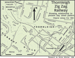
To the north of the station, a line previously branched off to a quarry. The quarry began when prominent railway contractors Amos & Co won the contract to construct the Homebush to Waratah line in 1883. They used the quarry to obtain white metal – metamorphosed sandstone for ballast. The quarry is located within 1 km, north-west of Thornleigh Station, through some steep terrain, 30m below the station level. To overcome problems with a steep gradient, a zig zag siding was built to the quarry from the main line near Thornleigh Station. However, land subdivision has since occurred and most of the line (except for a short section adjacent the quarry) has been built over. You can still see the old quarry today. Drive to one of the trail entrance points and take a stroll in.
References: Wikipedia, Engineers Australia Website
---------- << O >> ----------
To find this cache......
1. Find the GREAT NORTH WALK THORNLEIGH TRACKHEAD slatted distance board outside Platform 3.
2. Add all the whole number (no decimal) kilometres together. We'll call this number "ZIGZAG".
3. The cache is located at:
S33° 43.(ZIGZAG + 683)
E151° 04.(ZIGZAG + 363)
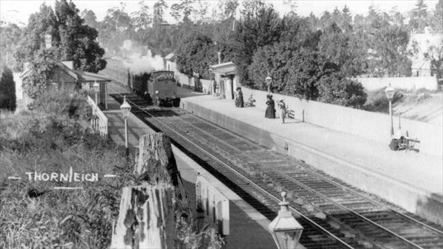
Early Thornleigh Station. The year is unknown. It's changed a bit!

FTF Honours
Ash_Kate
A Serendipitous SideTracker

Did you know that NSW has a geocaching association? Geocaching NSW aims to enhance and improve the activity of geocaching and holds regular events where geocachers meet to enjoy their common interests. Visit the association website here.