The River Wear in Durham has a long and varied history of flooding with reports as early as 1316 but in 2009 Durham saw some of the worst flooding of it's time causing devastation in the city.

The floods of 2009 created quite a bizarre phenomenon that was dubbed locally as the 'Grand Canyon of Durham'. A large trench was cut out by floodwaters near to Durham city and measured 80ft at its widest point, 14ft deep and several hundred metres in length!
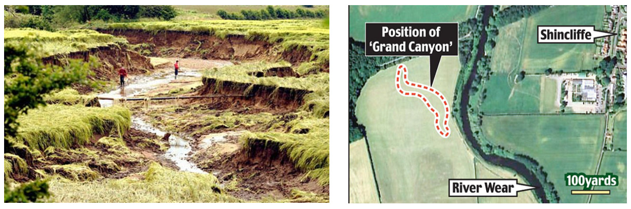
The canyon is thought to be an ancient river bed that had lain buried for centuries. The canyon appeared after the waters receded from a spring barley field at Houghall College, Durham. It is believed that monks diverted the River Wear in the 15th or 16th centuries, in an effort to avoid the city's peninsula (home to Durham Cathedral and Castle) becoming an island. The former riverbed had become buried under the 25-acre Battery Field, now part of East Durham College.
The listed coordinates will take you to a large black box which is the New Elvet River Gauge. Installed by the Environmental Agency, this gauge along with hundreds across the Uk help prepare for floods and droughts by regular daily monitoring of the river. You can go on line and view the river levels as well as flow statistics and Durham even has a webcam!
The cache can be located at N 54° 46.ABC' W 1° 34.DEF'
where
A = 4th number of the Floodline telephone number
B = 9th number of the incident Hotline
C = 1st + 2nd numbers of the Map Ref
D = Last number of the Map Ref
EF = Approximate depth of the Grand Canyon in feet
Check Sum of all the 6 missing digits added separately = 26
As this is a letter box cache, the container contains a stamp which should not be removed -many thanks!