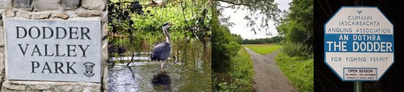
The River Dodder
The Dodder rises on the northern slopes of Kippure in Co. Wicklow, as Allison’s Brook, and is joined by several local streams. Along the river valley at Glenasmole are the two Bohernabreena Reservoirs, which form a major component of Dublin’s fresh water supply system. The Dodder runs for 26km passing onwards from Tallaght to Firhouse/Templeogue where this cache series is located and then onwards to Rathfarnham, Rathgar, Milltown, Clonskeagh, Donnybrook, and Ballsbridge, and enters the River Liffey, along with the Grand Canal, at Grand Canal Dock. There are a number of tributaries draining into the River Dodder with the significant ones being the Tallaght Stream, the Owendoher, the Whitechurch, the Little Dargle and the Dundrum Slang.
The Dodder Valley Linear Park
Dodder Valley Park is a suburban linear park in Dublin, consisting of over a hundred hectares of fragmented parkland and remnant countryside in South Co. Dublin. In addition to its wildlife conservation value and mixed woodland settings, the park offers fishing and assorted sporting amenities, and offers a retreat from the hustle and bustle of everyday life and is a favourite with runners.
The River Dodder provides the focus for this beautiful park which extends 6km, from Old Bawn Bridge in Tallaght to Bushey Park in Rathfarnham.
The Lands of Cherry Tree
Though now part of a SDCC linear park, these lands were once part of a fine country farmstead and orchard known simply as Cherry Tree; the orchard is clearly visible in Roque's 1760 Map of Dublin and now sits under the council composting area near the carpark. Cherry Tree was a house of note, as the Templeogue Ballad, one of two local gazettes following the 'gay antics' of Dublin's aristocracy as they took the waters at the nearby Spawell, was produced here in the 1730s. Cherry Tree was demolished in the late 18th Century - more of which will be revealed in Cache #2 of the series.

The Cache
First off, a ladder is simply not going to work here. Be clear about that. And the attributes indicates no tree climbing.
Look up. Spend some time. Moan a bit, Perhaps even wish me ill. And locate the cache.
Then curse me properly. Consider your special tool. Likely go home. Cachers from an older generation understand that not every cache is possible. I'll be checking signatures periodically for the spoofing self-delusional logs.
