The Scuba Diving geocaching series requires you to see some of the South Australian environment at a different perspective and depth than usual. Specialist equipment and skills are required to be able to find these geocaches, and safety should always be considered.
The Claris is a wreck dive located approximately 14.5 km from Glenelg / the coast.
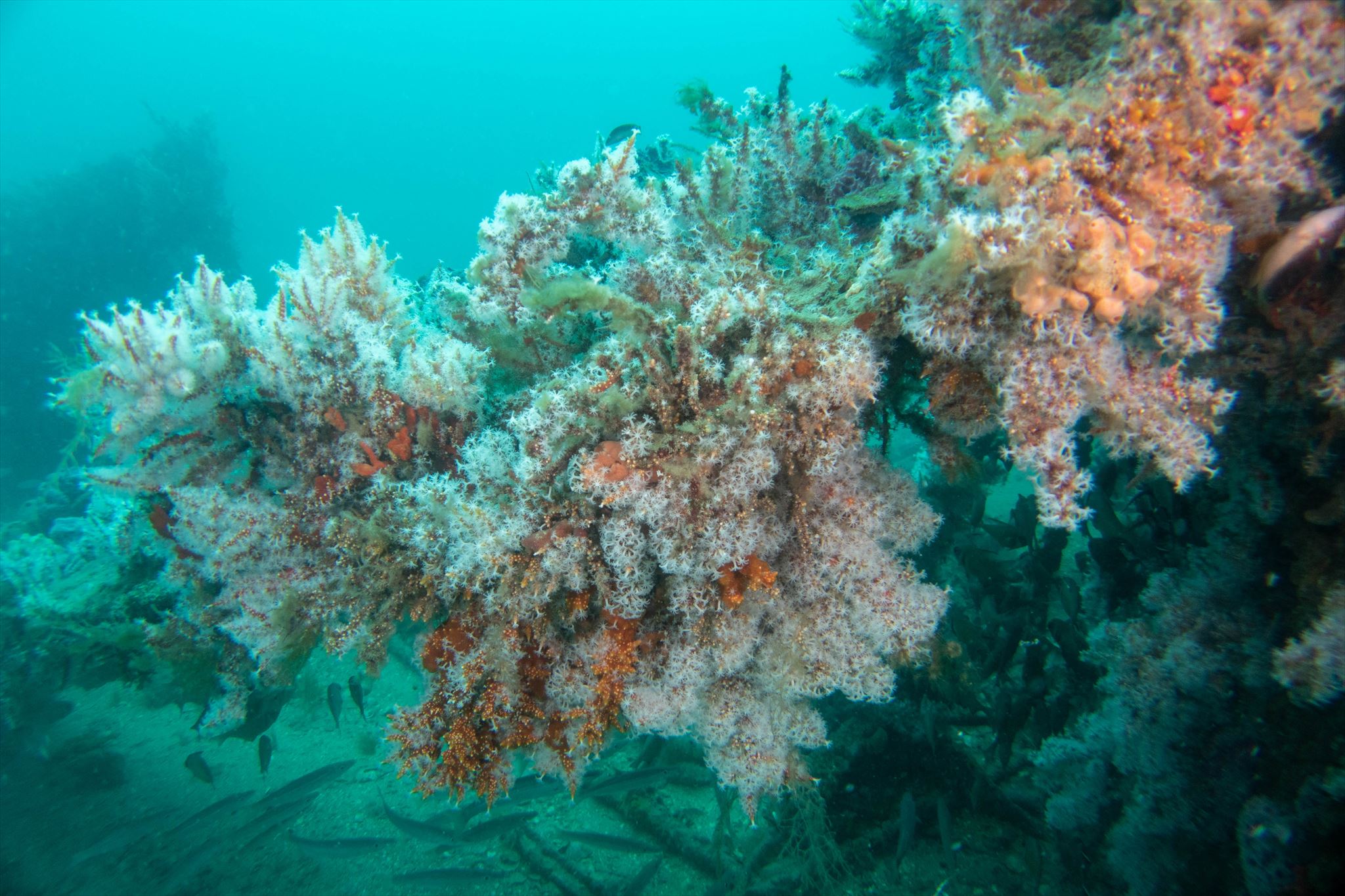
The story behind the Claris is a bit of a mystery as two small vessels lie close to each other at a water depth of approximately 25 m. The smaller, less intact vessel is widely considered to be the Claris – mostly a field of debris – while the other wreck appears to be a half cabin cruiser. This unknown vessel is around 25 m to the west of the Claris linked by a star picket trail, and just covered in the Carijoa (genus) soft corals that look like starry white christmas trees. There is also a rumoured third area of steel nearby.
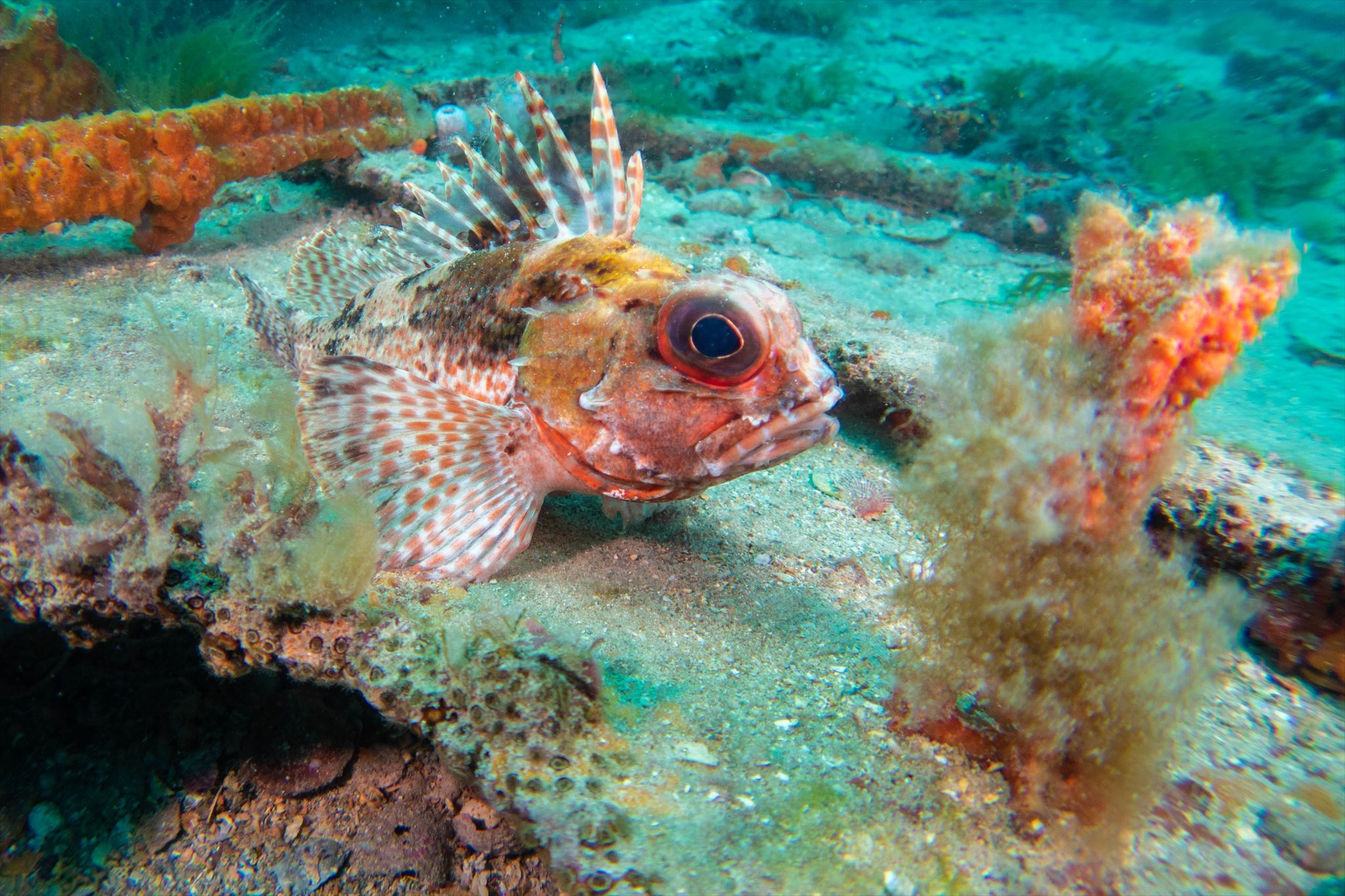
The site is usually prolific with aquatic life including bullseyes, old wives and leatherjackets.
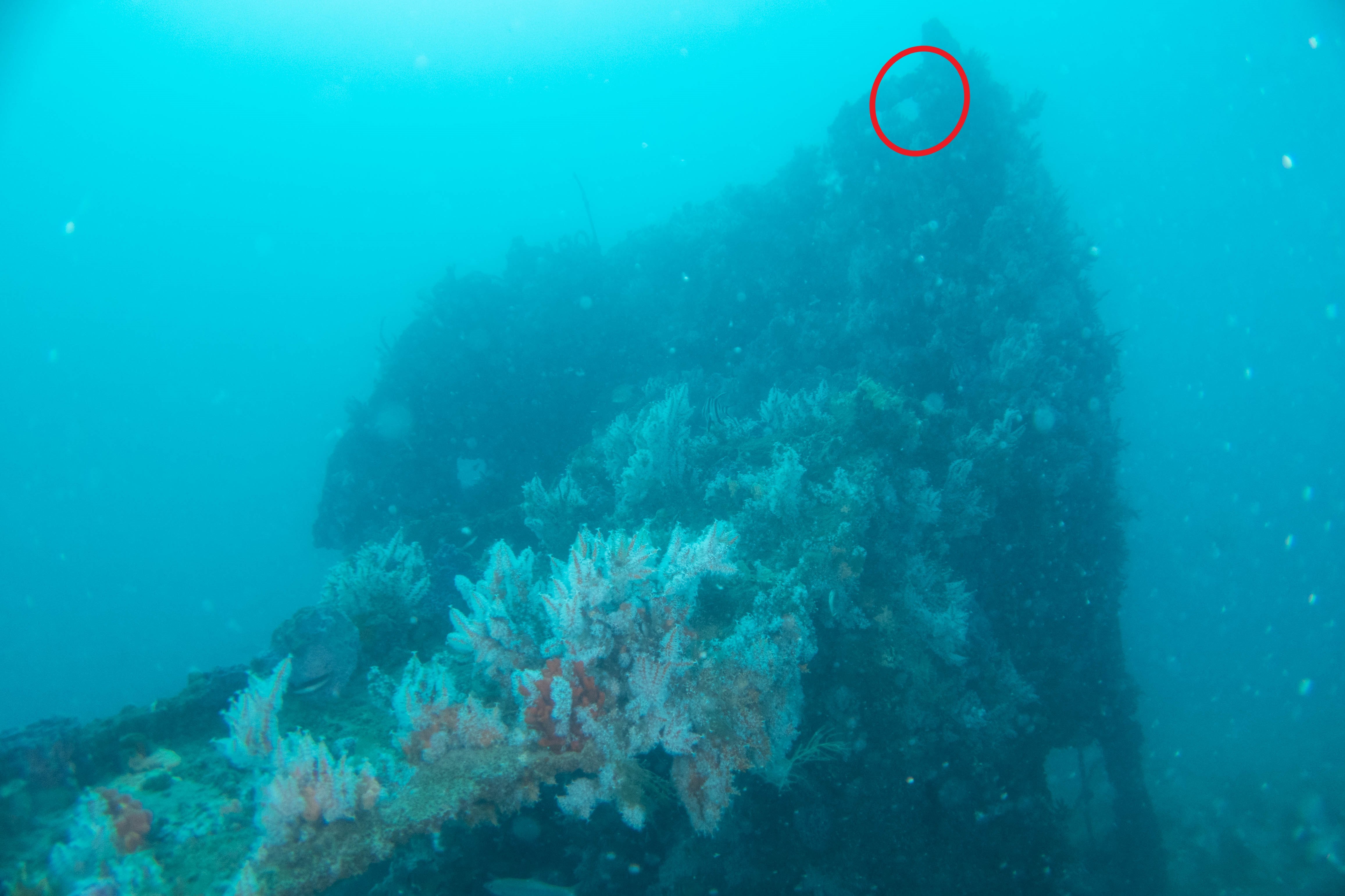
At the posted coordinates, you will need to scuba dive this site, and find the coordinates for GZ on the steel superstructure. As per the following dive site map provided by Timothy Brown, you are looking for the "Superstructure" approximately 20 m from the small boat wreck.
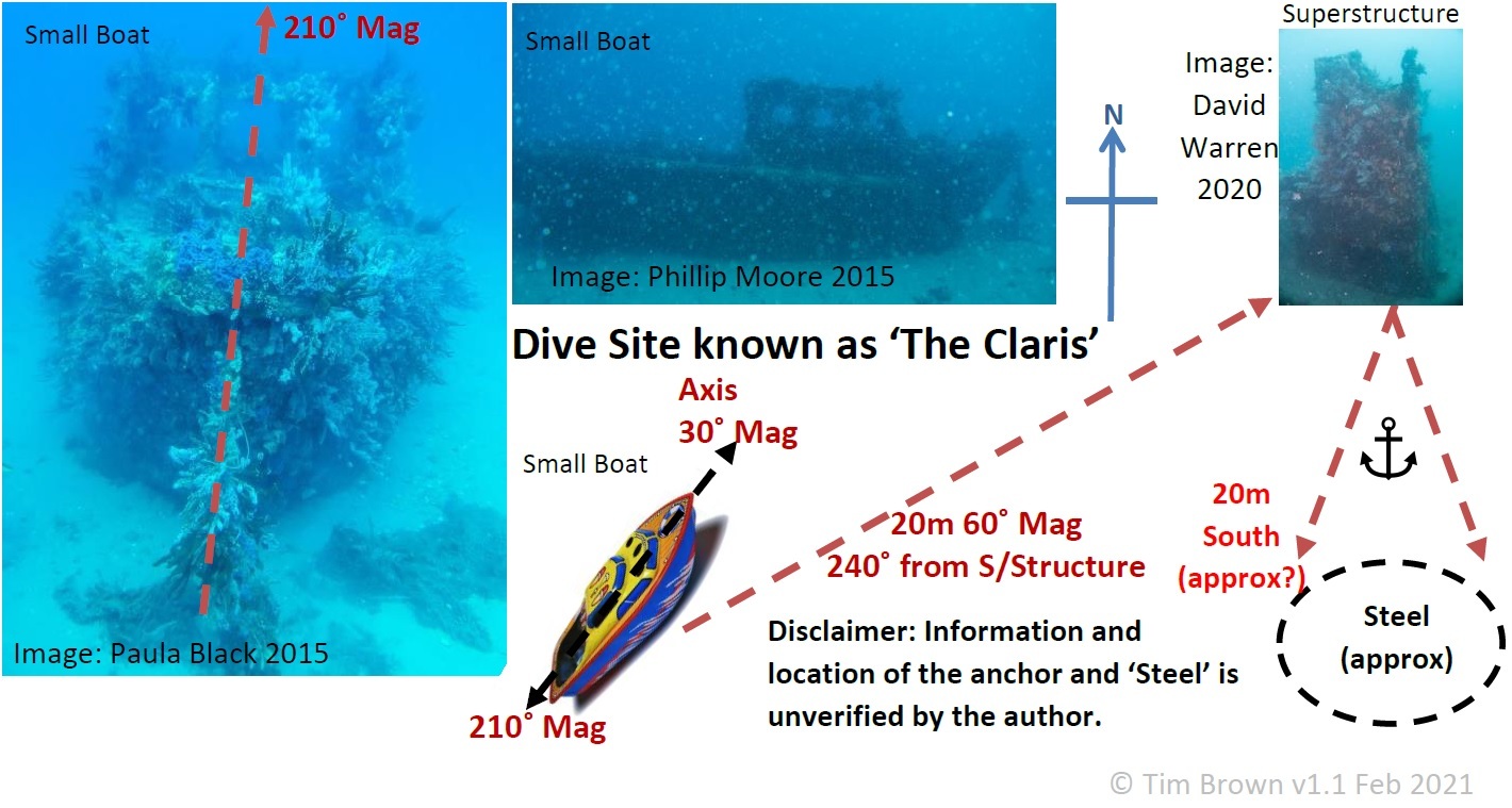
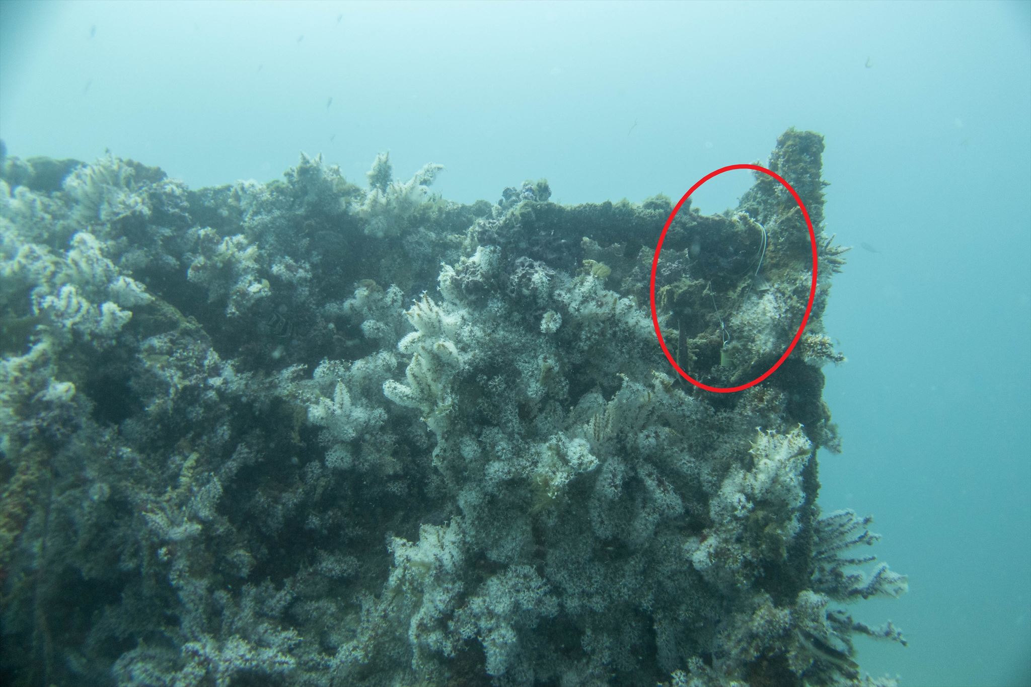
The set of coordinates are on a metal tag secured by a 2 mm wire cable, and located at the highest point on the structure attached to a ladder wrung, as per the photographs. These coordinates will then allow you to access the cache container at GZ to then sign the logbook.
Warning: Note that scuba diving is hazardous, and safety should not be compromised in order to just get a smiley. Scuba divers should have the right training and competency in order to retrieve the clue at the posted coordinates, and have the necessary dive equipment as required.